- Ovando, Montana
-
Ovando, Montana — CDP — Location of Ovando, Montana
Coordinates: 47°0′55″N 113°8′29″W / 47.01528°N 113.14139°WCoordinates: 47°0′55″N 113°8′29″W / 47.01528°N 113.14139°W Country United States State Montana County Powell Area – Total 9.1 sq mi (23.7 km2) – Land 9.0 sq mi (23.4 km2) – Water 0.1 sq mi (0.3 km2) Elevation 4,088 ft (1,246 m) Population (2000) – Total 71 – Density 7.9/sq mi (3.0/km2) Time zone Mountain (MST) (UTC-7) – Summer (DST) MDT (UTC-6) ZIP code 59854 Area code(s) 406 FIPS code 30-56125 GNIS feature ID 0788528 Ovando is a census-designated place (CDP) in Powell County, Montana, United States. The population was 71 at the 2000 census.
Geography
Ovando is located at 47°0′55″N 113°8′29″W / 47.01528°N 113.14139°W (47.015159, -113.141253)[1].
According to the United States Census Bureau, the CDP has a total area of 9.1 square miles (24 km2), of which, 9.0 square miles (23 km2) of it is land and 0.1 square miles (0.26 km2) of it (1.20%) is water.
Demographics
As of the census[2] of 2000, there were 71 people, 33 households, and 22 families residing in the CDP. The population density was 7.9 people per square mile (3.0/km²). There were 44 housing units at an average density of 4.9 per square mile (1.9/km²). The racial makeup of the CDP was 97.18% White, and 2.82% from two or more races.
There were 33 households out of which 27.3% had children under the age of 18 living with them, 54.5% were married couples living together, 9.1% had a female householder with no husband present, and 33.3% were non-families. 33.3% of all households were made up of individuals and 15.2% had someone living alone who was 65 years of age or older. The average household size was 2.15 and the average family size was 2.68.
In the CDP the population was spread out with 21.1% under the age of 18, 29.6% from 25 to 44, 32.4% from 45 to 64, and 16.9% who were 65 years of age or older. The median age was 44 years. For every 100 females there were 97.2 males. For every 100 females age 18 and over, there were 86.7 males.
The median income for a household in the CDP was $26,250, and the median income for a family was $31,250. Males had a median income of $21,250 versus $20,000 for females. The per capita income for the CDP was $15,012. There were 8.3% of families and 21.1% of the population living below the poverty line, including 26.7% of under eighteens and 33.3% of those over 64.
References
- ^ "US Gazetteer files: 2010, 2000, and 1990". United States Census Bureau. 2011-02-12. http://www.census.gov/geo/www/gazetteer/gazette.html. Retrieved 2011-04-23.
- ^ "American FactFinder". United States Census Bureau. http://factfinder.census.gov. Retrieved 2008-01-31.
Municipalities and communities of Powell County, Montana City 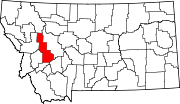
CDPs Categories:- Populated places in Powell County, Montana
- Census-designated places in Montana


Wikimedia Foundation. 2010.