- Plattsmouth, Nebraska
Infobox Settlement
official_name = Plattsmouth, Nebraska
settlement_type =City
nickname =
motto =
imagesize =
image_caption =
image_
imagesize =
image_caption =
image_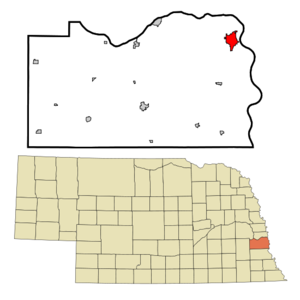
mapsize = 250px
map_caption = Location of Plattsmouth, Nebraska
mapsize1 =
map_caption1 =subdivision_type = Country
subdivision_name =United States
subdivision_type1 = State
subdivision_name1 =Nebraska
subdivision_type2 = County
subdivision_name2 = Cass
government_footnotes =
government_type =
leader_title =
leader_name =
leader_title1 =
leader_name1 =
established_title =
established_date =unit_pref = Imperial
area_footnotes =area_magnitude =
area_total_km2 = 7.5
area_land_km2 = 7.5
area_water_km2 = 0.0
area_total_sq_mi = 2.9
area_land_sq_mi = 2.9
area_water_sq_mi = 0.0population_as_of = 2000
population_footnotes =
population_total = 6887
population_density_km2 = 919.5
population_density_sq_mi = 2381.6timezone = Central (CST)
utc_offset = -6
timezone_DST = CDT
utc_offset_DST = -5
elevation_footnotes =
elevation_m = 299
elevation_ft = 981
latd = 41 |latm = 0 |lats = 31 |latNS = N
longd = 95 |longm = 53 |longs = 30 |longEW = Wpostal_code_type =
ZIP code
postal_code = 68048
area_code = 402
blank_name = FIPS code
blank_info = 31-39345GR|2
blank1_name = GNIS feature ID
blank1_info = 0832160GR|3
website =
footnotes =Plattsmouth is a city in Cass County,
Nebraska , founded in1855 . The population was 6,887 at the 2000 census. It is thecounty seat of Cass CountyGR|6.Geography
Plattsmouth is located at coor dms|41|0|31|N|95|53|30|W|city (41.008699, -95.891643)GR|1.
According to the
United States Census Bureau , the city has a total area of 2.9square mile s (7.5km² ), of which, 2.9 square miles (7.5 km²) of it is land and 0.34% is water.Demographics
As of the
census GR|2 of 2000, there were 6,887 people, 2,618 households, and 1,780 families residing in the city. Thepopulation density was 2,381.6 people per square mile (920.1/km²). There were 2,805 housing units at an average density of 970.0/sq mi (374.7/km²). The racial makeup of the city was 97.36% White, 0.30% African American, 0.51% Native American, 0.52% Asian, 0.01% Pacific Islander, 0.46% from other races, and 0.83% from two or more races. Hispanic or Latino of any race were 2.00% of the population.There were 2,618 households out of which 37.4% had children under the age of 18 living with them, 51.6% were married couples living together, 11.8% had a female householder with no husband present, and 32.0% were non-families. 27.0% of all households were made up of individuals and 12.0% had someone living alone who was 65 years of age or older. The average household size was 2.56 and the average family size was 3.10.
In the city the population was spread out with 29.1% under the age of 18, 8.8% from 18 to 24, 29.5% from 25 to 44, 18.8% from 45 to 64, and 13.9% who were 65 years of age or older. The median age was 33 years. For every 100 females there were 92.5 males. For every 100 females age 18 and over, there were 87.0 males.
The median income for a household in the city was $38,844, and the median income for a family was $43,425. Males had a median income of $32,702 versus $22,032 for females. The
per capita income for the city was $17,153. About 6.5% of families and 7.0% of the population were below thepoverty line , including 10.0% of those under age 18 and 5.5% of those age 65 or over.History
Plattsmouth first appeared in 1854 as "the Barracks", a trading post established by Sam Martin, owner of the Platteville ferry in neighboring
Mills County, Iowa , ferryman Wheatley Mickelwait, andGlenwood, Iowa attorney and politician Colonel Joseph Longworthy Sharp. The organization of the city under the charter of March, 1855, was effected December 29, 1856, by the election of Wheatley Mickelwait to the Mayoralty, and Enos Williams, W. M. Slaughter and Jacob Vallery, Aldermen. This Council met and proceeded to business January 29, 1857, their first ordinance, approved by the Mayor March 2, 1857, levying a tax of one-half of 1 per cent on all taxable property within the corporate limits of the city of Plattsmouth, the amount collected to be expended in the improvement of the streets and alleys and steamboat landings at and in the city. On December 7, 1857, the Council voted each member an annual salary of $100, being something over $16 apiece for each session held during the year. This is a noticeable fact, in view of the action taken by the succeeding Council on December 30, 1858, in ordaining that the Mayor and Alderman receive for their services during that year the sum of 5 cents each, payable in city scrip; the Assessor, Recorder and Treasurer being paid $25 apiece for the same term.Notable natives
* Birthplace of the famous Nebraska artist, John Falter.
ee also
*
Omaha Southern Railroad References
External links
* [http://www.plattsmouth.org/ Website of Plattsmouth, NE]
Wikimedia Foundation. 2010.