- Comberton
-
For other places with the same name, see Comberton (disambiguation).
Coordinates: 52°11′15″N 0°01′27″E / 52.187613°N 0.024048°E
Comberton 
Comberton village green and pond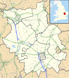
 Comberton
Comberton shown within CambridgeshirePopulation 2,189 (2001 Census)[1] OS grid reference TL383563 District South Cambridgeshire Shire county Cambridgeshire Region East Country England Sovereign state United Kingdom Post town CAMBRIDGE Postcode district CB23 Dialling code 01223 Police Cambridgeshire Fire Cambridgeshire Ambulance East of England EU Parliament East of England List of places: UK • England • Cambridgeshire Comberton is a village and civil parish in South Cambridgeshire, England, just east of the Prime Meridian.
Contents
History
Archaeological finds, including a Neolithic polished stone axe (found to the south of the current village) and a Bronze Age barrow (to the north), suggest there has been a settlement here for thousands of years. A Roman villa was discovered in 1842.[2] The village was mentioned in the Domesday Book as Cumbertone, and clearly dates to at least the 11th century. Some houses in the village date from the 14th century.
Comberton has a population of about 2,300 (as of 2006).[3] It features two churches: the Church of England St Mary's, an Early English-style building dating from the 13th century,[4] and a Baptist church dating from 1861.[5] It also has one pub (The Three Horseshoes), shops, a primary school (Meridian Community Primary School) and a post office, a recreation ground, a doctor's surgery, a dental surgery, and at the centre of the village, a village pond with resident ducks.
The Prime Meridian is marked by a Meridian Line stone plaque on the north sides of the main road (B1046). It is opposite the Cambridge Meridian Golf Club, situated between Comberton and the neighbouring village of Toft. The line runs up the 14th fairway according to the club, but a check of the co-ordinates reveals that it is actually on the white tee of the 15th hole.
The village has a website http://www.comberton.org.uk where reasonably up to date diary activities, minutes of meetings and village magazines can be found.[6]
Geography
Comberton is about 6 miles (10 km) south-west of the city of Cambridge, and just half a mile (800 m) east of the Prime Meridian, lying at a modest elevation of around 25 feet (8 m) above sea level. The civil parish covers 1,954 acres (7.9 km²), and is part of the local government district of South Cambridgeshire. Nearby villages include Barton to the east and Toft to the west. Comberton is twinned with Le Vaudreuil, a village near Rouen, France.
Education
The village is home to an infant playgroup, the Meridian Primary School [7], Comberton Village College [8] and the Comberton Sixth Form[9]. The latter two are part of the Comberton Educational Trust [10]., which has these other villages in its catchment area: Barton, Bourn, Caldecote, Coton, Cambourne, Hardwick, Haslingfield, and Toft.[11]. Comberton Village College has been at or near the top of the league tables for state comprehensive schools in England[citation needed] and is a National College 'National Support School' and offers its support for other secondary schools through being part of the Cambridge Consortium [12]. It was the last Cambridgeshire Village College opened by Henry Morris, Chief Education Officer for Cambridgeshire.
See also
References
- ^ "2001 Census". http://www.cambridgeshire.gov.uk/NR/rdonlyres/D2615621-EEE5-4FBB-A94B-FF1B149D36A1/0/Comberton.pdf. Retrieved 2009-12-19.
- ^ "Comberton history". http://www.comberton.org.uk/history.htm. Retrieved 2009-12-19.
- ^ "South Cambridgeshire District Council population forecasts". http://www.cambridgeshire.gov.uk/NR/rdonlyres/69A34FA3-F74F-4263-A4EB-B53C97BFA16C/0/SCpopLA1207.csv. Retrieved 2009-12-19.
- ^ "St. Mary's website: History". http://www.combertonchurch.co.uk/Index.asp?MainID=6816. Retrieved 2009-12-19.
- ^ "CBC website". http://www.c-b-c.org.uk/Index.asp?MainID=7065. Retrieved 2009-12-19.
- ^ "Comberton Village Website". http://www.comberton.org.uk. Retrieved 2011-11-07.
- ^ "Comberton Primary School". http://www.meridian-school.com/,. Retrieved 2011-11-07.
- ^ "Comberton Village College". http://www.combertonvc.org/. Retrieved 2011-11-07.
- ^ "Comberton Sixth Form". http://www.combertonsixthform.org/. Retrieved 2011-11-07.
- ^ "Comberton Educational Trust". http://http://www.combertonet.org.uk/. Retrieved 2011-11-07.
- ^ "Comberton Village College: Admissions Policy 2010-2011". http://www.about.combertonvc.org/policies/admission_policy_2011_b_feb11.doc. Retrieved 2011-11-07.
- ^ "Cambridge Consortium". http://www.cambridgeconsortium.org/. Retrieved 2011-11-07.
External links
 Media related to Comberton at Wikimedia CommonsCategories:
- Villages in Cambridgeshire
- Civil parishes in Cambridgeshire


Wikimedia Foundation. 2010.