- South Toms River, New Jersey
Infobox Settlement
official_name = South Toms River, New Jersey
settlement_type = Borough
nickname =
motto =
imagesize =
image_caption =
image_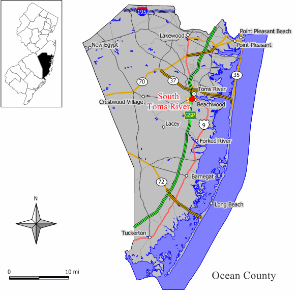
mapsize = 250x200px
map_caption = Map of South Toms River in Ocean County. Inset: Location of Ocean County highlighted in the State of New Jersey.
mapsize1 = 250x200px
map_caption1 = Census Bureau map of South Toms River, New Jerseysubdivision_type = Country
subdivision_name =United States
subdivision_type1 = State
subdivision_name1 =New Jersey
subdivision_type2 = County
subdivision_name2 = Ocean
government_footnotes =
government_type =Borough (New Jersey)
leader_title =Mayor
leader_name = Michael Keene (2010)
leader_title1 =
leader_name1 =
established_title = Incorporated
established_date =May 3 ,1927 unit_pref = Imperial
area_footnotes =
area_magnitude =
area_total_km2 = 3.2
area_land_km2 = 3.0
area_water_km2 = 0.1
area_total_sq_mi = 1.2
area_land_sq_mi = 1.2
area_water_sq_mi = 0.1population_as_of = 2006
population_footnotes =
population_total = 3716
population_density_km2 = 1209.2
population_density_sq_mi = 3131.9timezone = Eastern (EST)
utc_offset = -5
timezone_DST = EDT
utc_offset_DST = -4
elevation_footnotes = [Gnis|885404|Borough of South Toms River,Geographic Names Information System . AccessedJanuary 4 ,2008 .]
elevation_m = 17
elevation_ft = 56
latd = 39 |latm = 56 |lats = 27 |latNS = N
longd = 74 |longm = 12 |longs = 34 |longEW = Wpostal_code_type =
ZIP code
postal_code = 08757
area_code = 732
blank_name = FIPS code
blank_info = 34-69510GR|2 [ [http://mcdc2.missouri.edu/webrepts/commoncodes/ccc_nj.html A Cure for the Common Codes: New Jersey] , Missouri Census Data Center. AccessedJuly 14 ,2008 .]
blank1_name = GNIS feature ID
blank1_info = 0885404GR|3
website = http://www.strnj.com/
footnotes =South Toms River is a Borough in Ocean County,
New Jersey ,United States . As of theUnited States 2000 Census , the borough population was 3,634.South Toms River was incorporated as a borough by an Act of the
New Jersey Legislature onMarch 28 ,1927 , from portions of Berkeley Township, based on the results of a referendum held onMay 3 ,1927 ."The Story of New Jersey's Civil Boundaries: 1606-1968", John P. Snyder, Bureau of Geology and Topography; Trenton, New Jersey; 1969. p. 205.]Geography
South Toms River sits on the south side of the
Toms River , across from Toms River Township, and is bisected by theGarden State Parkway . U.S. Route 9, Route 166 and County Route 530 also pass through the community.South Toms River is located at coor dms|39|56|32|N|74|12|38|W|city (39.942351, -74.210509)GR|1.
According to the
United States Census Bureau , the borough has a total area of 1.2square mile s (3.2km² ), of which, 1.2 square miles (3.0 km²) of it is land and 0.1 square miles (0.2 km²) of it (4.92%) is water.Demographics
USCensusPop
1930=405
1940=445
1950=492
1960=1603
1970=3981
1980=3954
1990=3869
2000=3634
estimate= 3716
estyear=2006
estref= [http://factfinder.census.gov/servlet/SAFFPopulation?_event=Search&geo_id=16000US3471430&_geoContext=01000US%7C04000US34%7C16000US3471430&_street=&_county=south+toms+river&_cityTown=south+toms+river&_state=04000US34&_zip=&_lang=en&_sse=on&ActiveGeoDiv=geoSelect&_useEV=&pctxt=fph&pgsl=160&_submenuId=population_0&ds_name=null&_ci_nbr=null&qr_name=null®=null%3Anull&_keyword=&_industry= Census data for South Toms River borough] ,United States Census Bureau . AccessedAugust 17 ,2007 ]
footnote=Population 1930 - 1990. [ [http://www.wnjpin.net/OneStopCareerCenter/LaborMarketInformation/lmi01/poptrd6.htm New Jersey Resident Population by Municipality: 1930 - 1990] , Workforce New Jersey Public Information Network. AccessedMarch 1 ,2007 .] As of thecensus GR|2 of 2000, there were 3,634 people, 1,073 households, and 902 families residing in the borough. Thepopulation density was 3,131.9 people per square mile (1,209.6/km²). There were 1,123 housing units at an average density of 967.8/sq mi (373.8/km²). The racial makeup of the borough was 72.56% White, 21.16% African American, 0.14% Native American, 0.69% Asian, 2.50% from other races, and 2.94% from two or more races. Hispanic or Latino of any race were 9.27% of the population.There were 1,073 households out of which 43.1% had children under the age of 18 living with them, 55.2% were married couples living together, 22.7% had a female householder with no husband present, and 15.9% were non-families. 12.5% of all households were made up of individuals and 5.4% had someone living alone who was 65 years of age or older. The average household size was 3.39 and the average family size was 3.63.
In the borough the population was spread out with 32.1% under the age of 18, 9.3% from 18 to 24, 29.2% from 25 to 44, 20.4% from 45 to 64, and 9.0% who were 65 years of age or older. The median age was 32 years. For every 100 females there were 93.1 males. For every 100 females age 18 and over, there were 88.5 males.
The median income for a household in the borough was $43,468, and the median income for a family was $45,375. Males had a median income of $31,859 versus $24,837 for females. The
per capita income for the borough was $16,292. About 11.2% of families and 12.6% of the population were below thepoverty line , including 18.4% of those under age 18 and 18.3% of those age 65 or over.Government
Local government
South Toms River is governed under the Borough form of New Jersey municipal government. The government consists of a Mayor and a Borough Council comprising six council members, with all positions elected at large. A Mayor is elected directly by the voters to a four-year term of office. The Borough Council consists of six members elected to serve three-year terms on a staggered basis, with two seats coming up for election each year. ["2005 New Jersey Legislative District Data Book",
Rutgers University Edward J. Bloustein School of Planning and Public Policy , April 2005, p. 53.]The Mayor of South Toms River Borough is Michael Keene (D, term ends
December 31 ,2010 ). Members of the Borough Council are Oscar L. Cradle, Sr. (R, 2010), George J. Greitz, Jr. (R, 2010) Carla D. Kearney (D, 2009), Kevin McCormack (R, 2008), Sandford Ross, Jr. (R, 2008) and Anthony P. Tafaro (D, 2009). [ [http://www.strnj.com/index.php?option=com_content&task=view&id=26&Itemid=52 Information] , Borough of South Toms River. AccessedJune 24 ,2008 .] [ [http://www.oceancountyclerk.com/elelectedofficials2008.pdf#page=11 2008 Elected Officials of Ocean County] ,Ocean County, New Jersey . p. 11. AccessedApril 15 ,2008 .]Federal, state and county representation
South Toms River is in the Third Congressional District and is part of New Jersey's 10th Legislative District. [ [http://www.lwvnj.org/pubs/CG06.pdf 2006 New Jersey Citizen's Guide to Government] , New Jersey
League of Women Voters , p. 64. AccessedAugust 30 ,2006 .]Education
Public school students in grades K through 12 attend the
Toms River Regional Schools , a regional public school system primarily in Toms River Township. In addition to students from Toms River, the district incorporates the boroughs of Beachwood, Pine Beach and South Toms River. [ [http://education.state.nj.us/rc/rc07/narrative/29/5190/29-5190-000.html Toms River Regional School District 2007 Report Card Narrative] ,New Jersey Department of Education . AccessedApril 15 ,2008 . "With a student population in excess of 17,000, twelve elementary schools, three intermediate schools and three high schools, Toms River Regional School District is the largest suburban school districts in the state. Respective of our size, the district takes enormous pride in the neighborhood school concept providing high-quality educational programs and services to our four sending towns: Beachwood, Toms River, Pine Beach, and South Toms River."]References
External links
* [http://www.strnj.com/ Borough of South Toms River]
* [http://www.mpfc18.com/ Manitou Park Fire Company - Station 18]
* [http://www.trschools.com/index.asp Toms River Regional Schools]
*NJReportCard|29|5190|0|Toms River Regional Schools
* [http://nces.ed.gov/ccd/schoolsearch/school_list.asp?Search=1&DistrictID=3416230 Data for the Toms River Regional Schools] ,National Center for Education Statistics
*Geolinks-US-cityscale|39.942351|-74.210509
Wikimedia Foundation. 2010.