- La Cienega, New Mexico
Infobox Settlement
official_name = La Cienega, New Mexico
settlement_type = CDP
nickname =
motto =
imagesize =
image_caption =
image_
imagesize =
image_caption =
image_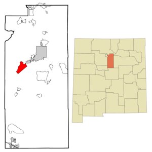
mapsize = 250px
map_caption = Location of La Cienega, New Mexico
mapsize1 =
map_caption1 =subdivision_type = Country
subdivision_name =United States
subdivision_type1 = State
subdivision_name1 =New Mexico
subdivision_type2 = County
subdivision_name2 = Santa Fe
government_footnotes =
government_type =
leader_title =
leader_name =
leader_title1 =
leader_name1 =
established_title =
established_date =unit_pref = Imperial
area_footnotes =area_magnitude =
area_total_km2 = 34.6
area_land_km2 = 34.6
area_water_km2 = 0.0
area_total_sq_mi = 13.3
area_land_sq_mi = 13.3
area_water_sq_mi = 0.0population_as_of = 2000
population_footnotes =
population_total = 3007
population_density_km2 = 87.0
population_density_sq_mi = 225.3timezone = Mountain (MST)
utc_offset = -7
timezone_DST = MDT
utc_offset_DST = -6
elevation_footnotes =
elevation_m = 1808
elevation_ft = 5932
latd = 35 |latm = 35 |lats = 33 |latNS = N
longd = 106 |longm = 6 |longs = 32 |longEW = Wpostal_code_type =
postal_code =
area_code = 505
blank_name = FIPS code
blank_info = 35-36720
blank1_name = GNIS feature ID
blank1_info = 0918216
website =
footnotes =La Cienega is a
census-designated place (CDP) in Santa Fe County,New Mexico ,United States . It is part of theSanta Fe, New Mexico Metropolitan Statistical Area . The population was 3,007 at the 2000 census.Geography
La Cienega is located at coor dms|35|35|33|N|106|6|32|W|city (35.592537, -106.108947)GR|1.
According to the
United States Census Bureau , the CDP has a total area of 13.4square mile s (34.6km² ), all of it land.Demographics
As of the
census GR|2 of 2000, there were 3,007 people, 1,033 households, and 761 families residing in the CDP. Thepopulation density was 225.3 people per square mile (87.0/km²). There were 1,079 housing units at an average density of 80.8/sq mi (31.2/km²). The racial makeup of the CDP was 60.86% White, 0.50% African American, 1.43% Native American, 0.30% Asian, 0.07% Pacific Islander, 31.19% from other races, and 5.65% from two or more races. Hispanic or Latino of any race were 70.80% of the population.There were 1,033 households out of which 44.9% had children under the age of 18 living with them, 56.1% were married couples living together, 10.5% had a female householder with no husband present, and 26.3% were non-families. 19.2% of all households were made up of individuals and 2.2% had someone living alone who was 65 years of age or older. The average household size was 2.91 and the average family size was 3.35.
In the CDP the population was spread out with 31.1% under the age of 18, 8.8% from 18 to 24, 33.9% from 25 to 44, 22.0% from 45 to 64, and 4.3% who were 65 years of age or older. The median age was 32 years. For every 100 females there were 103.9 males. For every 100 females age 18 and over, there were 104.3 males.
The median income for a household in the CDP was $38,028, and the median income for a family was $46,578. Males had a median income of $31,178 versus $30,092 for females. The
per capita income for the CDP was $17,329. About 7.2% of families and 6.8% of the population were below thepoverty line , including 3.3% of those under age 18 and 8.1% of those age 65 or over.Wetland
The name La Cienega refers to an important feature, a
cienega (spring and associated marsh) that supplies water toEl Rancho de las Golondrinas and the Santa Fe River Canyon at the foot of theCaja del Rio . The cienega itself is managed by the Santa Fe Botanical Garden as the Leonora Curtin Wetland Preserve. [ [http://www.santafebotanicalgarden.org/mainpages/5_leonora.html Santa Fe Botanical Garden: Leonora Curtin Wetland Preserve] , accessed 2008-07-06.] La Cienega is anArea of Critical Environmental Concern and has been a focus of recent efforts to create an open space corridor between Santa Fe and theRio Grande . [ [http://www.blm.gov/nm/st/en/fo/New_Mexico_State_Office/features/la_cienega_acec_expansion.html Community Celebrates Expansion of La Cienega ACEC] , United States Department of the Interior, Bureau of Land Management, Press Release dated 2007-08-23, accessed 2008-07-06.]References
External links
Wikimedia Foundation. 2010.