- Conesus, New York
-
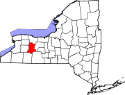
Conesus, New York — Town — Location within the state of New York
 Conesus, New York
Coordinates: 42°43′9″N 77°40′29″W / 42.71917°N 77.67472°W Country United States State New York County Livingston Government – Type Town Council – Town Supervisor Brenda B. Donahue (R) – Town Council Members' ListArea – Total 35.8 sq mi (92.8 km2) – Land 32.9 sq mi (85.3 km2) – Water 2.9 sq mi (7.5 km2) Elevation 1,407 ft (429 m) Population (2000) – Total 2,353 – Density 71.5/sq mi (27.6/km2) Time zone Eastern (EST) (UTC-5) – Summer (DST) EDT (UTC-4) ZIP code 14435 Area code(s) 585 FIPS code 36-17618 GNIS feature ID 0978858 Conesus is a town in Livingston County, New York (NY), United States. The population was 2,353 at the 2000 census. The name is derived from a native word meaning "Berry place."
The Town of Conesus is on the county's east border, and is north of Dansville, NY.
Contents
History
Settlement began around 1795. In 1819, Conesus was formed from parts of the Towns of Groveland and Livonia as the "Town of Freeport." The name was changed to "Browersville" in March, 1825 and was changed to "Conesus" a month later.
Geography
According to the United States Census Bureau, the town has a total area of 35.8 square miles (93 km2), of which, 32.9 square miles (85 km2) of it is land and 2.9 square miles (7.5 km2) of it (8.10%) is water.
Conesus Lake is on the west border of the town, and Hemlock Lake is on the east border of the town. Both lakes are considered minor Finger Lakes. The east town line is the border of Ontario County. The shore of Conesus Lake is a shallow gradient, so many communities are located by Conesus Lake. None are located at Hemlock Lake because the City of Rochester owns the lake and much of the surrounding property. The lake is used for the City of Rochester's water supply.
New York State Route 15 is an important north-south highway, which intersects the former New York State Route 255 at Conesus village.
Demographics
As of the census[1] of 2000, there were 2,353 people, 869 households, and 662 families residing in the town. The population density was 71.5 people per square mile (27.6/km²). There were 983 housing units at an average density of 29.9 per square mile (11.5/km²). The racial makeup of the town was 98.43% White, 0.17% African American, 0.34% Native American, 0.04% Asian, 0.13% from other races, and 0.89% from two or more races. Hispanic or Latino of any race were 0.21% of the population.
There were 869 households out of which 38.7% had children under the age of 18 living with them, 63.6% were married couples living together, 7.9% had a female householder with no husband present, and 23.8% were non-families. 18.2% of all households were made up of individuals and 7.1% had someone living alone who was 65 years of age or older. The average household size was 2.69 and the average family size was 3.05.
In the town the population was spread out with 27.4% under the age of 18, 6.2% from 18 to 24, 31.0% from 25 to 44, 25.8% from 45 to 64, and 9.6% who were 65 years of age or older. The median age was 38 years. For every 100 females there were 97.7 males. For every 100 females age 18 and over, there were 96.4 males.
The median income for a household in the town was $48,200, and the median income for a family was $53,125. Males had a median income of $40,313 versus $25,000 for females. The per capita income for the town was $22,773. About 3.9% of families and 5.3% of the population were below the poverty line, including 7.0% of those under age 18 and 3.5% of those age 65 or over.
Communities and locations in Conesus
- Conesus – The hamlet of Conesus on NY-15.
- Conesus Inlet – A stream draining into the south part of Conesus Lake.
- Conesus Inlet Fish and Wildlife Management Area – A conservation area at the south end of Conesus Lake.
- Crocketts Corners – A location north of Conesus village on NY-15.
- Excelsior Springs – A location on Conesus Lake, north of Walkleys Landing.
- Foots Corner – A hamlet north of Conesus village on NY-15.
- McMillan Creek – A stream flowing through Conesus village and terminating in Conesus Lake.
- Sunny Shores – A location on the north town line by Conesus Lake.
- Union Corners – A former community in the town.
- Walkleys Landing – A hamlet at the south end of Conesus Lake.
- Websters Crossing – A hamlet by the south town line on NY-15 and McMillan Creek.
References
- ^ "American FactFinder". United States Census Bureau. http://factfinder.census.gov. Retrieved 2008-01-31.
External links
Municipalities and communities of Livingston County, New York Towns Avon | Caledonia | Conesus | Geneseo | Groveland | Leicester | Lima | Livonia | Mount Morris | North Dansville | Nunda | Ossian | Portage | Sparta | Springwater | West Sparta | York
Villages Hamlets Coordinates: 42°43′08″N 77°40′35″W / 42.71889°N 77.67639°W
Categories:- Towns in New York
- Rochester, New York metropolitan area
- Populated places in Livingston County, New York
- Place names in New York of Native American origin


Wikimedia Foundation. 2010.