- Massapequa, New York
-
Massapequa, New York — CDP — 

 Massapequa, New York
Coordinates: 40°40′13″N 73°28′6″W / 40.67028°N 73.46833°W Country United States State New York County Nassau Area - Total 4.0 sq mi (10.4 km2) - Land 3.6 sq mi (9.5 km2) - Water 0.4 sq mi (1.0 km2) Elevation 26 ft (8 m) Population (2000) - Total 21,685 Time zone Eastern (EST) (UTC-5) - Summer (DST) EDT (UTC-4) ZIP code 11758 Area code(s) 516 FIPS code 36-45986 GNIS feature ID 0956651 Massapequa is a hamlet (and a census-designated place) located in the suburban Nassau County, New York. As of the 2010 census, the CDP had a total population of 21,685.
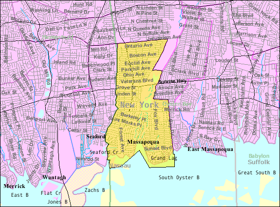
Massapequa is located on the South Shore of Long Island.[citation needed] In Geography, the political definition of Massapequa covers a wider area (the Massapequa Township). The Massapequas are Massapequa, Massapequa Park (Incorporated Village), East Massapequa, and North Massapequa.
Contents
History
For many years it was reported that Massapequa was one of the 13 tribes of Long Island. Later research says that it was the Native American name for the location.
Geography
Massapequa, on southern Long Island, is located at 40°40'13" North, 73°28'16" West (40.670403, -73.471150).[1]
According to the United States Census Bureau, the CDP has a total area of 4.0 square miles (10 km2), of which, 3.7 square miles (9.6 km2) of it is land and 0.4 square miles (1.0 km2) of it is water. The total area is 9.20% water.
Demographics
As of the census[2] of 2000, there were 22,652 people, 7,417 households, and 6,297 families residing in the CDP. The population density was 6,207.5 per square mile (2,396.2/km²). There were 7,514 housing units at an average density of 2,059.1/sq mi (794.8/km²). The racial makeup of the CDP was 97.42% White, 0.17% African American, 0.02% Native American, 1.27% Asian, 0.03% Pacific Islander, 0.37% from other races, and 0.73% from two or more races. 2.59% of the population were Hispanic or Latino of any race.
There were 7,417 households out of which 38.3% had children under the age of 18 living with them, 73.4% were married couples living together, 8.5% had a female householder with no husband present, and 15.1% were non-families. 12.5% of all households were made up of individuals and 6.9% have someone living alone who is 65 years of age or older. The average household size was 3.05 and the average family size was 3.33.
In the CDP the population was spread out with 25.6% under the age of 18, 5.9% from 18 to 24, 29.5% from 25 to 44, 24.7% from 45 to 64, and 14.3% who are 65 years of age or older. The median age was 41 years as of 2007. For every 100 females there were 94.9 males. For every 100 females age 18 and over, there were 110.0 males.
The median income for a household in the CDP was $107,181, and the median income for a family was $116,266.[3] Males had a median income of $77,859 versus $57,016 for females. The per capita income for the CDP was $42,169. 2.9% of the population and 1.6% of families were below the poverty line.
School District
During the 1960s and the 1970s, Massapequa School District had seven elementary schools (Carman Road, East Lake, Birch Lane, Fairfield, Unqua, Hawthorn, Raymond J. Lockhart), two junior high schools (John P. McKenna and J. Lewis Ames, formerly Parkside) and two high schools, Massapequa and Alfred G. Berner. In the 1990s the Massapequa school district restructured the district by leasing Carmans Road elementary to Nassau BOCES. Hawthorn Elementary was rented to the police department in 2006 and currently serves as the Nassau County Police Academy. John P. McKenna Jr. High School was converted to an elementary school, while Alfred G. Berner became the new middle school. J. Lewis Ames Jr. High School is also no longer a middle school, but now the "Ames Campus" of Massapequa High School, which is where the ninth grade currently attends.
Massapequa School District currently has:
- Six elementary schools (Grades K-6)
- Birch Lane
- East Lake
- Fairfield
- Lockhart
- Mckenna
- Unqua
- One middle school (grades 7-8)
- Berner (formerly Berner High School 1962–1987)
- One high school annex (Grade 9)
- Ames
- One high school (Grades 10-12)
Weather
Massapequa has a climate that is very similar to other coastal areas of the Northeastern United States; it has warm, humid summers and cold winters, but the Atlantic Ocean helps bring afternoon sea breezes that temper the heat in the warmer months and limit the frequency and severity of thunderstorms. However, severe thunderstorms are not uncommon, especially when they approach the island from the mainland (Bronx, Westchester and Connecticut) in the northwest. In the wintertime, temperatures are warmer than areas further inland (especially in the night and early morning hours), often causing a snowstorm further inland to fall as rain on the island. However, measurable snowfalls every winter, and in many winters one or more intense storms called Nor'easters may occasionally produce blizzard conditions with snowfalls of 1–2 feet (30–60 cm) and near-hurricane force winds. Average seasonal snowfall in 28".[4] Long Island temperatures also vary from west to east, with the western part of the island warmer on most occasions than the east. This is due to two factors; one because the western part is closer to the mainland and the other is the western part is more developed causing what is known as the "urban heat island" effect.
On August 25, 2006, a small F0 tornado struck Massapequa.
See also
- Massapequa Park
- North Massapequa
- East Massapequa
Notable residents
A - K
- John Antonucci- Porn Star
- the Baldwin brothers:
- Brian Baldinger
- Matt Bennett
- Peter Brennan – died there on October 2, 1996
- Joey Buttafuoco
- Roy DeMeo
- Joe Donnelly
- Michael Dougherty
- Elliot Easton – The Cars' lead guitarist
- Andre Eglevsky - ballet dancer
- William Gaddis
- Carlo Gambino
- Andy Glazer
- Steve Guttenberg – actor
- Jessica Hahn
- Marvin Hamlisch – composer
- Christine Jorgensen – transgender pioneer
- Charlie Kaufman - screenwriter/director
- Sean Kenniff
- Brian Kilmeade – of Fox and Friends
- Ron Kovic – Vietnam veteran, anti-war activist, author
L - Z
- Andy Conney-Popular Irish Singer
- Brian Langtry
- Hal Lester – guitarist and graphics artist
- Mark LoMonaco
- Joe Maca – died here on July 13, 1982
- John Melendez
- Bob Nelson
- Yvette Nelson – model and actress
- Peggy Noonan – political speechwriter and Conservative columnist
- Andrew Paskoff - Television Producer
- Scott Paskoff - Television Producer
- Michael K. Powers - Cosmonaut
- Eric Reid - Miami Heat television announcer
- Lee Rocker
- Angelo Dominick Roncallo
- Christopher Russoniello – song writer and industrial engineer
- Doc Schneider - Major League Lacrosse goaltender
- Jerry Seinfeld - Actor/Comedian
- Peter Senerchia - pro wrestler/announcer
- Brian Setzer - rockabilly icon
- Helen Slater
- Bobby Slayton
- Robert Sobel – author
- Jonathan Wright
- Laurie Veneziano - Automotive hand painted pinstriper(second generation)- Singer songwriter
References
- ^ "US Gazetteer files: 2010, 2000, and 1990". United States Census Bureau. 2011-02-12. http://www.census.gov/geo/www/gazetteer/gazette.html. Retrieved 2011-04-23.
- ^ "American FactFinder". United States Census Bureau. http://factfinder.census.gov. Retrieved 2008-01-31.
- ^ http://factfinder.census.gov/servlet/ACSSAFFFacts?_event=&geo_id=16000US3645986&_geoContext=01000US%7C04000US36%7C16000US3645986&_street=&_county=massapequa&_cityTown=massapequa&_state=&_zip=&_lang=en&_sse=on&ActiveGeoDiv=geoSelect&_useEV=&pctxt=fph&pgsl=160&_submenuId=factsheet_1&ds_name=DEC_2000_SAFF&_ci_nbr=null&qr_name=null®=null:null&_keyword=&_industry=
- ^ "Weather at New York John F. Kennedy Airport (JFK): Weather and Climate in New York Area, NY, USA". http://new-york-jfk.airports-guides.com/jfk_climate.html.
Town of Oyster Bay, New York County Villages Hamlets Bethpage · East Massapequa · East Norwich · Glen Head · Glenwood Landing · Greenvale · Hicksville · Jericho · Locust Valley · Massapequa · North Massapequa · Old Bethpage · Oyster Bay · Plainedge · Plainview · South Farmingdale · Syosset · Woodbury
Website: oysterbaytown.com Coordinates: 40°40′13″N 73°28′16″W / 40.670403°N 73.47115°W
Categories:- Town of Oyster Bay, New York
- Census-designated places in New York
- Hamlets in New York
- Populated places in Nassau County, New York
- Place names in New York of Native American origin

Wikimedia Foundation. 2010.