- Gorham, New York
-
Gorham, New York — Town — Location within the state of New York
 Gorham, New York
Coordinates: 42°48′32″N 77°13′18″W / 42.80889°N 77.22167°W Country United States State New York County Ontario Government - Type Town Council - Town Supervisor Richard M. Calabrese (R) - Town Council Members' ListArea - Total 53.2 sq mi (137.8 km2) - Land 48.9 sq mi (126.7 km2) - Water 4.3 sq mi (11.2 km2) Elevation 1,076 ft (328 m) Population (2000) - Total 3,776 - Density 77.2/sq mi (29.8/km2) Time zone Eastern (EST) (UTC-5) - Summer (DST) EDT (UTC-4) ZIP code 14461 Area code(s) 585 FIPS code 36-29531 GNIS feature ID 0979007 Gorham is a town in Ontario County, New York, USA. The population was 3,776 at the 2000 census. The town is named after Nathaniel Gorham.
The Town of Gorham is at the south border of the county, southeast of Canandaigua, NY.
Contents
History
The town was created at the same time as the county (1789) as the "Town of Easton." The town changed its name to "Lincoln" in 1806, and adopted the current name, the name of an early proprietor, in 1807. Part of Gorham was taken in 1822 to form the Town of Hopewell. More territory, including the east shore of Canandaigua Lake, was added to Gorham in 1824.
A fire consumed much of Gorham village in 1868.
Geography
According to the United States Census Bureau, the town has a total area of 53.2 square miles (138 km2), of which, 48.9 square miles (127 km2) of it is land and 4.3 square miles (11 km2) of it (8.10%) is water.
The south town line is the border of Yates County, and the east town line is marked by Canandaigua Lake, one of the Finger Lakes.
New York State Route 245 intersects New York State Route 247 northeast of Rushville. NY-247 and New York State Route 364 are north-south highways in the town, but NY-364 is farther west near Canandaigua Lake.
Demographics
As of the census[1] of 2000, there were 3,776 people, 1,410 households, and 1,036 families residing in the town. The population density was 77.2 people per square mile (29.8/km²). There were 1,900 housing units at an average density of 38.9 per square mile (15.0/km²). The racial makeup of the town was 98.36% White, 0.37% African American, 0.05% Native American, 0.13% Asian, 0.03% Pacific Islander, 0.21% from other races, and 0.85% from two or more races. Hispanic or Latino of any race were 0.48% of the population.
There were 1,410 households out of which 32.7% had children under the age of 18 living with them, 60.2% were married couples living together, 8.9% had a female householder with no husband present, and 26.5% were non-families. 19.9% of all households were made up of individuals and 9.4% had someone living alone who was 65 years of age or older. The average household size was 2.66 and the average family size was 3.05.
In the town the population was spread out with 26.3% under the age of 18, 6.8% from 18 to 24, 26.7% from 25 to 44, 26.7% from 45 to 64, and 13.5% who were 65 years of age or older. The median age was 39 years. For every 100 females there were 97.0 males. For every 100 females age 18 and over, there were 95.0 males.
The median income for a household in the town was $43,138, and the median income for a family was $45,917. Males had a median income of $35,658 versus $23,682 for females. The per capita income for the town was $20,736. About 4.2% of families and 7.0% of the population were below the poverty line, including 9.2% of those under age 18 and 3.2% of those age 65 or over.
Communities and locations in Gorham
- Babbitt Corner – A location in the northeast part of the town.
- Baldwin Corners – A location northeast of Rushville.
- Cottage City – A hamlet on the shore of Canandaigua Lake, south of Crystal Beach on NY-364.
- Crystal Beach – A hamlet on the shore of Canandaigua Lake, south of Greens Landing on NY-364.
- Flint Creek – A stream flowing northward past Gorham village.
- Gorham – The hamlet of Gorham is near the east town line on NY-245. It was previously called "Bethel," but the current name was adopted in 1856 to match the town's name.
- Granger – A location southwest of Gorham village on NY-245.
- Greens Landing – A hamlet on the shore of Canandaigua Lake on NY-364.
- Mead Corner – A location in the northeast part of the town.
- Reed Corner – A location in the north part of the town on NY-247.
- Rushville – The north part of the Village of Rushville lies within the town and is located on NY-247.
- West River – A stream in the south part of the town, passing Rushville, that eventually enters Canandaigua Lake.
- Wilson Corner – A location east of Cottage City at the junction of NY-247 and Lake to Lake Road.
References
- ^ "American FactFinder". United States Census Bureau. http://factfinder.census.gov. Retrieved 2008-01-31.
External links
Municipalities and communities of Ontario County, New York County seat: Canandaigua Cities 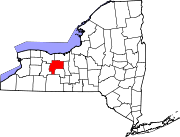
Towns Bristol | Canadice | Canandaigua | East Bloomfield | Farmington | Geneva | Gorham | Hopewell | Manchester | Naples | Phelps | Richmond | Seneca | South Bristol | Victor | West Bloomfield
Villages Bloomfield | Clifton Springs | Manchester | Naples | Phelps | Rushville‡ | Shortsville | Victor
Hamlets Centerfield | Fishers | Gorham | Hall | Honeoye | Stanley
Footnotes ‡This populated place also has portions in an adjacent county or counties
Coordinates: 42°47′56″N 77°07′54″W / 42.79889°N 77.13167°W
Categories:- Towns in New York
- Rochester, New York metropolitan area
- Populated places in Ontario County, New York


Wikimedia Foundation. 2010.