- Schuylerville, New York
-
Schuylerville, New York — Village — Location within the state of New York
 Schuylerville, New York
Coordinates: 43°6′3″N 73°34′53″W / 43.10083°N 73.58139°WCoordinates: 43°6′3″N 73°34′53″W / 43.10083°N 73.58139°W Country United States State New York County Saratoga Area – Total 0.6 sq mi (1.5 km2) – Land 0.5 sq mi (1.4 km2) – Water 0.1 sq mi (0.1 km2) Elevation 128 ft (39 m) Population (2000) – Total 1,197 – Density 2,264.5/sq mi (874.3/km2) Time zone Eastern (EST) (UTC-5) – Summer (DST) EDT (UTC-4) ZIP code 12871 Area code(s) 518 FIPS code 36-65750 GNIS feature ID 0964639 Schuylerville is a village in Saratoga County, New York, United States. The population was 1,197 at the 2000 census. The village is named after the Schuyler family.
The Village of Schuylerville is in the northeast part of the Town of Saratoga and is east of Saratoga Springs. It borders the Village of Victory.
Contents
History
The region was settled in 1691 and called Fort Saratoga by Dutch settlers from Albany, NY, notably the Schuyler family. The community that developed near the fort was originally called "Saratoga," but was partly destroyed in 1745. In 1777, during the Revolutionary War, the British crossed the Hudson here, and marched south about 9 miles to Stillwater. After their defeat, the British retreated back to the village, where they surrendered, marking the "turning point of the Revolution." This event is known as the Battles of Saratoga.
The village was incorporated in 1831 as Schuylerville. The Champlain Canal helped the local economy. Many people and businesses currently refer to the village by the nickname Old Saratoga, also, Olde Saratoga.
In the March 25, 1990 issue of The New York Times, writer James Howard Kunstler published a piece entitled "Schuylerville Stands Still". This piece used Schuylerville as an example of rural "rot and disrepair", citing unemployment, broken sidewalks, and dented cans at the local mini market, Mini Mart. Reaction to the article from members of the community was strongly negative. Kunstler also used Schuylerville as an example of a town in decline in a chapter titled "The loss of community" in his 1993 book, The Geography of Nowhere.
Also in 1990, a lawsuit arose between the Schuylerville school board and a local Jewish family, over the removal of a painting depicting the crucifixion of Christ from public display in the school auditorium. This lawsuit, which the school lost, prompted a visit to Schuylerville by a Ku Klux Klan member. At the same time, the Reverend Al Sharpton staged a counter-protest over the presence of the Klan.
Environmental concerns
There has been much debate about dredging the Hudson River that borders the east side of the Village of Schuylerville. The General Electric transformer plant dumped PCBs upstream in Hudson Falls, New York from 1947 to 1977. GE and the United States Environmental Protection Agency have come to an agreement in which GE is responsible for dredging a 40-mile stretch of the river. The first part of the dredging will end in Schuylerville. In a press release from the EPA dated February 8, 2007, the EPA announced that the dredging would not start until 2009 because of various project complications. The debate over dredging the Hudson River has created tension within the community from the mid- to late-1990s to about 2003. The debate was heated for sometime, with some residents skeptical as to whether dredging will make the problem better or worse. This is said to be the largest Superfund project in the United States.
Geography
Schuylerville is located at 43°06′03″N 73°34′53″W / 43.100832°N 73.581397°W.[1]
According to the United States Census Bureau, the village has a total area of 0.6 square miles (1.6 km2), of which, 0.5 square miles (1.3 km2) of it is land and 0.1 square miles (0.26 km2) of it (10.34%) is water.
The village is on the west bank of the Hudson River, which defines the county line of Washington County.
US Route 4 and NY Route 29 intersect in the community. NY Route 32 is conjoined with US-4 in the village.
Demographics
As of the census[2] of 2000, there were 1,197 people, 536 households, and 303 families residing in the village. The population density was 2,264.5 people per square mile (872.0/km2). There were 578 housing units at an average density of 1,093.5 per square mile (421.1/km2). The racial makeup of the village was 98.75% White, 0.25% African American, 0.25% from other races, and 0.75% from two or more races. Hispanic or Latino of any race were 1.17% of the population.
There were 536 households out of which 25.7% had children under the age of 18 living with them, 40.1% were married couples living together, 13.4% had a female householder with no husband present, and 43.3% were non-families. 35.6% of all households were made up of individuals and 14.2% had someone living alone who was 65 years of age or older. The average household size was 2.21 and the average family size was 2.92.
In the village the population was spread out with 22.8% under the age of 18, 7.4% from 18 to 24, 29.2% from 25 to 44, 24.1% from 45 to 64, and 16.4% who were 65 years of age or older. The median age was 38 years. For every 100 females there were 89.7 males. For every 100 females age 18 and over, there were 83.0 males.
The median income for a household in the village was $30,799, and the median income for a family was $37,083. Males had a median income of $31,667 versus $24,926 for females. The per capita income for the village was $18,664. About 9.2% of families and 11.7% of the population were below the poverty line, including 11.3% of those under age 18 and 5.3% of those age 65 or over.
The Marshall House
The Marshall House, a National Historic Place, lies one mile north of the village center on US Highway 4 and NY Highway 32. Made famous by Baroness Frederika Riedesel in her 'Letters and Journals relating to the War of the American Revolution and the Capture of the German Troops at Saratoga, by Mrs. General Riedesel'.
This house was built in 1770-1773. During the closing days of the Battles of Saratoga, Baroness Riedesel sheltered there together with the wives of officers of the British army and wounded personnel. Her account of the travails of those around her, her keen insight into the personalities of the principal officers of both the British and American armies and her devotion to her husband in peril have led some commentators to name her as the first woman war correspondent.
The Marshall House was bombarded by the Americans who supposed it an enemy headquarters. Within are conserved cannon balls and other reminders of the ordeal suffered by those who took refuge there. The Marshall House is the sole structure in the battles area surviving. The property is privately owned.
Bibliography
- [1] Pictorial Field-Book of the Revolution, I, by Benson J. Lossing, 1850.
- [2] Stone, William L., translator. Letters and Journals relating to the War of the American Revolution, and the Capture of the German Troops at Saratoga, by Mrs. General Riedesel. Joel Munsell, Albany, N. Y., 1867.
- Old Saratoga and The Burgoyne Campaign", by William S. Ostrander, Schuylerville, N. Y., 1897.
- The Baroness and the General, by Louise Hall Tharp, Little, Brown and Company, Boston/Toronto, 1962.
- Baroness von Riedesel and the American Revolution, Marvin L. Brown, JR., The University of North Carolina Press, Chapel Hill, 1965.
References
- ^ "US Gazetteer files: 2010, 2000, and 1990". United States Census Bureau. 2011-02-12. http://www.census.gov/geo/www/gazetteer/gazette.html. Retrieved 2011-04-23.
- ^ "American FactFinder". United States Census Bureau. http://factfinder.census.gov. Retrieved 2008-01-31.
External links
Municipalities and communities of Saratoga County, New York Cities 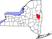
Towns Ballston | Charlton | Clifton Park | Corinth | Day | Edinburg | Galway | Greenfield | Hadley | Halfmoon | Malta | Milton | Moreau | Northumberland | Providence | Saratoga | Stillwater | Waterford | Wilton
Villages Ballston Spa | Corinth | Galway | Round Lake | Schuylerville | South Glens Falls | Stillwater | Victory | Waterford
CDPs Other
hamletsBloodville | Burnt Hills | Crescent | Gansevoort | Rexford | Rock City Falls | Vischer Ferry | West Milton
Footnotes ‡This populated place also has portions in an adjacent county or counties
Categories:- Villages in New York
- Schuyler family
- Populated places on the Hudson River
- Populated places in Saratoga County, New York


Wikimedia Foundation. 2010.