- Newcomerstown, Ohio
-
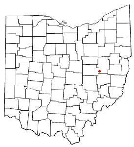
Newcomerstown, Ohio — Village — Location of Newcomerstown, Ohio
Coordinates: 40°16′28″N 81°36′9″W / 40.27444°N 81.6025°WCoordinates: 40°16′28″N 81°36′9″W / 40.27444°N 81.6025°W Country United States State Ohio County Tuscarawas Townships Oxford, Salem Government - Mayor Steven Guy Area - Total 2.5 sq mi (6.6 km2) - Land 2.5 sq mi (6.4 km2) - Water 0.1 sq mi (0.2 km2) Elevation[1] 810 ft (247 m) Population (2000) - Total 4,008 - Density 1,619.7/sq mi (625.4/km2) Time zone Eastern (EST) (UTC-5) - Summer (DST) EDT (UTC-4) ZIP code 43832 Area code(s) 740 FIPS code 39-54432[2] GNIS feature ID 1066860[1] Website http://www.newcomerstownoh.com/ Newcomerstown is a village in Tuscarawas County, Ohio, United States, 85 miles (137 km) east-northeast of Columbus. In the late 1770s, this was the largest Lenape village on the Tuscarawas River, with 700 residents. Chief Newcomer (Netawatwes) was the leader of the western Lenape here, and they called the village Gekelmukpechunk. Early European-American traders and settlers named the village Newcomerstown after the chief. Soon after the start of the American Revolutionary War, the Lenape moved west to Coshocton, Ohio.[3]
According to some accounts, Newcomerstown was named after an incident that occurred between a Lenape chief and his wife, Mary Harris. The chief, Eagle Feather grew tired of his wife and abducted a younger squaw and attempted to assimilate her into the same wigwam as Harris. Harris allegedly killed Chief Eagle Feather and told the warriors of the village that the young squaw ran away. The warriors hunted her down and killed her. The settlement was thenceforth known as "Newcomerstown," after the squaw. [4]
In 1900, 2,659 people lived in Newcomerstown; in 1910, 2,943. The population was 4,008 at the 2000 census.
Contents
Geography
Newcomerstown is located at 40°16′28″N 81°36′9″W / 40.27444°N 81.6025°W (40.274350, -81.602482),[5] along the Tuscarawas River.[6]
According to the United States Census Bureau, the village has a total area of 2.5 square miles (6.5 km2), of which, 2.5 square miles (6.5 km2) of it is land and 0.1 square miles (0.26 km2) of it (2.36%) is water.
Demographics
As of the census[2] of 2000, there were 4,008 people, 1,654 households, and 1,063 families residing in the village. The population density was 1,619.7 people per square mile (626.5/km²). There were 1,817 housing units at an average density of 734.3 per square mile (284.0/km²). The racial makeup of the village was 95.83% White, 2.57% African American, 0.25% Native American, 0.07% Asian, 0.20% from other races, and 1.07% from two or more races. Hispanic or Latino of any race were 0.72% of the population.
There were 1,654 households out of which 31.4% had children under the age of 18 living with them, 46.8% were married couples living together, 13.2% had a female householder with no husband present, and 35.7% were non-families. 31.0% of all households were made up of individuals and 16.0% had someone living alone who was 65 years of age or older. The average household size was 2.37 and the average family size was 2.96.
In the village the population was spread out with 26.1% under the age of 18, 7.8% from 18 to 24, 26.9% from 25 to 44, 21.2% from 45 to 64, and 17.9% who were 65 years of age or older. The median age was 38 years. For every 100 females there were 86.9 males. For every 100 females age 18 and over, there were 81.8 males.
The median income for a household in the village was $27,414, and the median income for a family was $34,464. Males had a median income of $26,703 versus $18,375 for females. The per capita income for the village was $15,946. About 12.0% of families and 16.0% of the population were below the poverty line, including 26.2% of those under age 18 and 11.4% of those age 65 or over.
Notable natives and residents
- Woody Hayes - coach, known for coaching the Ohio State Buckeyes football team
- Chief Newcomer (Netawatwes), western Lenape chief of Gekelmukpechunk, the settlement later called Newcomerstown after him, and founder of the principal village of Coshocton, Ohio.
- Cy Young - famous pitcher who is honored by baseball's Cy Young Award
References
- ^ a b "US Board on Geographic Names". United States Geological Survey. 2007-10-25. http://geonames.usgs.gov. Retrieved 2008-01-31.
- ^ a b "American FactFinder". United States Census Bureau. http://factfinder.census.gov. Retrieved 2008-01-31.
- ^ History of Newcomerstown, Ohio, Ohio History, accessed 19 Mar 2010
- ^ [1]Incident Among Indians Gave Community Name
- ^ "US Gazetteer files: 2010, 2000, and 1990". United States Census Bureau. 2011-02-12. http://www.census.gov/geo/www/gazetteer/gazette.html. Retrieved 2011-04-23.
- ^ DeLorme (1991). Ohio Atlas & Gazetteer. Yarmouth, Maine: DeLorme. ISBN 0-89933-233-1.
External links
Municipalities and communities of Tuscarawas County, Ohio County seat: New Philadelphia Cities 
Villages Baltic‡ | Barnhill | Bolivar | Dennison | Gnadenhutten | Midvale | Mineral City | Newcomerstown | Parral | Port Washington | Roswell | Stone Creek | Strasburg | Sugarcreek | Tuscarawas | Zoar
Townships Unincorporated
communitiesBernice | Dundee | Gilmore | New Cumberland | Newport | Peoli | Sandyville | Somerdale | Stillwater | Wainwright
Footnotes ‡This populated place also has portions in an adjacent county or counties
Categories:- Villages in Ohio
- Populated places in Tuscarawas County, Ohio

Wikimedia Foundation. 2010.