- Nether Wallop
-
Coordinates: 51°07′39″N 1°34′23″W / 51.127635°N 1.5731840°W
Nether Wallop 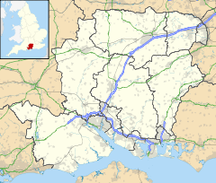
 Nether Wallop
Nether Wallop shown within HampshireOS grid reference SU2996536570 District Test Valley Shire county Hampshire Region South East Country England Sovereign state United Kingdom Post town ROMSEY Postcode district SO20 E Police Hampshire Fire Hampshire Ambulance South Central EU Parliament South East England UK Parliament North West Hampshire List of places: UK • England • Hampshire Nether Wallop is a village in central Hampshire, England.
It is part of The Wallops: Nether, Middle and Over Wallop. The name derives from 'waella' (stream) and 'hop' (valley) or 'the valley of springing water'. The element 'Wallop' is first attested in the Domesday Book of 1086 as 'Wallope'; 'Wollop inferior', that is to say Nether Wallop, is first attested circa 1270 in Episcopal Registers.[1]The village contains many old thatched cottages and has been featured in books and TV programmes as one of the prettiest villages in England.[2]
Nether Wallop was used as the setting for Miss Marple's village of St. Mary Mead in the BBC adaptations of Agatha Christie's novels.
Sir Richard Reade ( 1511-1575 ) Lord Chancellor of Ireland, was a native of Nether Wallop.
The conductor Leopold Stokowski died at his home in Nether Wallop on 13 September 1977.
The church is partly Anglo-Saxon, and unique fragments of frescoes apparently dating to the late Anglo-Saxon period have been discovered.[3]
References
Towns, villages and hamlets in the Test Valley District of Hampshire, England 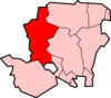 Abbotswood · Abbotts Ann · Abbotts Ann Down · Ampfield · Amport · Andover · Andover Down · Anna Valley · Appleshaw · Ashfield · Awbridge · Barton Stacey · Bossington · Braishfield · Broughton · Charlton · Chattis Hill · Chilbolton · Chilbolton Down · Clanville · Crampmoor · Dunbridge · Dunley · East Anton · Embley · East Cholderton · East Dean · East Tytherley · Faberstown · Faccombe · Finkley · Finkley Down · Forton · Fox Amport · Foxcotte · Freefolk · Fullerton · Fyfield · Goodworth Clatford · Gore End · Grateley · Hatherden · Hillyfields · Houghton · Houghton Down · Hurstbourne Tarrant · Kimbridge · Kimpton · King's Somborne · Knights Enham · Leckford · Lickenholt · Little Down · Little Hatherden · Little Somborne · Lockerley · Longparish · Longstock · Longstock Park · Lower Wyke · Marsh Court · Michelmersh · Middle Wallop · Monxton · Mottisfont · Nether Wallop · Newton Stacey · North Baddesley · North Houghton · Nursling · Over Wallop · Penton Corner · Penton Grafton · Picket Piece · Picket Twenty · Pill Heath · Plaitford · Quarley · Ragged Appleshaw · Ramridge Park · Red Post Bridge · Red Rice · Redenham · Romsey · Sherfield English · Shipton Bellinger · Shootash · Smannell · South Harewood · Stockbridge · Tangley · Thruxton · Up Somborne · Upper Clatford · Upper Enham · Vernhams Dean · Vernham Street · Wellow · West Tytherley · Wherwell · Wherwell Wood · WildhernCategories:
- Villages in Hampshire
- Hampshire geography stubs


Wikimedia Foundation. 2010.