- Old Somerby
-
Coordinates: 52°53′23″N 0°34′30″W / 52.889855°N 0.574959°W
Old Somerby 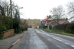
Old Somerby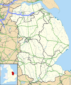
 Old Somerby
Old Somerby shown within LincolnshirePopulation 242 (2001) OS grid reference SK959334 District South Kesteven Shire county Lincolnshire Region East Midlands Country England Sovereign state United Kingdom Postcode district NG33 Police Lincolnshire Fire Lincolnshire Ambulance East Midlands EU Parliament East Midlands UK Parliament Grantham and Stamford List of places: UK • England • Lincolnshire Old Somerby is situated three miles east of the town of Grantham in southern Lincolnshire in South Kesteven.[1] It is situated on the B1176 approximately 1 mile from its junction with the A52 and B6403 and 250 metres from the East Coast Main Line.[2]
The ecclesiastical parish is part of The North Beltisloe Group of the Deanery of Beltisloe in the Diocese of Lincoln. The incumbent is The Revd Richard Ireson.[3]
A very small village, the main attraction is the impressive Fox and Hounds public house on Grantham Road (B1176). Adjacent villages are Ropsley and Boothby Pagnell.
Despite the size, the village is divided into Old Somerby, High Somerby and Low Somerby.[2]
History
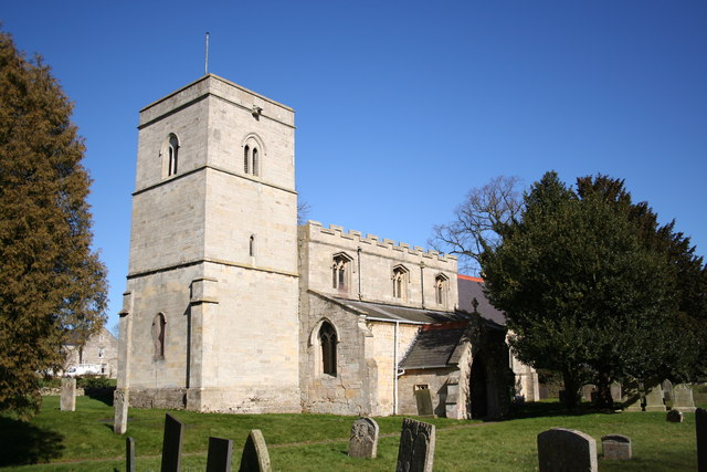
 St Mary Magdalene's church
Somerby was a colony of the Danes who ruled Lincolnshire after King Alfred made peace with them in 878. Its name was Summerledebi, meaning the home of the Summer Sailor, under which name it appears in the Domesday book.[4]
The village church in High Somerby is dedicated to St Mary Magdalene, the same dedication as at nearby Bitchfield.[5][4]
Nearby there is a moated Manor house site.[6]
References
- ^ Parish Council
- ^ a b OSGB (2006). Grantham: Bottesford & Colsterworth (Map). 1:25000 (3 ed.). p. 247. ISBN 9780319238332. http://leisure.ordnancesurvey.co.uk/products/paper-maps/paper-maps-ordnance-survey-great-britain/paper-maps-ordnance-survey-great-britain-os-explorer-map/grantham/pid-9780319238332.
- ^ "Eclesiastical Parish details". http://www.lincoln.anglican.org/search_parishes.php?14023060.
- ^ a b "Parish details on North Beltisloe web site". http://www.northbeltisloeparishes.co.uk/somerby.htm.
- ^ "National Monument record for Church". http://www.pastscape.org.uk/hob.aspx?hob_id=325695.
- ^ "National Monument Record for Manor Farm". http://www.pastscape.org.uk/hob.aspx?hob_id=325692.
External links
Categories:- Villages in Lincolnshire
- Civil parishes in Lincolnshire
- South Kesteven
- Lincolnshire geography stubs


Wikimedia Foundation. 2010.