- Delmont, Pennsylvania
-
Delmont, Pennsylvania — Borough — Delmont's business district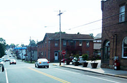
Greensburg Street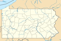
 Delmont, Pennsylvania
Coordinates: 40°24′47″N 79°34′17″W / 40.41306°N 79.57139°WCoordinates: 40°24′47″N 79°34′17″W / 40.41306°N 79.57139°W Country United States State Pennsylvania County Westmoreland Settled Incorporated Government – Type Borough Council – Mayor Area – Total 1.1 sq mi (2.8 km2) Elevation 1,260 ft (384 m) Population (2000) – Total 2,497 – Density 2,333.1/sq mi (900.8/km2) Time zone Eastern (EST) (UTC-5) – Summer (DST) EDT (UTC-4) Zip code 15626 Website Delmont's website Delmont is a borough in Westmoreland County, Pennsylvania, United States. The population was 2,497 at the 2000 census.
Contents
Geography
Delmont is located at 40°24′47″N 79°34′17″W / 40.41306°N 79.57139°W (40.412971, -79.571433)[1].
According to the United States Census Bureau, the borough has a total area of 1.1 square miles (2.8 km2), all of it land.
Delmont has been assigned the ZIP code of 15626.
Demographics
As of the census[2] of 2000, there were 2,497 people, 1,070 households, and 714 families residing in the borough. The population density was 2,333.1 people per square mile (901.0/km²). There were 1,139 housing units at an average density of 1,064.2 per square mile (411.0/km²). The racial makeup of the borough was 97.96% White, 0.52% African American, 0.04% Native American, 0.44% Asian, 0.04% from other races, and 1.00% from two or more races. Hispanic or Latino of any race were 0.24% of the population.
There were 1,070 households out of which 31.0% had children under the age of 18 living with them, 55.4% were married couples living together, 9.3% had a female householder with no husband present, and 33.2% were non-families. 29.9% of all households were made up of individuals and 12.1% had someone living alone who was 65 years of age or older. The average household size was 2.33 and the average family size was 2.91.
In the borough the population was spread out with 24.4% under the age of 18, 6.2% from 18 to 24, 31.0% from 25 to 44, 24.7% from 45 to 64, and 13.7% who were 65 years of age or older. The median age was 39 years. For every 100 females there were 92.2 males. For every 100 females age 18 and over, there were 88.2 males.
The median income for a household in the borough was $39,700, and the median income for a family was $52,056. Males had a median income of $39,097 versus $25,804 for females. The per capita income for the borough was $21,090. About 4.6% of families and 6.9% of the population were below the poverty line, including 7.1% of those under age 18 and 14.9% of those age 65 or over.
Most primary and secondary education is provided by two school districts - Greensburg Salem, in Greensburg, and Franklin Regional, in Murrysville. Students to the south and east of the borough are generally assigned to Greensburg Salem, while the bulk of the students in the borough, and those who reside in the north and west portions, attend Franklin Regional.
History
Delmont was initially known as Salem Crossroads. Several areas in and around the borough still carry the Salem reference. Major navigational roads were built through the area in the late 18th century, and what is now local Route 66 was built in 1800. The Northern Turnpike was completed in 1818, which formed the "crossroads". Delmont was a busy stagecoach stop until trains replaced stagecoaches in the 1850s. [1]
The Salem Crossroads Historical Restoration Society is active in maintaining local history. In 1980, the society purchased Shields Farm, a local farm that had been a tannery in the 19th century and which had been well preserved. The borough holds a fall Apple 'N Arts festival on the site. For many years, a Christmas pilgrimage was held on Pittsburgh Street; the pilgrimage is now also held at the farm. [2]
Roads
Aside from the historical genesis of the town as a toll intersection and stagecoach stop, one of Delmont's notable characteristics is that it is the meeting point of two major highways, U.S. Route 22 and State Route 66.
For many years, these roads did not directly intersect but were linked by a cloverleaf interchange. Delmont became known for this interchange; many local merchants incorporated "Cloverleaf" into their business names as a result. Recently, the "cloverleaf" system was dismantled and a Single Point Urban Interchange was built in its place. This change was made to accommodate a plan to widen Route 22, which is one of the most heavily traveled roads in Pennsylvania.
Points of interest
Note some of the places listed below are not located within the limits of Delmont but are commonly considered in the borough.
- Aspex - A producer of Scanning Electron Microscopes.
- Apple Hill Playhouse – hosts plays and other theatrical performances. The theater commemorated its 50th season in 2006. [3]
- Center Ice Arena – an ice skating and recreational facility consisting of three NHL-size ice rinks, a skate shop, party room, conference area, video arcade, and fitness center. It hosts local high school and college hockey games in addition to other events during the year. [4]
- Newhouse Park – a recreational park with a walking/running path, two tennis courts, a basketball court, a deck hockey rink, a little league baseball field, and a standard-size baseball field.
- Cloverleaf Golf Club – a 27-hole public golf course that accommodates outings and weekly leagues.
- Steel City Raceway – a professional motocross racetrack that hosts a variety of races throughout the year, including an AMA Motocross Championship. [5]
- Spagnolo’s Shop ‘N Save – originally Fatur’s Market. Fatur’s Market served the Delmont area for 79 years, during which it played an important role in the community. [6] The Spagnolo family bought the grocery store in January 2006. [7]
- Delmont Public Library – formerly the Delmont Public School building.
- Shields Farm – location of the Apple ‘N Arts Festival, “Christmas in Salem Crossroads,” and Delmont Area Athletic Association (D.A.A.A.) recreational baseball and softball games.
- The Central Hotel – one of Delmont’s historical buildings. It was the means of lodging 19th century stagecoach passengers and currently the building houses several businesses. [8]
- The watering trough – provided stagecoach horses with water from the nearby spring in the 19th century. The watering trough was recently refurbished and still stands today. [9]
- Salem Evangelical Lutheran Church – constructed in 1868. Today, the church is nationally recognized as a historical place and still holds worship every Sunday morning. [10]
References
- ^ "US Gazetteer files: 2010, 2000, and 1990". United States Census Bureau. 2011-02-12. http://www.census.gov/geo/www/gazetteer/gazette.html. Retrieved 2011-04-23.
- ^ "American FactFinder". United States Census Bureau. http://factfinder.census.gov. Retrieved 2008-01-31.
External links
Categories:- Boroughs in Westmoreland County, Pennsylvania
- Populated places established in 1800
- Pittsburgh metropolitan area


Wikimedia Foundation. 2010.