- Isabel, South Dakota
Infobox Settlement
official_name = Isabel, South Dakota
other_name =
native_name =
nickname =
settlement_type =Town
motto =
imagesize =
image_caption =
flag_size =
image_
seal_size =
image_shield =
shield_size =
image_blank_emblem =
blank_emblem_type =
blank_emblem_size =
imagesize =
image_caption =
flag_size =
image_
seal_size =
image_shield =
shield_size =
image_blank_emblem =
blank_emblem_type =
blank_emblem_size =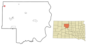
mapsize = 250px
map_caption = Location in Dewey County and the state ofSouth Dakota
mapsize1 =
map_caption1 =
image_dot_
dot_mapsize =
dot_map_caption =
dot_x =
dot_y =
pushpin_
pushpin_label_position =
pushpin_map_caption =
pushpin_mapsize =
subdivision_type = Country
subdivision_name =United States
subdivision_type1 = State
subdivision_name1 =South Dakota
subdivision_type2 = County
subdivision_name2 = Dewey
subdivision_type3 =
subdivision_name3 =
subdivision_type4 =
subdivision_name4 =
government_footnotes =
government_type =
leader_title =
leader_name =
leader_title1 =
leader_name1 =
leader_title2 =
leader_name2 =
leader_title3 =
leader_name3 =
leader_title4 =
leader_name4 =
established_title =
established_date =
established_title2 =
established_date2 =
established_title3 =
established_date3 =
area_magnitude =
unit_pref = Imperial
area_footnotes =
area_total_km2 = 2.3
area_land_km2 = 2.3
area_water_km2 = 0
area_total_sq_mi = 0.9
area_land_sq_mi = 0.9
area_water_sq_mi = 0
area_water_percent =
area_urban_km2 =
area_urban_sq_mi =
area_metro_km2 =
area_metro_sq_mi =
area_blank1_title =
area_blank1_km2 =
area_blank1_sq_mi =
population_as_of = 2000
population_footnotes =
population_note =
population_total = 239
population_density_km2 = 103.9
population_density_sq_mi = 265.6
population_metro =
population_density_metro_km2 =
population_density_metro_sq_mi =
population_urban =
population_density_urban_km2 =
population_density_urban_sq_mi =
population_blank1_title =
population_blank1 =
population_density_blank1_km2 =
population_density_blank1_sq_mi =
timezone = Mountain (MST)
utc_offset = -7
timezone_DST = MDT
utc_offset_DST = -6
latd = 45 |latm = 23 |lats = 38 |latNS = N
longd = 101 |longm = 25 |longs = 50 |longEW = W
elevation_footnotes =
elevation_m = 731
elevation_ft = 2398
postal_code_type =ZIP code
postal_code = 57633
area_code = 605
blank_name = FIPS code
blank_info = 46-32140GR|2
blank1_name = GNIS feature ID
blank1_info = 1255785GR|3
website =
footnotes =Isabel is a town in Dewey County,
South Dakota ,United States . The population was 239 at the 2000 census.Geography
Isabel is located at coor dms|45|23|38|N|101|25|50|W|city (45.393756, -101.430471)GR|1.
According to the
United States Census Bureau , the town has a total area of 0.9square mile s (2.3km² ), all of it land.Isabel has been assigned the
ZIP code 57633 and theFIPS place code 32140.Demographics
As of the
census GR|2 of 2000, there were 239 people, 89 households, and 59 families residing in the town. Thepopulation density was 269.1 people per square mile (103.7/km²). There were 125 housing units at an average density of 140.7/sq mi (54.2/km²). The racial makeup of the town was 66.1% White, 33.1% Native American, 0.42% Pacific Islander, and 5.4% from two or more races. Hispanic or Latino of any race were 0.42% of the population.There were 89 households out of which 34.8% had children under the age of 18 living with them, 49.4% were married couples living together, 10.1% had a female householder with no husband present, and 32.6% were non-families. 31.5% of all households were made up of individuals and 22.5% had someone living alone who was 65 years of age or older. The average household size was 2.69 and the average family size was 3.38.
In the town the population was spread out with 33.9% under the age of 18, 5.4% from 18 to 24, 24.7% from 25 to 44, 16.7% from 45 to 64, and 19.2% who were 65 years of age or older. The median age was 35 years. For every 100 females there were 91.2 males. For every 100 females age 18 and over, there were 90.4 males.
The median income for a household in the town was $14,643, and the median income for a family was $18,750. Males had a median income of $23,438 versus $18,125 for females. The
per capita income for the town was $7,919. About 28.3% of families and 36.8% of the population were below thepoverty line , including 52.2% of those under the age of eighteen and 29.0% of those sixty five or over.References
External links
Wikimedia Foundation. 2010.