- Montrose, South Dakota
-
Montrose, South Dakota — City — Location in McCook County and the state of South Dakota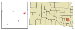
Coordinates: 43°41′58″N 97°11′9″W / 43.69944°N 97.18583°WCoordinates: 43°41′58″N 97°11′9″W / 43.69944°N 97.18583°W Country United States State South Dakota County McCook Platted 1880[1] Area – Total 0.4 sq mi (1.1 km2) – Land 0.4 sq mi (1.1 km2) – Water 0 sq mi (0 km2) Elevation 1,470 ft (448 m) Population (2010) – Total 472 – Density 1,180/sq mi (429.1/km2) Time zone Central (CST) (UTC-6) – Summer (DST) CDT (UTC-5) ZIP code 57048 Area code(s) 605 FIPS code 46-43500[2] GNIS feature ID 1256529[3] Montrose is a city in McCook County, South Dakota, United States. The population was 472 at the 2010 census.
Contents
Geography
Montrose is located at 43°41′58″N 97°11′9″W / 43.69944°N 97.18583°W (43.699453, -97.185858).[4]
According to the United States Census Bureau, the city has a total area of 0.4 square miles (1.0 km2), all of it land.
Montrose has been assigned the ZIP code 57048 and the FIPS place code 43500.
Demographics
As of the census[2] of 2000, there were 460 people, 195 households, and 124 families residing in the city. The population density was 1,133.7 people per square mile (433.2/km²). There were 202 housing units at an average density of 497.8 per square mile (190.2/km²). The racial makeup of the city was 98.70% White, 0.87% Native American, 0.43% from other races. Hispanic or Latino of any race were 1.09% of the population.
There were 195 households out of which 26.7% had children under the age of 18 living with them, 53.8% were married couples living together, 6.2% had a female householder with no husband present, and 35.9% were non-families. 31.3% of all households were made up of individuals and 17.4% had someone living alone who was 65 years of age or older. The average household size was 2.36 and the average family size was 2.98.
In the city the population was spread out with 25.0% under the age of 18, 8.3% from 18 to 24, 28.9% from 25 to 44, 18.3% from 45 to 64, and 19.6% who were 65 years of age or older. The median age was 36 years. For every 100 females there were 88.5 males. For every 100 females age 18 and over, there were 88.5 males.
The median income for a household in the city was $31,250, and the median income for a family was $39,583. Males had a median income of $30,385 versus $19,886 for females. The per capita income for the city was $15,233. About 3.5% of families and 11.8% of the population were below the poverty line, including 8.5% of those under age 18 and 18.9% of those age 65 or over.
About the Town
It has a campground that has a rating of 9/10. It is right next to a pool. It also allows you to camp in a tent. There are hookups for electricity and water. RV Park Reviews
Porter Sculpture Park
The Porter Sculpture Park is located outside the Montrose community, not far from I-90. Inside the park there sit 50 giant metal creatures designed by welding extra metal junk together. Of these 50 there is a 60-foot-tall (18 m) longhorn, a giant pink rocking horse, and a magic dragon. It is an example of one man's view of the world.[1]Porter Sculpture Park
References
- ^ "SD Towns". South Dakota State Historical Society. http://history.sd.gov/Archives/forms/exhibits/SD%20Towns.pdf. Retrieved 2010-02-14.
- ^ a b "American FactFinder". United States Census Bureau. http://factfinder.census.gov. Retrieved 2008-01-31.
- ^ "US Board on Geographic Names". United States Geological Survey. 2007-10-25. http://geonames.usgs.gov. Retrieved 2008-01-31.
- ^ "US Gazetteer files: 2010, 2000, and 1990". United States Census Bureau. 2011-02-12. http://www.census.gov/geo/www/gazetteer/gazette.html. Retrieved 2011-04-23.
Municipalities and communities of McCook County, South Dakota Cities Bridgewater | Canistota | Montrose | Salem | Spencer
 Categories:
- Cities in South Dakota
- Populated places in McCook County, South Dakota
- Sioux Falls metropolitan area


Wikimedia Foundation. 2010.