- Chatmoss, Virginia
-
Chatmoss, Virginia — CDP — Location of Chatmoss, Virginia
Coordinates: 36°40′47″N 79°48′20″W / 36.67972°N 79.80556°WCoordinates: 36°40′47″N 79°48′20″W / 36.67972°N 79.80556°W Country United States State Virginia County Henry Area – Total 5.4 sq mi (13.9 km2) – Land 5.4 sq mi (13.9 km2) – Water 0.0 sq mi (0.1 km2) Elevation 646 ft (197 m) Population (2000) – Total 1,742 – Density 325.4/sq mi (125.6/km2) Time zone Eastern (EST) (UTC-5) – Summer (DST) EDT (UTC-4) FIPS code 51-15048[1] GNIS feature ID 1495377[2] Chatmoss is a census-designated place (CDP) in Henry County, Virginia, USA. The population was 1,742 at the 2000 census. It is part of the Martinsville Micropolitan Statistical Area.
Contents
History
Chatmoss takes its name from a 2,700-acre (11 km2) Hairston family plantation on the site, which was later incorporated into a larger country club building on the site.[3] The Hairston family owned many plantations scattered across the South, including plantations in North Carolina, Tennessee, Mississippi and Virginia. The family's Henry County plantations included still extant Beaver Creek Plantation and Hordsville, as well as plantations at Marrowbone, Magna Vista, Leatherwood, Camp Branch and Shawnee, which are no longer standing.[4] The Chatmoss property was long owned by Harden Hairston, who inherited it, but it was later sold by a descendant to the developers of the country club on the site.[5]
Geography
Chatmoss is located at 36°40′47″N 79°48′20″W / 36.67972°N 79.80556°W (36.679666, -79.805641)[6].
According to the United States Census Bureau, the CDP has a total area of 5.4 square miles (13.9 km²), of which, 5.3 square miles (13.9 km²) of it is land and 0.04 square miles (0.1 km²) of it (0.37%) is water.
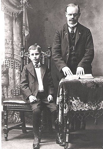
 Blind itinerant evangelist and assistant, Chatmoss, c. 1898
Demographics
As of the census[1] of 2000, there were 1,742 people, 678 households, and 549 families residing in the CDP. The population density was 325.4 people per square mile (125.7/km²). There were 715 housing units at an average density of 133.6/sq mi (51.6/km²). The racial makeup of the CDP was 80.31% White, 15.67% African American, 0.17% Native American, 1.78% Asian, 1.15% from other races, and 0.92% from two or more races. Hispanic or Latino of any race were 6.08% of the population.
There were 678 households out of which 32.3% had children under the age of 18 living with them, 72.6% were married couples living together, 5.8% had a female householder with no husband present, and 18.9% were non-families. 17.1% of all households were made up of individuals and 7.1% had someone living alone who was 65 years of age or older. The average household size was 2.57 and the average family size was 2.88.
In the CDP the population was spread out with 22.8% under the age of 18, 5.3% from 18 to 24, 25.0% from 25 to 44, 33.6% from 45 to 64, and 13.3% who were 65 years of age or older. The median age was 43 years. For every 100 females there were 94.4 males. For every 100 females age 18 and over, there were 93.8 males.
The median income for a household in the CDP was $58,929, and the median income for a family was $67,431. Males had a median income of $46,146 versus $27,031 for females. The per capita income for the CDP was $36,777. About 2.3% of families and 2.3% of the population were below the poverty line, including 1.8% of those under age 18 and 5.1% of those age 65 or over.
References
- ^ a b "American FactFinder". United States Census Bureau. http://factfinder.census.gov. Retrieved 2008-01-31.
- ^ "US Board on Geographic Names". United States Geological Survey. 2007-10-25. http://geonames.usgs.gov. Retrieved 2008-01-31.
- ^ Chatmoss celebrates half century of club growth, sports, friendships, The Martinsville Bulletin, 16 November 2008
- ^ Henry County, Thomas D. Perry, Arcadia Publishing, 2009, ISBN 9780738567044
- ^ History of Patrick and Henry Counties, Virginia, Virginia G. Pedigo, Lewis Gravely Pedigo, Genealogical Publishing Company, 1977, ISBN 9780806380100
- ^ "US Gazetteer files: 2010, 2000, and 1990". United States Census Bureau. 2011-02-12. http://www.census.gov/geo/www/gazetteer/gazette.html. Retrieved 2011-04-23.
Municipalities and communities of Henry County, Virginia Town 
CDPs Bassett | Chatmoss | Collinsville | Fieldale | Horsepasture | Laurel Park | Oak Level | Sandy Level | Stanleytown | Villa Heights
Unincorporated
communityCategories:- Populated places in Henry County, Virginia
- Census-designated places in Virginia
- Martinsville micropolitan area

Wikimedia Foundation. 2010.