- Chester, West Virginia
-
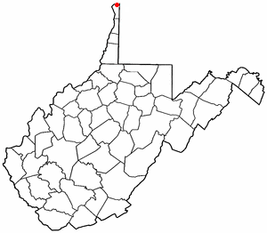
Chester, West Virginia — City — City Hall Location of Chester, West Virginia
Coordinates: 40°36′46″N 80°33′46″W / 40.61278°N 80.56278°WCoordinates: 40°36′46″N 80°33′46″W / 40.61278°N 80.56278°W Country United States State West Virginia County Hancock Government - Mayor Ken Morris Area - Total 1.0 sq mi (2.5 km2) - Land 1.0 sq mi (2.5 km2) - Water 0.0 sq mi (0.0 km2) Elevation 705 ft (215 m) Population (2000) - Total 2,592 - Density 2,705.1/sq mi (1,044.4/km2) Time zone Eastern (EST) (UTC-5) - Summer (DST) EDT (UTC-4) ZIP code 26034 Area code(s) 304 FIPS code 54-15076[1] GNIS feature ID 1537260[2] Chester is a city in Hancock County, West Virginia, United States, along the Ohio River. It is part of the Weirton–Steubenville, WV-OH Metropolitan Statistical Area. The population was 2,592 at the 2000 census. Chester was established in 1896, but not incorporated until 1907. The city is named for J.C. McDonald, one of the city's original planners.
Chester is home to the Mountaineer Casino, Racetrack and Resort, a popular regional attraction, and the Chester teapot, the World's Largest Teapot.
Contents
Geography
Chester is located at 40°36′46″N 80°33′46″W / 40.61278°N 80.56278°W (40.612792, -80.562771)[3]. At the outbreak of hostilities of the American Civil War in April, 1861, this location was the northernmost point in any slave state (at the time, Virginia).
According to the United States Census Bureau, the city has a total area of 1.0 square miles (2.5 km²), all of it land.
Demographics
As of the census[1] of 2000, there were 2,592 people, 1,160 households, and 725 families residing in the city. The population density was 2,705.1 people per square mile (1,042.5/km²). There were 1,289 housing units at an average density of 1,345.2 per square mile (518.4/km²). The racial makeup of the city was 98.77% White, 0.15% African American, 0.23% Asian, 0.31% from other races, and 0.54% from two or more races. Hispanic or Latino of any race were 1.12% of the population.
There were 1,160 households out of which 25.8% had children under the age of 18 living with them, 46.4% were married couples living together, 11.5% had a female householder with no husband present, and 37.5% were non-families. 33.8% of all households were made up of individuals and 16.8% had someone living alone who was 65 years of age or older. The average household size was 2.23 and the average family size was 2.85.
The age distribution is 22.0% under the age of 18, 8.0% from 18 to 24, 27.2% from 25 to 44, 23.1% from 45 to 64, and 19.8% who were 65 years of age or older. The median age was 40 years. For every 100 females there were 88.0 males. For every 100 females age 18 and over, there were 87.0 males.
The median income for a household in the city was $28,550, and the median income for a family was $37,672. Males had a median income of $30,625 versus $18,724 for females. The per capita income for the city was $17,137. About 8.1% of families and 10.8% of the population were below the poverty line, including 11.3% of those under age 18 and 11.6% of those age 65 or over.
See also
- List of cities and towns along the Ohio River
- Jennings Randolph Bridge
Notable residents
- Win Mercer, born in Chester, major league baseball player[4]
- Daniel Johnston, artist, singer and songwriter.
References
- ^ a b "American FactFinder". United States Census Bureau. http://factfinder.census.gov. Retrieved 2008-01-31.
- ^ "US Board on Geographic Names". United States Geological Survey. 2007-10-25. http://geonames.usgs.gov. Retrieved 2008-01-31.
- ^ "US Gazetteer files: 2010, 2000, and 1990". United States Census Bureau. 2011-02-12. http://www.census.gov/geo/www/gazetteer/gazette.html. Retrieved 2011-04-23.
- ^ Reichler, Joseph L., ed (1979) [1969]. The Baseball Encyclopedia (4th edition ed.). New York: Macmillan Publishing. ISBN 0-02-578970-8.
External links
Municipalities and communities of Hancock County, West Virginia County seat: New Cumberland Cities Chester | New Cumberland | Weirton‡

CDP Unincorporated
communitiesChestnut Hill | Congo | Fairhaven | Kings Creek | Lawrenceville | Lennyville | Moscow | New Manchester | Pleasant Valley | Sun Valley
Footnotes ‡This populated place also has portions in an adjacent county or counties
The Northern Panhandle of West Virginia Counties 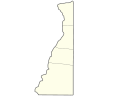
Communities Beech Bottom | Benwood | Bethlehem | Bethany | Cameron | Chester | Clearview | Follansbee | Glen Dale | McMechen | Moundsville | New Cumberland | New Vrindaban | Triadelphia | Valley Grove | Weirton | Wellsburg | West Liberty | Wheeling | Windsor Heights
Attractions Bethany College | Capitol Theatre | Chester Teapot | Grave Creek Mound | Mountaineer Casino, Racetrack and Resort | Oglebay Park | Palace of Gold | Tomlinson Run State Park | West Liberty University | West Virginia Independence Hall | West Virginia Northern Community College | West Virginia State Penitentiary | Wheeling Island | Wheeling Island Hotel-Casino-Racetrack | Wheeling Jesuit University | Wheeling Suspension Bridge | The Highlands Shopping, Dining & Entertainment Complex
Categories:- Cities in West Virginia
- Populated places in Hancock County, West Virginia
- Weirton–Steubenville metropolitan area


Wikimedia Foundation. 2010.