Ceredigion — For other uses, see Ceredigion (disambiguation). Ceredigion Sir Ceredigion Geography Area Total % … Wikipedia
New Quay — This article is about the town in Wales. For the similarly named town of Newquay in Cornwall, see Newquay. For other uses, see New Quay (disambiguation). New Quay Welsh: Cei Newydd … Wikipedia
Devil's Bridge, Ceredigion — The three bridges, looking downstream … Wikipedia
River Teifi — The River Teifi (Welsh: Afon Teifi ) is a river in West Wales flowing into the sea below Cardigan town. The catchment of the river is estimated to be 1,008 square kilometres yielding an average flow at Glan Teifi of 31.026 m³/s. The maximum… … Wikipedia
Mwnt — Coordinates: 52°08′13″N 4°38′20″W / 52.13684°N 4.63878°W / 52.13684; 4.63878 … Wikipedia
List of places in Ceredigion — This is a list of towns and villages in the principal area of Ceredigion, Wales. See the list of places in Wales for places in other principal areas.compactTOC NOTOC A*Aberaeron *Aberarth *Aberffrwd *Aber meurig *Aberporth *Aberystwyth *Allt y… … Wikipedia
Dinerth Castle — The Castle of Dinerth (Welsh: Castell Dineirth or Castell Dinerth, also Castell Allt Craig Arth) is a Welsh castle located near Aberarth, Ceredigion, west Wales (ca.1110). The ruins of the medieval timber castle can be found on a hill about 1½… … Wikipedia
Penbryn — beach Penbryn (grid reference SN294520) is a village on the coast of Ceredigion in Wales, some ten miles up the coast from Cardigan between the vil … Wikipedia
Oakford, Ceredigion — Oakford (Welsh Derwen Gam) is a hamlet in the Welsh county of Ceredigion. It is some 5 miles (8 km) south of the coastal town of Aberaeron. External links www.geograph.co.uk : photos of Oakford and surrounding area Map sources for… … Wikipedia
Cribyn — For the mountain in the Brecon Beacons, see Cribyn (hill). Coordinates: 52°08′20″N 4°09′43″W / 52.139°N 4.162°W / 52.13 … Wikipedia
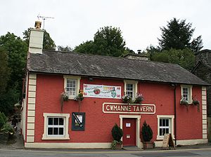 Cwmanne Tavern

