- Cranesville Swamp Preserve
-
Cranesville Swamp Preserve Nature Conservancy Preserve  Bog at Cranesville Swamp
Country United States States Maryland, West Virginia Counties Garrett MD, Preston WV Elevation 2,547 ft (776.3 m) [1] Coordinates 39°31′53″N 79°28′55″W / 39.53139°N 79.48194°W Area 1,600 acres (647.5 ha) [2] Established 1960 [2] - National Natural Landmark October 1964 [3] Owner The Nature Conservancy IUCN category III - Natural Monument Nearest city Friendsville, Maryland 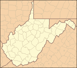
 Location of Cranesville Swamp Preserve in West Virginia
Wikimedia Commons: Cranesville Swamp Preserve Website: Cranesville Swamp Preserve Cranesville Swamp Preserve is a 1,600-acre (650 ha) preserve situated in Preston County, West Virginia and Garrett County, Maryland.[4] It is one of the few remaining boreal bogs in the southern United States, [5] unusual in harboring many plants and animals that are normally only seen in more northern climates.[4]
Contents
History
The Nature Conservancy purchased the 1,600 acres (650 ha) beginning in 1960.[2] In October 1964, the site was designated as one of the first National Natural Landmarks in the country.[2][3]
Geology
Cranesville Swamp is situated in a natural bowl, or "frost pocket," creating a climate that is more consistent with more northerly regions.[3][4]
Ecology
Flora
Cranesville Swamp's unusual setting allows 19 different plant communities to flourish, [6] with the most dominant species being, among others, Sphagnum moss, Speckled Alder (Alnus rugosa), various sedges (Carex folliculata, and C. stricta) and grasses. Bog species include round-leaved sundew (Drosera rotundifolia) and narrowleaf gentian (Gentiana linearis).[2]
The swamp is also home to the southernmost natural community of larches.[2]
Fauna
In addition to black bear, porcupine, snowshoe hare and a wide variety of birds, the rare northern water shrew has been documented here. Birders have also noted the golden-crowned kinglet and Nashville warbler, rarely seen in this area.[2]
References
- ^ "Cranesville Swamp". Elevation Query. U.S. Geological Survey. http://gisdata.usgs.gov/xmlwebservices2/elevation_service.asmx/getElevation?X_Value=-79.481944&Y_Value=39.531389&Elevation_Units=FEET&Source_Layer=-1&Elevation_Only=FALSE. Retrieved 2009-03-08.
- ^ a b c d e f g "Cranesville Swamp Preserve". The Nature Conservancy. Archived from the original on 2009-03-08. http://www.webcitation.org/5f8Ol6tsI. Retrieved 2009-02-26.
- ^ a b c "Cranesville Swamp Nature Sanctuary". National Park Service. http://www.nature.nps.gov/nnl/Registry/USA_Map/States/Maryland/NNL/CS/index.cfm. Retrieved 2009-03-02.
- ^ a b c "Cranesville Swamp". West Virginia University Extension Service. http://www.wvu.edu/~agexten/wildlife/cranesvi.htm. Retrieved 2009-02-26.
- ^ Fuller, KB; Frank, PS Jr. (Autumn 1974). "The Cranesville Pine Swamp". Atlantic Naturalist. 3 29: 101–105. http://md1.csa.com/partners/viewrecord.php?requester=gs&collection=ENV&recid=7809107&q=Cranesville+swamp&uid=1067078&setcookie=yes. Retrieved 2009-03-04.
- ^ Colbert, Judy (2004). Maryland and Delaware: Off the Beaten Path : a Guide to Unique Places (8, Illustrated ed.). Globe Pequot. p. 10. ISBN 0-7627-4418-9. http://books.google.com/?id=lYny4tkhFgkC&printsec=frontcover#PPA10,M1. Retrieved 2009-03-05.
Categories:- Protected areas of Preston County, West Virginia
- Protected areas of Garrett County, Maryland
- Nature Conservancy preserves
- Nature reserves in Maryland
- Nature reserves in West Virginia


Wikimedia Foundation. 2010.