- Maryland Route 669
-
Maryland Route 669
Springs Road Route information Maintained by MDSHA Length: 1.69 mi[1] (2.72 km) Major junctions South end: 
 US 40 Alt. in Grantsville
North end:  PA 669 near Grantsville
Location Counties: Garrett Highway system Maryland highway system
Interstate • US • State • Minor • Former • Turnpikes←  MD 668
MD 670  →
→Maryland Route 669 (MD 669) is a state highway in the U.S. state of Maryland. Known as Springs Road, the state highway runs 1.69 miles (2.72 km) from U.S. Route 40 Alternate (US 40 Alternate) in Grantsville north to the Pennsylvania state line, where the highway continues as Pennsylvania Route 669 (PA 669). MD 669 was constructed in the early 1930s as MD 417 and renumbered in the early 1960s to match its Pennsylvania counterpart.
Contents
Route description
MD 669 begins at US 40 Alternate (Main Street) in Grantsville. The state highway heads north as a two-lane road, leaving the town limits of Grantsville and passing scattered residences and farmland.[1][2] MD 669 reaches its northern terminus at the Pennsylvania state line, where Springs Road continues north toward Springs and Salisbury as PA 669.[2][3]
History
Springs Road was constructed as a modern highway starting in 1930.[4] The state highway was completed by 1933 and marked as MD 417 in 1935.[5][6] The Pennsylvania Department of Highways designated the adjacent portion of Springs Road part of PA 669 in 1962.[7] The Maryland State Roads Commission renumbered MD 417 to match the Pennsylvania number in 1963.[8]
Junction list
The entire route is in Grantsville in Garrett County.
Mile[1] Destinations Notes 0.00
US 40 Alt. (Main Street) – Keysers Ridge, FrostburgSouthern terminus 1.69 PA 669 (Springs Road) – Springs, PA, Salisbury, PANorthern terminus; Pennsylvania state line 1.000 mi = 1.609 km; 1.000 km = 0.621 mi References
- ^ a b c "Highway Location Reference: Garrett County" (PDF). Maryland State Highway Administration. 2009. http://www.marylandroads.com/Location/2009_GARRETT.pdf. Retrieved 2010-10-27.
- ^ a b Google, Inc. Google Maps – Maryland Route 669 (Map). Cartography by Google, Inc. http://maps.google.com/maps?f=d&source=s_d&saddr=us+40+alternate+and+md-669+grantsville,+md&daddr=Pennsylvania+669+%26+Maryland+669&hl=en&geocode=FXi-XQIdNxRI-yn9j8fGSbrKiTEXF8yZwelwfw%3BFWMdXgIdwB5I-ynJVSclgbnKiTEjXE46lqmcHQ&mra=ls&sll=39.710158,-79.160957&sspn=0.030307,0.077162&ie=UTF8&t=h&z=14. Retrieved 2010-03-01.
- ^ Pennsylvania Department of Transportation (PDF). General Highway Map: Somerset County, Pennsylvania (Map) (2009 ed.). ftp://ftp.dot.state.pa.us/public/pdf/BPR_pdf_files/Maps/GHS/Roadnames/somerset_GHSN.pdf. Retrieved 2010-03-01.
- ^ Report of the State Roads Commission of Maryland. 1927-1930. Baltimore: Maryland State Roads Commission. 1930-10-01. p. 213. http://www.archive.org/details/reportofstateroa1927mary. Retrieved 2010-10-27.
- ^ Maryland Geological Survey. Map of Maryland Showing State Road System: State Aid Roads and Improved County Road Connections (Map) (1933 ed.).
- ^ Maryland Geological Survey. Map of Maryland Showing State Road System: State Aid Roads and Improved County Road Connections (Map) (1935 ed.).
- ^ Pennsylvania Department of Highways (1962). Pennsylvania (Map). Cartography by Pennsylvania Department of Highways (1962-3 ed.).
- ^ Maryland State Roads Commission. Maryland: Official Highway Map (Map) (1963 ed.).
External links
Roads in Garrett County, Maryland State highways 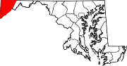
U.S. Highways Interstate Highways Categories:- State highways in Maryland
- Roads in Garrett County, Maryland


Wikimedia Foundation. 2010.