- Maryland Route 831
-
Maryland Route 831
Route information Maintained by MDSHA Location Counties: Allegany, Carroll Highway system Maryland highway system
Interstate • US • State • Minor • Former • Turnpikes←  MD 830
MD 832  →
→Maryland Route 831 (MD 831) is a collection of unsigned state highways in the U.S. state of Maryland. Eight of the nine highways are sections of the old alignment of MD 36 between Frostburg and Cumberland in northwestern Allegany County. The segments of MD 831 range from MD 831A at MD 36's northern terminus to MD 831G south of Frostburg. MD 831H and MD 831I are spurs from MD 831C and MD 831A, respectively. MD 831J is a section of the old alignment of MD 31 in New Windsor in Carroll County.
Allegany County
- MD 831A is the designation for Old Mount Savage Road, an old alignment of MD 36 near MD 36's northern terminus between Corriganville and Cumberland. The state highway runs 0.48 miles (0.77 km) between US 40 Alternate and MD 36. At its northern end, it follows Dakota Road a very short distance to connect back with MD 36 while MD 831I (Dakota Avenue) continues north on the old alignment to a dead end.[1][2]
- MD 831B is the designation for Old Mount Savage Road, an old alignment of MD 36 south of Corriganville. The state highway runs 0.11 miles (0.18 km) between two dead ends with an intersection with Homewood Street, which is unsigned MD 36C between MD 831B and MD 36.[1][3]
- MD 831C is the designation for Kriegbaum Road, an old alignment of MD 36 through Corriganville. The state highway runs east–west 0.90 miles (1.45 km) between two intersections with MD 36. Near the highway's western end, the old alignment continues west as MD 831H to a dead end.[1][4]
- MD 831D is the designation for Portertown Road, a 0.37-mile (0.60 km) section of old alignment of MD 36 between Corriganville and Barrelville.[1][5]
- MD 831G is the designation for Caboose Road, a 0.12-mile (0.19 km) spur from MD 936 south of Frostburg just north of Interstate 68.[1][7]
- MD 831H is an unnamed 0.07-mile (0.11 km) spur from MD 831C near its western terminus to a dead end.[1][8]
- MD 831I is the designation for Dakota Avenue, a 0.04-mile (0.064 km) spur from MD 831A near its northern terminus to a dead end.[1][9]
Carroll County
- MD 831J is the designation for a 0.08-mile (0.13 km) section of Main Street between two intersections with MD 31, which is High Street at the western intersection and Main Street and Green Valley Road at the eastern intersection, in New Windsor.[10][11]
References
- ^ a b c d e f g h "Highway Location Reference: Allegany County" (PDF). Maryland State Highway Administration. 2009. http://www.marylandroads.com/Location/2009_ALLEGANY.pdf. Retrieved 2010-11-11.
- ^ Google, Inc. Google Maps – Maryland Route 831A (Map). Cartography by Google, Inc. http://maps.google.com/maps?f=d&source=s_d&saddr=Maryland+831A%2FMt+Savage+Rd&daddr=Dakota+Ave+NW%2FMaryland+831A&hl=en&geocode=FWxOXQIdPLdN-w%3BFZFmXQId7rpN-w&mra=ls&sll=39.669662,-78.793194&sspn=0.003807,0.009645&ie=UTF8&ll=39.672479,-78.792636&spn=0.007548,0.01929&t=h&z=16. Retrieved 2010-07-02.
- ^ Google, Inc. Google Maps – Maryland Route 831B (Map). Cartography by Google, Inc. http://maps.google.com/maps?f=d&source=s_d&saddr=Unknown+road&daddr=Iowa+Dr+NW&geocode=FaaCXQIdC9FN-w%3BFXqFXQId9NZN-w&hl=en&mra=ls&sll=39.682687,-78.785376&sspn=0.000943,0.002411&ie=UTF8&ll=39.683089,-78.785534&spn=0.000943,0.002411&t=h&z=19. Retrieved 2010-07-02.
- ^ Google, Inc. Google Maps – Maryland Route 831C (Map). Cartography by Google, Inc. http://maps.google.com/maps?f=d&source=s_d&saddr=Kline+Dr+NW%2FMaryland+831C&daddr=Kreighbaum+Rd+NW%2FMaryland+831C&geocode=FSamXQIdEY5N-w%3BFc6rXQId3stN-w&hl=en&mra=ls&sll=39.692353,-78.801734&sspn=0.003773,0.009645&ie=UTF8&t=h&z=16. Retrieved 2010-07-02.
- ^ Google, Inc. Google Maps – Maryland Route 831D (Map). Cartography by Google, Inc. http://maps.google.com/maps?f=d&source=s_d&saddr=Portertown+Rd&daddr=Portertown+Rd+NW&geocode=FfrEXQIdvy1N-w%3BFZa9XQIdhEVN-w&hl=en&mra=ls&sll=39.698099,-78.823294&sspn=0.001886,0.004823&ie=UTF8&t=h&z=17. Retrieved 2010-07-02.
- ^ Google, Inc. Google Maps – Maryland Route 831F (Map). Cartography by Google, Inc. http://maps.google.com/maps?f=d&source=s_d&saddr=Frostburg&daddr=Frostburg&geocode=FbzKXQIdKvJM-w%3BFdrKXQIdqvRM-w&hl=en&mra=ls&sll=39.701343,-78.842778&sspn=0.001886,0.004823&ie=UTF8&t=h&z=20. Retrieved 2010-07-02.
- ^ Google, Inc. Google Maps – Maryland Route 831G (Map). Cartography by Google, Inc. http://maps.google.com/maps?f=d&source=s_d&saddr=Caboose+Rd+SW&daddr=Caboose+Rd+SW&geocode=FRzGXAId1JRL-w%3BFc_KXAIdqZlL-w&hl=en&mra=ls&sll=39.634845,-78.931993&sspn=0.001888,0.004823&ie=UTF8&ll=39.635059,-78.93216&spn=0.001888,0.004823&t=h&z=18. Retrieved 2010-07-02.
- ^ Google, Inc. Google Maps – Maryland Route 831H (Map). Cartography by Google, Inc. http://maps.google.com/maps?f=d&source=s_d&saddr=Kreighbaum+Rd+NW&daddr=Kreighbaum+Rd+NW&geocode=Fa-nXQIdzolN-w%3BFbSmXQIdIo5N-w&hl=en&mra=ls&sll=39.691862,-78.803692&sspn=0.001886,0.004823&ie=UTF8&t=h&z=20. Retrieved 2010-07-02.
- ^ Google, Inc. Google Maps – Maryland Route 831I (Map). Cartography by Google, Inc. http://maps.google.com/maps?f=d&source=s_d&saddr=Dakota+Ave+NW&daddr=Old+Mt+Savage+Rd+NW&geocode=FbxmXQIdArpN-w%3BFWBoXQIdtrpN-w&hl=en&mra=ls&sll=39.67546,-78.792433&sspn=0.003774,0.009645&ie=UTF8&t=h&z=20. Retrieved 2010-07-02.
- ^ "Highway Location Reference: Carroll County" (PDF). Maryland State Highway Administration. 2009. http://www.marylandroads.com/Location/2009_CARROLL.pdf. Retrieved 2010-11-11.
- ^ Google, Inc. Google Maps – Maryland Route 831J (Map). Cartography by Google, Inc. http://maps.google.com/maps?f=d&source=s_d&saddr=Main+St&daddr=Main+St&hl=en&geocode=FShhWwIdvmtn-w%3BFdZiWwIdanFn-w&mra=ls&sll=39.543781,-77.105945&sspn=0.003797,0.009645&ie=UTF8&ll=39.543425,-77.108102&spn=0.001899,0.004823&t=h&z=18. Retrieved 2010-11-11.
Roads in Allegany County, Maryland State highways 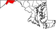
U.S. Highways Interstate Highways Roads in Carroll County, Maryland State highways 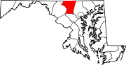
U.S. Highways Interstate Highways Categories:- State highways in Maryland
- Roads in Allegany County, Maryland
- Roads in Carroll County, Maryland


Wikimedia Foundation. 2010.