- Meliden
-
Meliden (Welsh: Gallt Melyd) is a village between Prestatyn and Dyserth in Denbighshire, Wales. It grew up around the locality of lead mines and limestone quarries. The placename "Meliden" has variously been claimed to be derived from that of Bishop Melitus or St. Melyd (the village has the church of St. Melyd as its main place of worship); its Welsh placename, "Gallt Melyd", means "wooded hill of Melyd".[1] The railway between Prestatyn and Dyserth, long since lifted and formerly with sidings in the village, is now a public walkway and nature trek. It has a 9-hole golf course, which is split in half by the former railway/nature walk. The local school, St. Melyd Primary, is a feeder school to the High School, Prestatyn.
Meliden's football club, Meliden F.C., reformed in 2008,[2] joining the Clywd Football League.[3]
References
- ^ Thomas, Harry (2005). Memory Lane. III. Gwasg Helygain. p. 34. ISBN 9780955033827. http://books.google.co.uk/books?id=z_nxRqSciO0C&pg=PA34&dq=%22Saint.+Melyd%22+meliden+%22Gallt+Melyd%22#PPA34,M1.
- ^ Boyd, Andrew (2008-06-18). "Soccer club set to reform". Rhyl Journal (North Wales Newspapers). http://www.rhyljournal.co.uk/sport/Soccer-club-set-to-reform.4189983.jp. Retrieved 2008-12-07.
- ^ "Clwyd Football League Club Directory Season 2008/09". Clwyd Football League. 2008. http://clwydfootballleague.co.uk/Club_Directory.htm#meliden. Retrieved 2008-12-07.
External links
Coordinates: 53°19′N 3°25′W / 53.317°N 3.417°W
Denbighshire Principal settlements 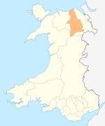
Towns and villages Aberwheeler · Berwyn · Betws Gwerfil Goch · Bodelwyddan · Bodfari · Bontuchel · Bryneglwys · Bylchau · Carrog · Castell · Cefnmeriadog · Cerrigydrudion · Clocaenog · Corwen · Crogen · Cwm · Cyffylliog · Cynwyd · Derwen · Druid · Dyserth · Efenechtyd · Gellifor · Gellioedd · Glasfryn · Glyndyfrdwy · Gronant · Gwaenysgor · Gwyddelwern · Henllan · Hirwaen · Llanarmon-yn-Iâl · Llanbedr-Dyffryn-Clwyd · Llandegla · Llandrillo · Llandyrnog · Llanefydd · Llanelidan · Llanferres · Llanfwrog · Llangar · Llangwyfan · Llangyhafal · Llanrhaeadr-yng-Nghinmeirch · Llansanffraid Glyndyfrdwy · Llantysilio · Llanychan · Llanynys · Llwynmawr · Maerdy · Meliden · Nantglyn · Prion · Pentrecelyn · Rhewl · Rhuallt · Saron · Tafarn Y Gelyn · Trefnant · Trelawnyd · Tremeirchion
Oldest inhabited location Moors Categories:- Villages in Denbighshire
- Clwyd geography stubs

Wikimedia Foundation. 2010.