- National Register of Historic Places listings in Bon Homme County, South Dakota
-
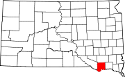
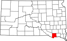 Location of Bon Homme County in South Dakota
This is a list of the National Register of Historic Places listings in Bon Homme County, South Dakota.
This is intended to be a complete list of the properties and districts on the National Register of Historic Places in Bon Homme County, South Dakota, United States. The locations of National Register properties and districts for which the latitude and longitude coordinates are included below, may be seen in a Google map.[1]
There are 39 properties and districts listed on the National Register in the county.
-
- This National Park Service list is complete through NPS recent listings posted November 10, 2011.[2]
Current listings
[3] Landmark name [4] Image Date listed Location City or town Summary 1 Bon Homme County Courthouse December 13, 1984 Walnut and Washington Sts.
42°59′38″N 97°51′56″W / 42.993889°N 97.865556°WTyndall 2 Bon Homme Hutterite Colony 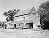
June 30, 1982 On the Missouri River
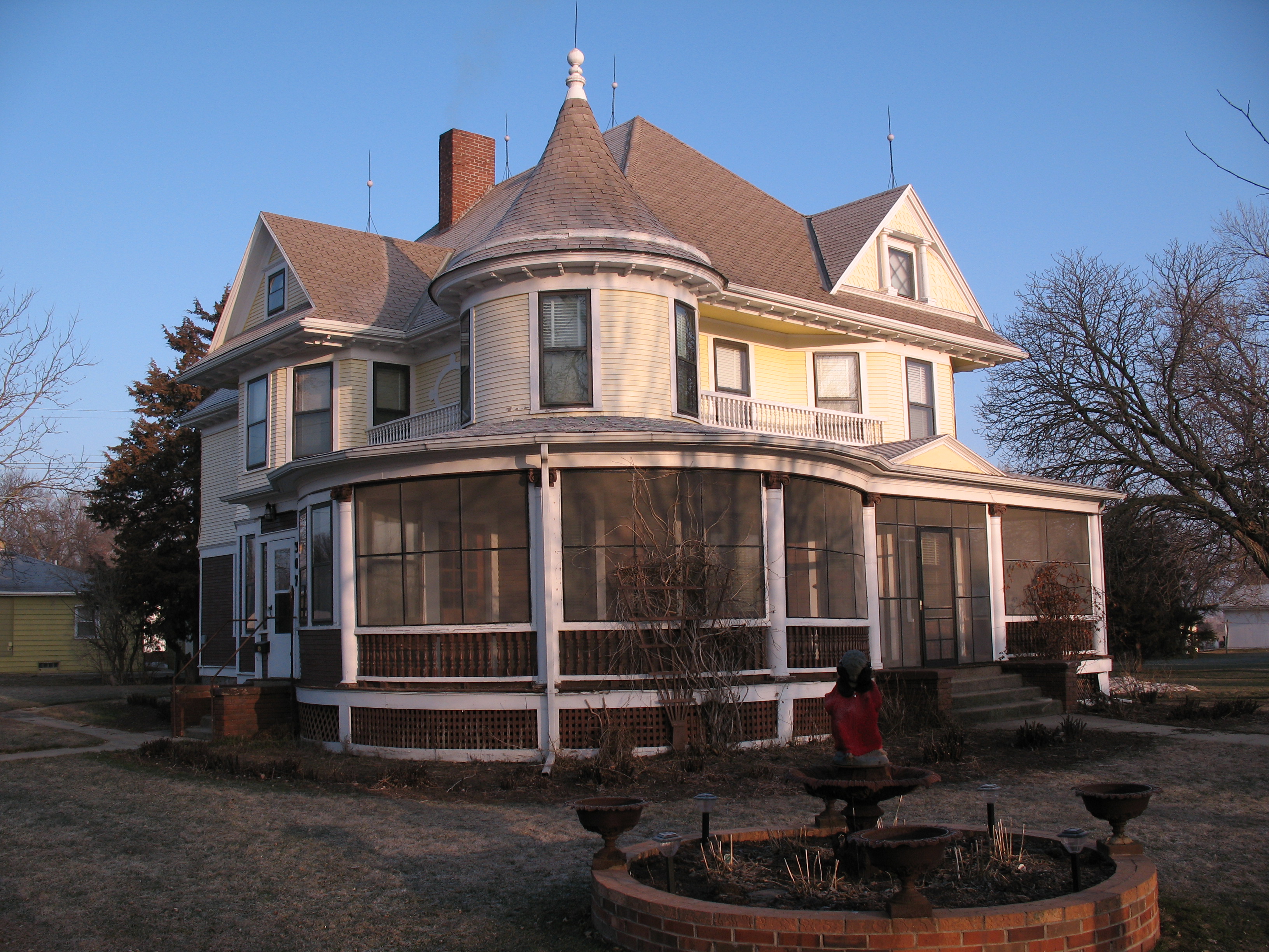
42°51′46″N 97°42′23″W / 42.862778°N 97.706389°WTabor 3 Gen. Charles T. Campbell House June 17, 1982 611 4th St.
43°08′26″N 97°42′58″W / 43.140556°N 97.716111°WScotland 4 Carnegie Public Library of Tyndall December 13, 1984 State and Main Sts.
42°59′33″N 97°51′48″W / 42.9925°N 97.863333°WTyndall 5 Cihak Farmstead November 28, 1984 Southeastern corner of the southwestern quadrant of Section 2, T69N, R60W[5] Scotland 6 John Frydrych Farmstead July 6, 1987 Northern side of Highway 50
42°58′41″N 97°46′32″W / 42.978056°N 97.775556°WTyndall 7 Dr. John C. Greenfield House 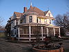
October 19, 1989 307 W. 1st St.
43°00′19″N 98°03′46″W / 43.005278°N 98.062778°WAvon 8 John Hakl Chalkrock House June 7, 1987 Southwest of Tabor off Highway 50
42°56′22″N 97°41′34″W / 42.939444°N 97.692778°WTabor 9 Joseph Herman Chalkrock House July 6, 1987 Western side of Highway 25
42°58′02″N 97°43′13″W / 42.967222°N 97.720278°WTabor 10 Joseph Herman Log Stable July 6, 1987 Western side of Highway 25
42°58′03″N 97°43′14″W / 42.9675°N 97.720556°WTabor 11 Joseph Herman Rubblestone Barn July 6, 1987 Western side of Highway 25
42°58′03″N 97°43′11″W / 42.9675°N 97.719722°WTabor 12 Martin Honner Chalkrock House July 6, 1987 Northwest of Tabor off Highway 50
42°57′15″N 97°40′37″W / 42.954167°N 97.676944°WTabor 13 Koobs House August 1, 1984 431 4th St.
43°08′56″N 97°42′55″W / 43.148889°N 97.715278°WScotland 14 Main Hall February 3, 1981 Former University of South Dakota - Springfield campus
42°51′32″N 97°53′50″W / 42.858889°N 97.897222°WSpringfield 15 John and Kate Merkwan Log and Rubblestone House July 6, 1987 Eastern side of Highway 25
43°00′24″N 97°42′31″W / 43.006667°N 97.708611°WTabor 16 John and Kate Merkwan Rubblestone House-Barn July 6, 1987 Eastern side of Highway 25
43°00′24″N 97°42′33″W / 43.006667°N 97.709167°WTabor 17 John Merkwan, Jr. Rubblestone House July 6, 1987 Western side of Highway 25
43°00′16″N 97°42′59″W / 43.004444°N 97.716389°WTabor 18 Methodist Episcopal Church September 12, 1979 811 6th St.
43°08′51″N 97°42′01″W / 43.1475°N 97.700278°WScotland 19 William Metzgers New Emporium October 7, 2001 1610 Main St.
42°59′38″N 98°06′36″W / 42.993889°N 98.11°WTyndall 20 Peter and Minnie Monfore House 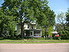
October 31, 2002 612 12th St.
42°51′32″N 97°53′38″W / 42.858889°N 97.893889°WSpringfield 21 Joseph Noll Chalkrock Barn July 6, 1987 South of Tabor off Highway 50
42°56′12″N 97°39′48″W / 42.936667°N 97.663333°WTabor 22 Old St. Wenceslaus Catholic Parish House February 8, 1988 227 Yankton St.
42°56′54″N 97°39′26″W / 42.948333°N 97.657222°WTabor 23 St. Andrew's Episcopal Church June 17, 1982 4th and Poplar Sts.
43°08′30″N 97°42′59″W / 43.141667°N 97.716389°WScotland 24 St. Wenceslaus Catholic Church and Parish House December 13, 1984 Yankton and Lidice Sts.
42°57′02″N 97°39′28″W / 42.950556°N 97.657778°WTabor 25 Scotland Main Street Historic District December 9, 1999 Along Main St., roughly bounded by Railway, Poplar, 3rd, and Juniper Sts.
43°08′58″N 97°43′05″W / 43.149444°N 97.718056°WScotland 26 Scotland Residential Historic District December 13, 1995 Roughly bounded by Chestnut, 5th, Juniper and 3rd Sts.
43°09′04″N 97°42′57″W / 43.151111°N 97.715833°WScotland 27 Scotland Royal Theater October 31, 1996 565 Main St.
43°08′58″N 97°43′09″W / 43.149444°N 97.719167°WScotland 28 Jacob Sedlacek Chalkrock House July 6, 1987 Southwest of Tabor off Highway 50
42°56′06″N 97°41′28″W / 42.935°N 97.691111°WTabor 29 South Dakota Dept. of Transportation Bridge No. 05-028-200 December 9, 1993 Local road over Choteau Creek
42°52′48″N 98°06′48″W / 42.88°N 98.113333°WPerkins 30 South Dakota Dept. of Transportation Bridge No. 05-032-170 December 9, 1993 Local road over Choteau Creek
42°55′25″N 98°06′22″W / 42.923611°N 98.106111°WAvon 31 South Dakota Dept. of Transportation Bridge No. 05-138-080 December 9, 1993 Local road over Emanuel Creek
43°03′13″N 97°53′39″W / 43.053611°N 97.894167°WTyndall 32 South Dakota Dept. of Transportation Bridge No. 05-255-130 December 9, 1993 Local road over Beaver Creek
42°58′52″N 97°39′53″W / 42.981111°N 97.664722°WTabor 33 Tabor School September 2, 1983 Off Highway 50
42°56′51″N 97°39′30″W / 42.9475°N 97.658333°WTabor 34 Teibel-Sykora Rubblestone Barn July 6, 1987 Western side of Highway 25
43°01′17″N 97°43′16″W / 43.021389°N 97.721111°WTabor 35 Thompson House October 23, 2003 30985 421st. Ave.
42°53′46″N 97°46′28″W / 42.896111°N 97.774444°WSpringfield 36 John Travnicek Chalkrock House July 6, 1987 Western side of junction of Highway 50 and Highway 25
42°57′46″N 97°42′55″W / 42.962778°N 97.715278°WTabor 37 Joseph V. Wagner House June 6, 2001 112 Lidice St.
42°56′51″N 97°39′27″W / 42.9475°N 97.6575°WTabor 38 Albion Walker Chalkrock House July 6, 1987 South of Highway 52
42°54′10″N 97°39′36″W / 42.902778°N 97.66°WTabor 39 ZCBJ Hall January 31, 1985 Nebraska and Washington Sts.
42°59′44″N 97°51′58″W / 42.995556°N 97.866111°WTyndall See also
- List of National Historic Landmarks in South Dakota
- National Register of Historic Places listings in South Dakota
References
- ^ The latitude and longitude information provided in this table was derived originally from the National Register Information System, which has been found to be fairly accurate for about 99% of listings. For about 1% of NRIS original coordinates, experience has shown that one or both coordinates are typos or otherwise extremely far off; some corrections may have been made. A more subtle problem causes many locations to be off by up to 150 yards, depending on location in the country: most NRIS coordinates were derived from tracing out latitude and longitudes off of USGS topographical quadrant maps created under North American Datum of 1927, which differs from the current, highly accurate GPS system used by Google maps. Chicago is about right, but NRIS longitudes in Washington are higher by about 4.5 seconds, and are lower by about 2.0 seconds in Maine. Latitudes differ by about 1.0 second in Florida. Some locations in this table may have been corrected to current GPS standards.
- ^ "National Register of Historic Places: Weekly List Actions". National Park Service, United States Department of the Interior. Retrieved on November 10, 2011.
- ^ Numbers represent an ordering by significant words. Various colorings, defined here, differentiate National Historic Landmark sites and National Register of Historic Places Districts from other NRHP buildings, structures, sites or objects.
- ^ "National Register Information System". National Register of Historic Places. National Park Service. . http://nrhp.focus.nps.gov/natreg/docs/All_Data.html.
- ^ Location derived from its NRHP nomination form; the NRIS lists it as "Address Restricted"
U.S. National Register of Historic Places Topics Lists by states Alabama • Alaska • Arizona • Arkansas • California • Colorado • Connecticut • Delaware • Florida • Georgia • Hawaii • Idaho • Illinois • Indiana • Iowa • Kansas • Kentucky • Louisiana • Maine • Maryland • Massachusetts • Michigan • Minnesota • Mississippi • Missouri • Montana • Nebraska • Nevada • New Hampshire • New Jersey • New Mexico • New York • North Carolina • North Dakota • Ohio • Oklahoma • Oregon • Pennsylvania • Rhode Island • South Carolina • South Dakota • Tennessee • Texas • Utah • Vermont • Virginia • Washington • West Virginia • Wisconsin • WyomingLists by territories Lists by associated states Other  Category:National Register of Historic Places •
  Portal:National Register of Historic Places
Municipalities and communities of Bon Homme County, South Dakota County seat: Tyndall Cities Avon | Scotland | Springfield | Tyndall
Town Unorganized
territoriesNortheast Bon Homme | Northwest Bon Homme | Southeast Bon Homme | Southwest Bon Homme
Categories:- Bon Homme County, South Dakota
- National Register of Historic Places in South Dakota by county
- Buildings and structures in Bon Homme County, South Dakota
-


Wikimedia Foundation. 2010.