- National Register of Historic Places listings in Capitol Reef National Park
-
This is a list of the National Register of Historic Places listings in Capitol Reef National Park.
This is intended to be a complete list of the properties and districts on the National Register of Historic Places in Capitol Reef National Park, Utah, United States. The locations of National Register properties and districts for which the latitude and longitude coordinates are included below, may be seen in a Google map.[1]
There are ten properties and districts listed on the National Register in the park.
-
- This National Park Service list is complete through NPS recent listings posted November 10, 2011.[2]
Current listings
[3] Landmark name[4] Image Date listed Location City or Town Summary 1 Elijah Cutler Behunin Cabin 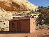
September 13, 1999 State Route 24, 1.5 miles southeast of the tip of Horse Mesa
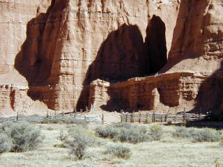
38°16′56″N 111°10′12″W / 38.28222°N 111.17°WTorrey 2 Cathedral Valley Corral 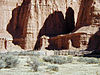
September 13, 1999 Middle Desert, southeast of the confluence of Cathedral Mountain and Cathedral Valley
38°29′5″N 111°20′58″W / 38.48472°N 111.34944°WTorrey 3 Civilian Conservation Corps Powder Magazine 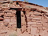
September 13, 1999 South of the Fremont River, north of Cuts Canyon
38°16′33″N 111°15′4″W / 38.27583°N 111.25111°WTorrey 4 Fruita Rural Historic District 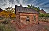
March 25, 1997 Roughly along State Route 24 from Sulphur Creek to Hickman Natural Bridge
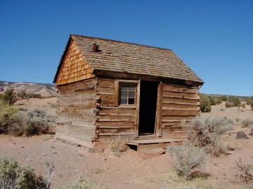
38°17′6″N 111°15′7″W / 38.285°N 111.25194°WFruita 5 Fruita Schoolhouse 
February 23, 1972 Capitol Reef National Park on State Route 24
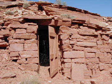
38°17′15″N 111°14′45″W / 38.2875°N 111.24583°WFruita 6 Hanks' Dugouts September 13, 1999 Confluence of Pleasant Creek and South Draw
38°10′39″N 111°11′3″W / 38.1775°N 111.18417°WTorrey 7 Lesley Morrell Line Cabin and Corral 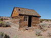
September 13, 1999 Confluence of Middle Desert Wash and Cathedral Valley
38°29′2″N 111°21′55″W / 38.48389°N 111.36528°WTorrey 8 Oak Creek Dam September 13, 1999 Oak Creek, north of North Coleman Canyon
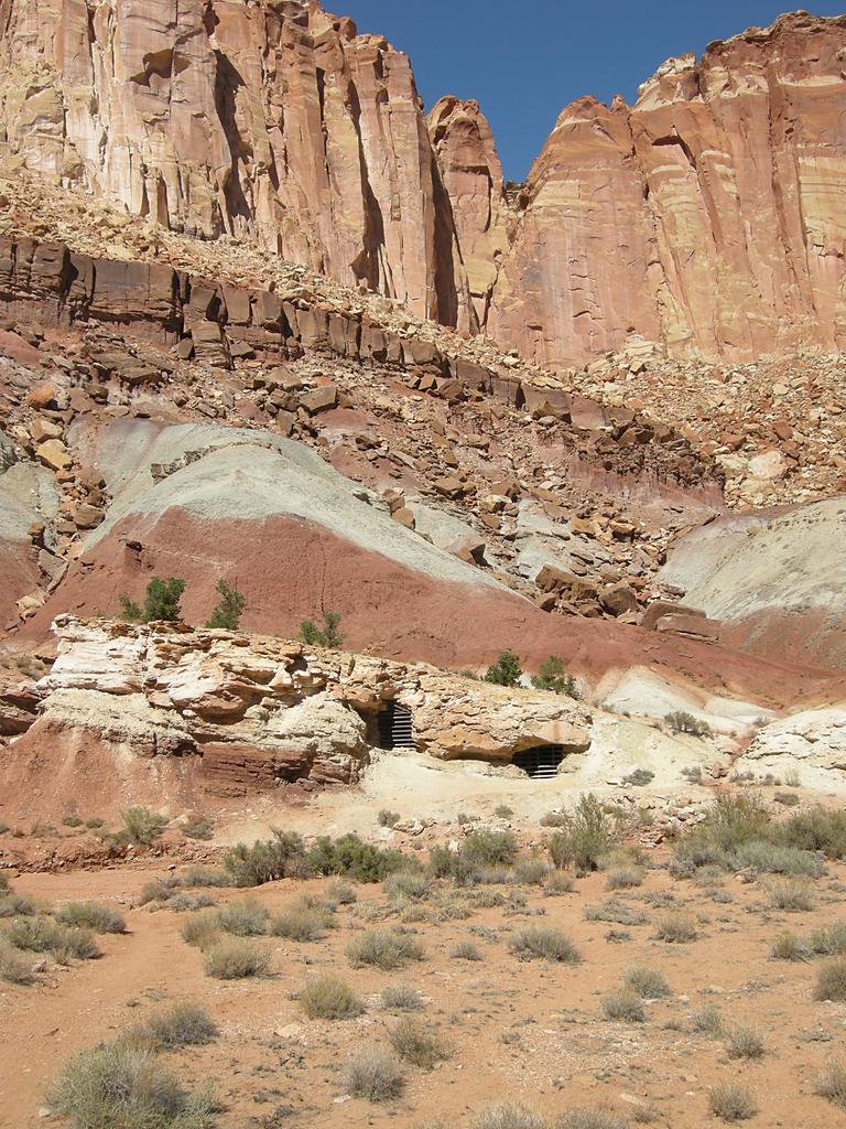
38°5′0″N 111°8′15″W / 38.083333°N 111.1375°WTorrey 9 Oyler Mine 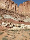
September 14, 1999 Confluence of Grand Wash and Cohab Canyon
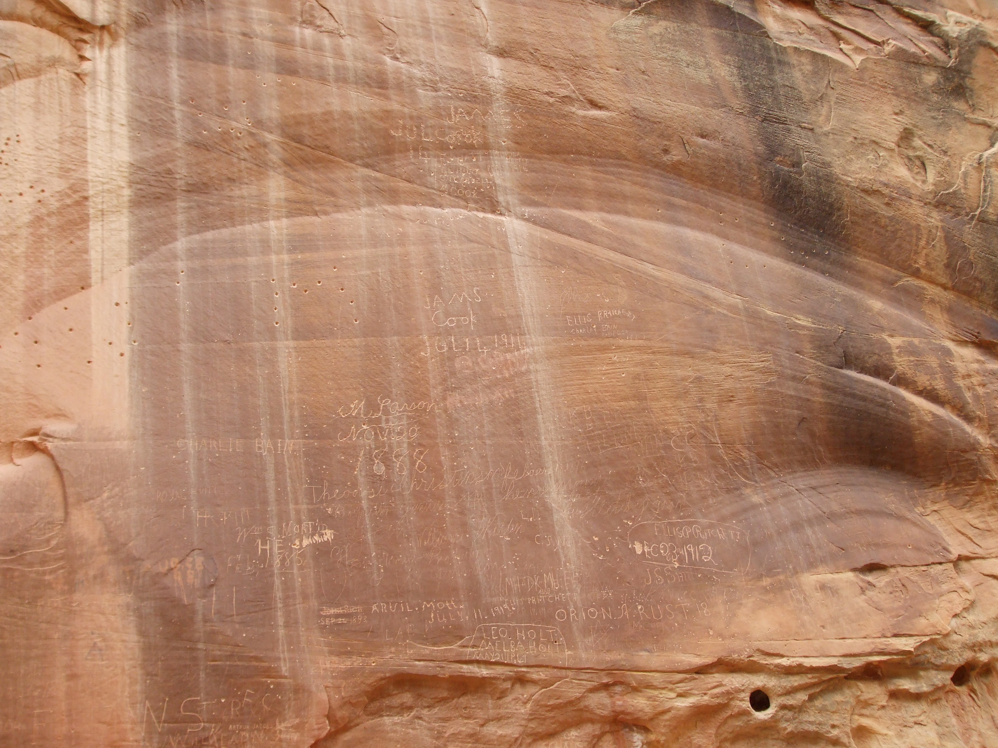
38°15′33″N 111°13′51″W / 38.25917°N 111.23083°WTorrey 10 Pioneer Register 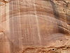
September 13, 1999 Southwest of the confluence of Capitol Wash and Waterpocket Canyon
38°12′41″N 111°9′36″W / 38.21139°N 111.16°WTorrey See also
- National Register of Historic Places listings in Wayne County, Utah
- National Register of Historic Places listings in Garfield County, Utah
- National Register of Historic Places listings in Utah
References
- Brower, Benjamin; McKoy, Kathy. National Register of Historic Places Multiple Property Documentation Form: Capitol Reef National Park Multiple Property Documentation Form. National Park Service March 15, 1996 [1]
- ^ The latitude and longitude information provided in this table was derived originally from the National Register Information System, which has been found to be fairly accurate for about 99% of listings. For about 1% of NRIS original coordinates, experience has shown that one or both coordinates are typos or otherwise extremely far off; some corrections may have been made. A more subtle problem causes many locations to be off by up to 150 yards, depending on location in the country: most NRIS coordinates were derived from tracing out latitude and longitudes off of USGS topographical quadrant maps created under the North American Datum of 1927, which differs from the current, highly accurate WGS84 GPS system used by Google maps. Chicago is about right, but NRIS longitudes in Washington are higher by about 4.5 seconds, and are lower by about 2.0 seconds in Maine. Latitudes differ by about 1.0 second in Florida. Some locations in this table may have been corrected to current GPS standards.
- ^ "National Register of Historic Places: Weekly List Actions". National Park Service, United States Department of the Interior. Retrieved on November 10, 2011.
- ^ Numbers represent an ordering by significant words. Various colorings, defined here, differentiate National Historic Landmark sites and National Register of Historic Places Districts from other NRHP buildings, structures, sites or objects.
- ^ "National Register Information System". National Register of Historic Places. National Park Service. 2008-04-24. http://nrhp.focus.nps.gov/natreg/docs/All_Data.html.
National Register of Historic Places in Capitol Reef National Park Other historic districts Fruita Rural Historic District
Other properties Elijah Cutler Behunin Cabin | Cathedral Valley Corral | Civilian Conservation Corps Powder Magazine | Fruita Schoolhouse | Hanks' Dugouts | Lesley Morrell Line Cabin and Corral | Oak Creek Dam | Oyler Mine | Pioneer Register
See also: National Register of Historic Places listings in Capitol Reef National ParkU.S. National Register of Historic Places Topics Lists by states Alabama • Alaska • Arizona • Arkansas • California • Colorado • Connecticut • Delaware • Florida • Georgia • Hawaii • Idaho • Illinois • Indiana • Iowa • Kansas • Kentucky • Louisiana • Maine • Maryland • Massachusetts • Michigan • Minnesota • Mississippi • Missouri • Montana • Nebraska • Nevada • New Hampshire • New Jersey • New Mexico • New York • North Carolina • North Dakota • Ohio • Oklahoma • Oregon • Pennsylvania • Rhode Island • South Carolina • South Dakota • Tennessee • Texas • Utah • Vermont • Virginia • Washington • West Virginia • Wisconsin • WyomingLists by territories Lists by associated states Other Categories:- National Register of Historic Places lists in the National Park Service
- Capitol Reef National Park
-


Wikimedia Foundation. 2010.