- National Register of Historic Places listings in Eagle County, Colorado
-
 Location of Eagle County in Colorado
This is a list of the National Register of Historic Places listings in Eagle County, Colorado. It is intended to be a complete list of the properties and districts on the National Register of Historic Places in Eagle County, Colorado, United States. The locations of National Register properties and districts for which the latitude and longitude coordinates are included below, may be seen in a Google map.[1]
There are 11 properties and districts listed on the National Register in the county.
-
- This National Park Service list is complete through NPS recent listings posted November 10, 2011.[2]
Listings county-wide
[3] Landmark name [4] Image Date listed Location City or town Summary 1 Archeological Site 5EA484 May 10, 1982 Address Restricted Basalt 2 Camp Hale Site 
April 10, 1992 Address Restricted Leadville 3 Dotsero Bridge October 15, 2002 Interstate 70 service road at milepost 133.51
39°38′57″N 107°03′47″W / 39.649167°N 107.063056°WDotsero 4 Eagle River Bridge 
October 15, 2002 U.S. Route 6 at milepost 150.24
39°39′36″N 106°48′55″W / 39.66°N 106.815278°WEagle 5 First Evangelical Lutheran Church June 24, 1993 400 2nd St.
39°38′44″N 106°57′08″W / 39.645556°N 106.952222°WGypsum 6 Red Cliff Bridge 
February 4, 1985 U.S. Route 24
39°30′29″N 106°22′34″W / 39.508056°N 106.376111°WRed Cliff 7 State Bridge 
June 24, 1985 Off State Highway 131
39°51′29″N 106°38′54″W / 39.858056°N 106.648333°WState Bridge 8 Waterwheel 
April 11, 1977 Southeast of McCoy at the Colorado River
39°54′10″N 106°43′00″W / 39.902778°N 106.716667°WMcCoy 9 Wolcott Bridge October 15, 2002 State Highway 131 at milepost 0.07
39°42′06″N 106°40′39″W / 39.701667°N 106.6775°WWolcott 10 Woods Lake Resort August 11, 1988 11 miles north of Thomasville at Woods Lake
39°25′32″N 106°37′35″W / 39.425556°N 106.626389°WThomasville 11 Yarmony Archeological Site May 28, 1991 Address Restricted Radium See also
- List of National Historic Landmarks in Colorado
- National Register of Historic Places listings in Colorado
References
- ^ The latitude and longitude information provided in this table was derived originally from the National Register Information System, which has been found to be fairly accurate for about 99% of listings. For about 1% of NRIS original coordinates, experience has shown that one or both coordinates are typos or otherwise extremely far off; some corrections may have been made. A more subtle problem causes many locations to be off by up to 150 yards, depending on location in the country: most NRIS coordinates were derived from tracing out latitude and longitudes off of USGS topographical quadrant maps created under North American Datum of 1927, which differs from the current, highly accurate GPS system used by Google maps. Chicago is about right, but NRIS longitudes in Washington are higher by about 4.5 seconds, and are lower by about 2.0 seconds in Maine. Latitudes differ by about 1.0 second in Florida. Some locations in this table may have been corrected to current GPS standards.
- ^ "National Register of Historic Places: Weekly List Actions". National Park Service, United States Department of the Interior. Retrieved on November 10, 2011.
- ^ Numbers represent an ordering by significant words. Various colorings, defined here, differentiate National Historic Landmark sites and National Register of Historic Places Districts from other NRHP buildings, structures, sites or objects.
- ^ "National Register Information System". National Register of Historic Places. National Park Service. . http://nrhp.focus.nps.gov/natreg/docs/All_Data.html.
U.S. National Register of Historic Places Topics Lists by states Alabama • Alaska • Arizona • Arkansas • California • Colorado • Connecticut • Delaware • Florida • Georgia • Hawaii • Idaho • Illinois • Indiana • Iowa • Kansas • Kentucky • Louisiana • Maine • Maryland • Massachusetts • Michigan • Minnesota • Mississippi • Missouri • Montana • Nebraska • Nevada • New Hampshire • New Jersey • New Mexico • New York • North Carolina • North Dakota • Ohio • Oklahoma • Oregon • Pennsylvania • Rhode Island • South Carolina • South Dakota • Tennessee • Texas • Utah • Vermont • Virginia • Washington • West Virginia • Wisconsin • WyomingLists by territories Lists by associated states Other  Category:National Register of Historic Places •
  Portal:National Register of Historic Places
Municipalities and communities of Eagle County, Colorado County seat: Eagle Towns 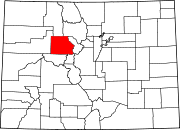
CDPs Unincorporated
communitiesBeaver Creek | Bond | Burns | Cordillera | Eagle-Vail | Gilman
Footnotes ‡This populated place also has portions in an adjacent county or counties
Categories:- National Register of Historic Places in Colorado by county
- Eagle County, Colorado
-


Wikimedia Foundation. 2010.