- National Register of Historic Places listings in Jefferson County, Mississippi
-
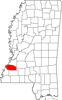 Location of Jefferson County in Mississippi
This is a list of the National Register of Historic Places listings in Jefferson County, Mississippi.
This is intended to be a complete list of the properties and districts on the National Register of Historic Places in Jefferson County, Mississippi, United States. Latitude and longitude coordinates are provided for many National Register properties and districts; these locations may be seen together in a Google map.[1]
There are 23 properties and districts listed on the National Register in the county.
-
- This National Park Service list is complete through NPS recent listings posted November 10, 2011.[2]
Current listings
[3] Landmark name [4] Image Date listed Location City or town Summary 1 Blantonia Plantation House March 4, 1993 3 miles east of Red Lick on an unmarked road off Mississippi Highway 552
31°48′06″N 90°55′55″W / 31.801667°N 90.931944°WLorman 2 Cedar Grove Place March 28, 1979 Mississippi Highway 553
31°42′36″N 91°14′39″W / 31.71°N 91.244167°WChurch Hill 3 China Grove April 3, 1980 West of Lorman off U.S. Route 61
31°49′43″N 91°03′50″W / 31.828611°N 91.063889°WLorman 4 Christ Church May 6, 1977 Mississippi Highway 553
31°42′54″N 91°14′17″W / 31.715°N 91.238056°WChurch Hill 5 Church Hill Rural Historic District September 8, 2000 Mississippi Highway 553 and Church Hill Rd., 1 mile south of Christ Episcopal Church
31°42′27″N 91°14′37″W / 31.7075°N 91.243611°WNatchez 6 Coon Box Fork Bridge May 23, 1979 Coon Box Rd.
31°47′25″N 91°05′37″W / 31.790278°N 91.093611°WCoon Box 7 Hays House March 10, 2009 18800 U.S. Route 61, S.
31°49′28″N 91°02′54″W / 31.824358°N 91.048206°WLorman 8 Hughes-Clark House August 3, 1987 221 Poindexter St.
31°42′40″N 91°03′36″W / 31.711111°N 91.06°WFayette 9 Laurietta November 24, 1980 South of Fayette off Mississippi Highway 33
31°40′45″N 91°04′56″W / 31.679167°N 91.082222°WFayette 10 Mud Island Creek Complex (22JE508 and 22JE513) June 29, 1989 Address Restricted Lorman 11 Oak Grove February 22, 1979 Mississippi Highway 553
31°42′42″N 91°14′22″W / 31.711667°N 91.239444°WChurch Hill 12 Old Hill Place Bridge May 23, 1979 Hill Rd.
31°40′09″N 91°10′52″W / 31.669167°N 91.181111°WFayette 13 Pecan Grove March 13, 1980 North of Church Hill off Mississippi Highway 551
31°44′06″N 91°13′51″W / 31.735°N 91.230833°WChurch Hill 14 Poplar Hill Grade School March 10, 2010 3080 Poplar Hill Rd. Fayette 15 Richland July 5, 1984 Off Mississippi Highway 553
31°45′07″N 91°11′54″W / 31.751944°N 91.198333°WChurch Hill 16 Rodney Center Historic District 
August 29, 1980 Northwest of Lorman
31°51′40″N 91°11′52″W / 31.861111°N 91.197778°WLorman 17 Rodney Presbyterian Church February 6, 1973 West of Alcorn in the village of Rodney
31°51′49″N 91°12′21″W / 31.863611°N 91.205833°WAlcorn 18 Rosswood December 8, 1978 East of Lorman on Mississippi Highway 552
31°49′08″N 91°00′43″W / 31.818889°N 91.011944°WLorman 19 Springfield Plantation 
November 23, 1971 8 miles west of Fayette off Mississippi Highway 553
31°44′46″N 91°11′35″W / 31.746111°N 91.193056°WFayette 20 Union Church Presbyterian Church July 18, 1979 Mississippi Highway 550
31°40′58″N 90°47′26″W / 31.682778°N 90.790556°WUnion Church 21 Woodland Plantation November 27, 1978 South of Church Hill on Mississippi Highway 553
31°40′00″N 91°13′54″W / 31.666667°N 91.231667°WChurch Hill 22 Wyolah Plantation May 30, 1985 Off Mississippi Highway 553
31°42′10″N 91°14′47″W / 31.702778°N 91.246389°WChurch Hill 23 Youngblood Bridge May 23, 1979 Youngblood Rd.
31°38′00″N 90°48′51″W / 31.633333°N 90.814167°WUnion Church See also
- List of National Historic Landmarks in Mississippi
- National Register of Historic Places listings in Mississippi
References
- ^ The latitude and longitude information provided in this table was derived originally from the National Register Information System, which has been found to be fairly accurate for about 99% of listings. For about 1% of NRIS original coordinates, experience has shown that one or both coordinates are typos or otherwise extremely far off; some corrections may have been made. A more subtle problem causes many locations to be off by up to 150 yards, depending on location in the country: most NRIS coordinates were derived from tracing out latitude and longitudes off of USGS topographical quadrant maps created under the North American Datum of 1927, which differs from the current, highly accurate WGS84 GPS system used by Google maps. Chicago is about right, but NRIS longitudes in Washington are higher by about 4.5 seconds, and are lower by about 2.0 seconds in Maine. Latitudes differ by about 1.0 second in Florida. Some locations in this table may have been corrected to current GPS standards.
- ^ "National Register of Historic Places: Weekly List Actions". National Park Service, United States Department of the Interior. Retrieved on November 10, 2011.
- ^ Numbers represent an ordering by significant words. Various colorings, defined here, differentiate National Historic Landmark sites and National Register of Historic Places Districts from other NRHP buildings, structures, sites or objects.
- ^ "National Register Information System". National Register of Historic Places. National Park Service. . http://nrhp.focus.nps.gov/natreg/docs/All_Data.html.
U.S. National Register of Historic Places Topics Lists by states Alabama • Alaska • Arizona • Arkansas • California • Colorado • Connecticut • Delaware • Florida • Georgia • Hawaii • Idaho • Illinois • Indiana • Iowa • Kansas • Kentucky • Louisiana • Maine • Maryland • Massachusetts • Michigan • Minnesota • Mississippi • Missouri • Montana • Nebraska • Nevada • New Hampshire • New Jersey • New Mexico • New York • North Carolina • North Dakota • Ohio • Oklahoma • Oregon • Pennsylvania • Rhode Island • South Carolina • South Dakota • Tennessee • Texas • Utah • Vermont • Virginia • Washington • West Virginia • Wisconsin • WyomingLists by territories Lists by associated states Other Municipalities and communities of Jefferson County, Mississippi City 
Unincorporated
communitiesAlcorn | Church Hill | Harriston | Lorman | Red Lick | Rodney | Union Church
Categories:- Jefferson County, Mississippi
- National Register of Historic Places in Mississippi by county
- Buildings and structures in Jefferson County, Mississippi
-


Wikimedia Foundation. 2010.