- National Register of Historic Places listings in Weld County, Colorado
-
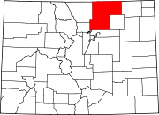
 Location of Weld County in Colorado
This is a list of the National Register of Historic Places listings in Weld County, Colorado.
This is intended to be a complete list of the properties and districts on the National Register of Historic Places in Weld County, Colorado, United States. The locations of National Register properties and districts for which the latitude and longitude coordinates are included below, may be seen in a Google map.[1]
There are 39 properties and districts listed on the National Register in the county.
-
- This National Park Service list is complete through NPS recent listings posted November 10, 2011.[2]
Current listings
[3] Landmark name Image Date listed Location City or town Summary 1 Amanda K. Alger Memorial Methodist Episcopal Church October 25, 2006 303 Maple Ave.
40°31′45″N 104°42′49″W / 40.529167°N 104.713611°WEaton 2 Anderson Barn October 6, 2004 5255 State Highway 60
40°20′11″N 104°57′18″W / 40.336389°N 104.955°WJohnstown 3 Clubhouse-Student Union October 29, 2008 Between 18th and 19th Sts., and 8th and 10th Aves.
40°20′11″N 104°57′18″W / 40.336389°N 104.955°WGreeley 4 Elmer and Etta Ball Ranch October 16, 1991 County Road 69 west of Briggsdale
40°37′26″N 104°24′45″W / 40.623889°N 104.4125°WBriggsdale 5 Jared L. Brush Barn October 16, 1991 24308 County Road 17
40°21′08″N 104°54′11″W / 40.352222°N 104.903056°WJohnstown 6 Daniels School July 6, 2005 U.S. Route 60 and County Road 25
40°19′50″N 104°49′28″W / 40.330556°N 104.824444°WMilliken 7 Dearfield 
August 4, 1995 Along US 34, 11 miles west of Wiggins
40°17′18″N 104°15′25″W / 40.288333°N 104.256944°WWiggins 8 Aaron James Eaton House April 19, 2006 207 Elm St.
40°31′40″N 104°42′44″W / 40.527778°N 104.712222°WEaton 9 First Baptist Church November 25, 1987 Northwestern corner of the intersection of 10th Ave. and 11th St.
40°25′18″N 104°41′39″W / 40.421667°N 104.694167°WGreeley 10 First Methodist Episcopal Church July 7, 2004 503 Walnut St.
40°28′42″N 104°54′14″W / 40.478333°N 104.903889°WWindsor 11 Fort Vasquez 
September 30, 1970 13412 U.S. Route 85
40°11′40″N 104°49′13″W / 40.194444°N 104.820278°WPlatteville 12 Glazier House February 5, 1991 1403 10th Ave.
40°25′00″N 104°41′39″W / 40.416667°N 104.694167°WGreeley 13 Greeley High School April 15, 1999 1515 14th Ave.
40°24′53″N 104°42′07″W / 40.414722°N 104.701944°WGreeley 14 Greeley High School and Grade School July 23, 1981 1015 8th St.
40°25′31″N 104°41′43″W / 40.425278°N 104.695278°WGreeley 15 Greeley Junior High School October 11, 2003 811 15th St.
40°24′58″N 104°41′27″W / 40.416111°N 104.690833°WGreeley 16 Greeley Masonic Temple July 7, 2004 829 10th Ave.
40°25′27″N 104°41′39″W / 40.424167°N 104.694167°WGreeley 17 Greeley Tribune Building April 18, 2007 714 8th St.
40°25′29″N 104°41′22″W / 40.424722°N 104.689444°WGreeley 18 Greeley Union Pacific Railroad Depot 
November 4, 1993 Junction of 7th Ave. and 9th St.
40°25′27″N 104°41′17″W / 40.424167°N 104.688056°WGreeley 19 Jurgens Site July 18, 1990 Address Restricted Kersey 20 Keota Stone Circles Archeological District July 28, 1981 Address Restricted Keota 21 Land Utilization Program Headquarters October 29, 2009 44741 County Road 77
40°39′01″N 104°20′05″W / 40.650258°N 104.334608°WBriggsdale 22 Lincoln School 
July 22, 1981 645 Holbrook St.
40°03′03″N 105°02′58″W / 40.050833°N 105.049444°WErie 23 Little Thompson River Bridge October 15, 2002 Interstate 25 service road at milepost 249.90
40°18′03″N 104°58′44″W / 40.300833°N 104.978889°WBerthoud 24 Meeker Memorial Museum February 26, 1970 1324 9th Ave.
40°25′02″N 104°41′29″W / 40.417222°N 104.691389°WGreeley 25 Milne Farm February 3, 1993 18457 State Highway 392
40°28′53″N 104°42′23″W / 40.481389°N 104.706389°WLucerne 26 Nettleton-Mead House April 2, 2002 1303 9th Ave.
40°25′06″N 104°41′32″W / 40.418333°N 104.692222°WGreeley 27 Ottesen Grain Company Feed Mill November 5, 1998 815 7th St.
40°05′10″N 104°48′30″W / 40.086111°N 104.808333°WFort Lupton 28 Harvey J. Parish House April 14, 2000 701 Charlotte St.
40°20′10″N 104°54′49″W / 40.336111°N 104.913611°WJohnstown 29 Sandstone Ranch 
January 23, 1984 East of Longmont off State Highway 119
40°09′05″N 105°02′12″W / 40.151389°N 105.036667°WLongmont 30 SLW Ranch 
March 15, 1991 27401 County Road 58½
40°24′53″N 104°29′34″W / 40.414722°N 104.492778°WGreeley 31 United Church of Christ of Highlandlake February 10, 1989 16896 County Road 5
40°14′55″N 105°00′50″W / 40.248611°N 105.013889°WMead 32 Von Gohren-Thompson Homestead-Gerry Farm Rural Historic Landscape May 4, 2011 Address Restricted Greeley vicinity Historic Farms and Ranches of Weld County MPS 33 Von Trotha-Firestien Farm at Bracewell May 12, 2009 Junction of O St. and 83rd Ave., in Bracewell
40°27′32″N 104°49′0″W / 40.45889°N 104.816667°W[4]Greeley 34 Weld County Courthouse 
January 9, 1978 9th St. and 9th Ave.
40°25′25″N 104°41′33″W / 40.423611°N 104.6925°WGreeley 35 West Stoneham Archeological District September 23, 1994 Address Restricted Stoneham 36 White-Plumb Farm July 27, 2005 955 39th Ave.
40°25′21″N 104°44′42″W / 40.4225°N 104.745°WGreeley 37 Windsor Milling and Elevator Co. Building September 3, 1998 301 Main St.
40°28′47″N 104°54′01″W / 40.479722°N 104.900278°WWindsor 38 Windsor Town Hall January 15, 1999 116 5th St.
40°28′50″N 104°54′13″W / 40.480556°N 104.903611°WWindsor 39 Joseph A. Woodbury House May 17, 1984 1124 7th St.
40°25′32″N 104°41′48″W / 40.425556°N 104.696667°WGreeley See also
- List of National Historic Landmarks in Colorado
- National Register of Historic Places listings in Colorado
References
- ^ The latitude and longitude information provided in this table was derived originally from the National Register Information System, which has been found to be fairly accurate for about 99% of listings. For about 1% of NRIS original coordinates, experience has shown that one or both coordinates are typos or otherwise extremely far off; some corrections may have been made. A more subtle problem causes many locations to be off by up to 150 yards, depending on location in the country: most NRIS coordinates were derived from tracing out latitude and longitudes off of USGS topographical quadrant maps created under North American Datum of 1927, which differs from the current, highly accurate GPS system used by Google maps. Chicago is about right, but NRIS longitudes in Washington are higher by about 4.5 seconds, and are lower by about 2.0 seconds in Maine. Latitudes differ by about 1.0 second in Florida. Some locations in this table may have been corrected to current GPS standards.
- ^ "National Register of Historic Places: Weekly List Actions". National Park Service, United States Department of the Interior. Retrieved on November 10, 2011.
- ^ Numbers represent an ordering by significant words. Various colorings, defined here, differentiate National Historic Landmark sites and National Register of Historic Places Districts from other NRHP buildings, structures, sites or objects.
- ^ Location derived from this Greeley Tribune article; the NRIS lists the site as "Address Restricted"
U.S. National Register of Historic Places Topics Lists by states Alabama • Alaska • Arizona • Arkansas • California • Colorado • Connecticut • Delaware • Florida • Georgia • Hawaii • Idaho • Illinois • Indiana • Iowa • Kansas • Kentucky • Louisiana • Maine • Maryland • Massachusetts • Michigan • Minnesota • Mississippi • Missouri • Montana • Nebraska • Nevada • New Hampshire • New Jersey • New Mexico • New York • North Carolina • North Dakota • Ohio • Oklahoma • Oregon • Pennsylvania • Rhode Island • South Carolina • South Dakota • Tennessee • Texas • Utah • Vermont • Virginia • Washington • West Virginia • Wisconsin • WyomingLists by territories Lists by associated states Other  Category:National Register of Historic Places •
  Portal:National Register of Historic Places
Municipalities and communities of Weld County, Colorado County seat: Greeley Cities Brighton‡ | Dacono | Evans | Fort Lupton | Greeley | Longmont‡ | Northglenn‡ | Thornton‡
Towns CDP Unincorporated
communitiesAdna | Auburn | Briggsdale | Carr | Galeton | Gill | Hereford | Highlandlake | Lucerne | Prospect Valley | Roggen | Stoneham | Tampa | Wattenburg
Ghost towns Footnotes ‡This populated place also has portions in an adjacent county or counties
Categories:- National Register of Historic Places in Colorado by county
- Weld County, Colorado
- Buildings and structures in Weld County, Colorado
-


Wikimedia Foundation. 2010.