- Marshall-Shadeland
-
Coordinates: 40°28′08″N 80°01′55″W / 40.469°N 80.032°W
Marshall-Shadeland (Brightwood) 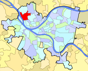
Neighborhood in Pittsburgh, PennsylvaniaCoordinates: 40°28′08″N 80°01′55″W / 40.469°N 80.032°W Population (1990): 7903[1] Population (2000): 6951[1] Area: 1.254 sq mi (3.25 km2)[1] Marshall-Shadeland is a neighborhood on Pittsburgh, Pennsylvania's North Side. It has a zip codes of both 15212 and 15214, and has representation on Pittsburgh City Council by the council member for District 1 (North Neighborhoods).
The neighborhood is a largely residential area that was annexed by Allegheny City in 1870. It is bordered by Woods Run Avenue on the north, Marshall Avenue on the south, and Riverview Park, Highwood Cemetery, and Uniondale Cemetery on the east. The neighborhood technically extends west to the Ohio River, but in practice the residential district ends at California Avenue. The area between California Avenue and the Ohio River is an industrial site and the home of the Woods Run Penitentiary, now known as SCI-Pittsburgh.
The neighborhood has been home to a number of different ethnic groups and has been called a number of different names.
It was called "Woods Run" after early settler John Ross, and the neighborhood's library is still the Woods Run branch of the Carnegie Library of Pittsburgh. In an article about the library, reporter Patricia Lowry described the neighborhood by saying that "Woods Run isn't an official city neighborhood, but it has always seemed to me to be one of the most quintessentially Pittsburgh places -- a valley village with some neatly kept gardens and frame houses stacked on the hillsides." [2]
It was called "Shadeland-Halls Grove" in a 1974 Neighborhood Profile by the City of Pittsburgh Department of Urban Planning, which drew a distinction between the residential neighborhood and the "Woods Run Industrial district." [3]
It was called "Marshall-Shadeland" in a 1977 Neighborhood Atlas that purported to be part of "a neighborhood information system that more closely reflects neighborhood boundaries as defined by residents instead of by public officials." [4] The Atlas stated that "Marshall-Shadeland was named for Archibald M. Marshall, Irish grocer, dry goods merchant, landscaper of West Park and a partner in the Marshall-Kennedy Milling Company. A residential area, Marshall-Shadeland is predominately Slovak, with Italians, Carpatho-Rusins, Russians, Irish and Germans also represented."
More recently, residents have been calling the area Brightwood. [5] The City of Pittsburgh's website now (2011) refers to the area as Brightwood. [6] Area advocates have organized the Brightwood Civic Group. [7]
 Large, early 20th-century housing in the southern portion of the neighborhood
Contents
Surrounding Pittsburgh neighborhoods
Surrounding neighborhoods include Brighton Heights, California-Kirkbride, Chateau, Manchester, Perry North, and Perry South.
Transportation
Brighton Heights is within the city of Pittsburgh, and is in "Zone 1" of the public transit system. Bus lines serving Brighton Heights include the 500, 16A, 16B and 16D.
References
- ^ a b c Census: Pittsburgh. Pittsburgh Department of City Planning. January 2006. http://www.city.pittsburgh.pa.us/cp/assets/census/2000_census_pgh_jan06.pdf. Retrieved 2007-07-19.
- ^ Lowry, Patricia (August 9, 2006). "Places: Woods Run renovation brings light, neighborhood into library". Pittsburgh Post-Gazette. http://www.post-gazette.com/pg/06221/712001-51.stm. Retrieved 1 November 2011.
- ^ "A Community Profile of Shadeland-Halls Grove". Neighborhood Profiles. City of Pittsburgh Department of Urban Planning. http://www.ucsur.pitt.edu/files/nrep/1974/shadeland%20halls%20grove%201974.pdf. Retrieved 1 November 2011.
- ^ "An Atlas of the North Side". Marshall-Shadeland Area of Pittsburgh. Pittsburgh Neighborhood Atlas. http://www.ucsur.pitt.edu/files/nrep/1977/north%20side%20marshall%20shadeland%20PNA%201977.pdf. Retrieved 1 November 2011.
- ^ "Brightwood hopes for brighter future". Pittsburgh Post-Gazette. April 30, 2007. http://www.post-gazette.com/pg/07120/782127-53.stm. Retrieved 1 November 2011.
- ^ "Marshall-Shadeland (Brightwood)". Pittsburgh City Council District 1. City of Pittsburgh. http://www.city.pittsburgh.pa.us/district1/html/marshall-shadeland.html. Retrieved 1 November 2011.
- ^ "About Us". Brightwood Civic Group. http://brightwoodcivicgroup.org/about.php.
External links
- Interactive Pittsburgh Neighborhoods Map
- Pittsburgh Northside -- Brightwood
- Pittsburgh Northside Business Districts -- Brightwood
See also
Categories:- Neighborhoods in Pittsburgh, Pennsylvania
- Allegheny County, Pennsylvania geography stubs
- Pittsburgh, Pennsylvania stubs


Wikimedia Foundation. 2010.