- Dundurn No. 314, Saskatchewan
-
Dundurn No. 314 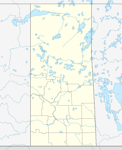
 Dundurn No. 314
Coordinates: 51°50′N 106°33′W / 51.833°N 106.55°WCoordinates: 51°50′N 106°33′W / 51.833°N 106.55°W Country Canada Province Saskatchewan Government[1] - Reeve Wilson R.Fred - Administrator Barna Violet P. Area - Total 800.91 km2 (309.2 sq mi) Population (2006) - Total 632 - Density 0.8/km2 (2.1/sq mi) [2] Time zone CST (UTC-6) Area code(s) 306 Dundurn No. 314 is a rural municipality in north-central Saskatchewan on the South Saskatchewan River. RM Dundurn is an administrative division for the rural area around the town of Dundurn. It is located in Census Division No. 11 for enumeration purposes. Saskatoon—Biggar is the economic district for the region, and the residents of the Rural municipality are represented in this federal riding by their member of parliament.[3] The Member of the legislative assembly represents the Arm River-Watrous provincial constituency.[4]
Contents
Demographics 2006
Canada census – Dundurn No. 314, Saskatchewan Community Profile References: 2006[5] 2001[6] Demographics 2001
According to the Canada 2001 Census:
- Population: 562
- % Change (1996–2001): 1.3
- Dwellings: 161
- Area km² (sq mi): 800.91 km2 (309.23 sq mi)
- Density - persons per km² (sq mi): 0.7 /km2 (1.8 /sq mi)
Communities
In this rural municipality, localities are enumerated as a part of the RM and their administration and towns have their own mayor and administrative body.
- Beaver Creek [Locality]
- Canadian Forces Ammunition Depot Dundurn Canadian Forces Base
- Dundurn [Locality]
- Haultain [Locality]
- Indi [Town with its own administration]
- Shields [Locality]
- Strehlow [Locality]
- Thode [Locality][7]
- SARM
 Subdivisions of Saskatchewan
Subdivisions Communities Cities Estevan · Flin Flon (part) · Humboldt · Lloydminster (part) · Martensville · Meadow Lake · Melfort · Melville · Moose Jaw · North Battleford · Prince Albert · Regina · Saskatoon · Swift Current · Weyburn · YorktonRural municipalities Aberdeen · Abernethy · Antelope Park · Antler · Arborfield · Argyle · Arlington · Arm River · Auvergne · Baildon · Barrier Valley · Battle River · Bayne · Beaver River · Bengough · Benson · Big Arm · Biggar · Big Quill · Big River · Big Stick · Birch Hills · Bjorkdale · Blaine Lake · Blucher · Bone Creek · Bratt's Lake · Brittania · Brock · Brokenshell · Browning · Buchanan · Buckland · Buffalo · Calder · Caledonia · Cambria · Cana · Canaan · Canwood · Carmichael · Caron · Chaplin · Chester · Chesterfield · Churchbridge · Clayton · Clinworth · Coalfields · Colonsay · Connaught · Corman Park · Cote · Coteau · Coulee · Craik · Cupar · Cut Knife · Cymri · Deer Forks · Douglas · Duck Lake · Dufferin · Dundurn · Eagle Creek · Edenwold · Elcapo · Eldon · Elfros · Elmsthorpe · Emerald · Enfield · Enniskillen · Enterprise · Estevan · Excel · Excelsior · Eyebrow · Eye Hill · Fertile Belt · Fertile Valley · Fillmore · Fish Creek · Flett's Springs · Foam Lake · Fox Valley · Francis · Frenchman Butte · Frontier · Gainsborough · Garden River · Garry · Glen Bain · Glen McPherson · Glenside · Golden West · Good Lake · Grandview · Grant · Grass Lake · Grassy Creek · Gravelbourg · Grayson · Great Bend · Greenfield · Griffin · Gull Lake · Happyland · Happy Valley · Harris · Hart Butte · Hazel Dell · Hazelwood · Heart's Hill · Hillsborough · Hillsdale · Hoodoo · Hudson Bay · Humboldt · Huron · Indian Head · Insinger · Invergordon · Invermay · Ituna Bon Accord · Kellross · Kelvington · Keys · Key West · Kindersley · King George · Kingsley · Kinistino · Lacadena · Lac Pelletier · Laird · Lajord · Lake Alma · Lake Johnston · Lakeland · Lake Lenore · Lake of the Rivers · Lakeside · Lakeview · Langenburg · Last Mountain Valley · Laurier · Lawtonia · Leask · Leroy · Lipton · Livingston · Lomond · Lone Tree · Longlaketon · Loon Lake · Loreburn · Lost River · Lumsden · Manitou Lake · Mankota · Maple Bush · Maple Creek · Mariposa · Marquis · Marriott · Martin · Maryfield · Mayfield · McCraney · McKillop · McLeod · Meadow Lake · Medstead · Meeting Lake · Meota · Mervin · Milden · Milton · Miry Creek · Monet · Montmartre · Montrose · Moose Creek · Moose Jaw · Moose Mountain · Moose Range · Moosomin · Morris · Morse · Mountain View · Mount Hope · Mount Pleasant · Newcombe · Nipawin · North Battleford · North Qu'Appelle · Norton · Oakdale · Old Post · Orkney · Paddockwood · Parkdale · Paynton · Pense · Perdue · Piapot · Pinto Creek · Pittville · Pleasantdale · Pleasant Valley · Ponass Lake · Poplar Valley · Porcupine · Prairiedale · Prairie Rose · Preeceville · Prince Albert · Progress · Reciprocity · Redberry · Redburn · Reford · Reno · Riverside · Rocanville · Rodgers · Rosedale · Rosemount · Rosthern · Round Hill · Round Valley · Rudy · Runnymede · Saltcoats · Sarnia · Saskatchewan Landing · Sasman · Scott · Senlac · Shamrock · Shellbrook · Shell Lake · Sherwood · Silverwood · Sliding Hills · Snipe Lake · Souris Valley · South Qu'Appelle · Spalding · Spiritwood · Spy Hill · St. Andrews · Stanley · Star City · St. Louis · St. Peter · St. Philips · Stonehenge · Storthoaks · Surprise Valley · Sutton · Swift Current · Tecumseh · Terrell · The Gap · Three Lakes · Tisdale · Torch River · Touchwood · Tramping Lake · Tullymet · Turtle River · Usborne · Val Marie · Vanscoy · Victory · Viscount · Wallace · Walpole · Waverley · Wawken · Webb · Wellington · Weyburn · Wheatlands · Whiska Creek · White Valley · Willner · Willow Bunch · Willow Creek · Willowdale · Wilton · Winslow · Wise Creek · Wolseley · Wolverine · Wood Creek · Wood River · WrefordTopics  Category ·
  Portal ·
  WikiProject
Footnotes
- ^ "Municipal Directory System". Government of Saskatchewan. 2007-04-13. http://www.municipal.gov.sk.ca/apps/Pub/MDS/muniDetails.aspx?cat=1&mun=2368. Retrieved 2007-12-09.
- ^ "2006 Community Profiles". Statistics Canada. Government of Canada. 2007-03-13. http://www12.statcan.ca/english/census06/data/profiles/community/Details/Page.cfm?Lang=E&Geo1=CSD&Code1=4711061&Geo2=PR&Code2=47&Data=Count&SearchText=dundurn&SearchType=Begins&SearchPR=01&B1=All&Custom=. Retrieved 2007-12-09.
- ^ Commissioner of Canada Elections, Chief Electoral Officer of Canada (2005). "Elections Canada On-line". http://www.elections.ca/home.asp
- ^ Canadian Textiles Institute. (2005). "CTI Determine your provincial constituency". http://www.textiles.ca/eng/nonAuthProg/redirect.cfm?path=IssPolContacts§ionID=7601.cfm
- ^ "2006 Community Profiles". Statistics Canada. Government of Canada. 2009-02-24. http://www12.statcan.ca/census-recensement/2006/dp-pd/prof/92-591/index.cfm?Lang=E. Retrieved 2009-02-24.
- ^ "2001 Community Profiles". Statistics Canada. Government of Canada. 2007-02-01. http://www12.statcan.ca/english/profil01/CP01/Index.cfm?Lang=E. Retrieved {{{2001_access_date}}}.
- ^ "4711061 - Dundurn No. 314, geographical codes and localities ,2006". Statistics Canada. Government of Canada. 2007-03-13. http://stds.statcan.ca/english/sgc/2006/2006-cma-searchlocal-fin.asp?criteria=4711061. Retrieved 2007-12-09.
Categories:- Dundurn No. 314, Saskatchewan
- Saskatchewan geography stubs

Wikimedia Foundation. 2010.