- Churchbridge No. 211, Saskatchewan
-
Churchbridge No. 211, Saskatchewan Location of Churchbridge No. 211, in Saskatchewan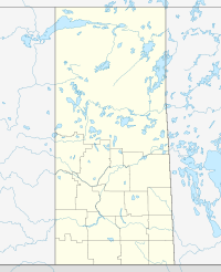

Coordinates: 51°00′N 101°50′W / 51°N 101.833°WCoordinates: 51°00′N 101°50′W / 51°N 101.833°W Country Canada Province Saskatchewan Local improvement district Rural Municipality January 1, 1913 Government - Reeve - Administrator - Councilor - Councilor - Councilor Area - Total 958.98 km2 (370.3 sq mi) Population (2006) - Total 679 Time zone UTC (UTC-6) This article is about the rural municipality in Canada. For other places with the same name, see Churchbridge
Churchbridge No. 211, Saskatchewan, is a rural municipality of 679 rural residents (2006 census) in the east centralpart of Saskatchewan, Canada. The RM was incorporated January 1, 1913.[1] Other localities in the area include MacNutt, Beresina, Langenburg and Churchbridge.[2][3][4]
A rural municipality is an administrative district consisting of an elected reeve, councilors, administrator who provide essential services within their area.
Contents
Statistics
Canada census – Churchbridge No. 211, Saskatchewan Community Profile 2006 Population:
Land area:
Population density:
Median age:
Total private dwellings:
Mean household income:679 (-12.0% from 2001)
958.98 km2 (370.26 sq mi)
0.7 /km2 (1.8 /sq mi)
N/A (males: N/A, females: N/A)
275
$N/A
References: 2006[5] Area statistics
- Lat 51° 00' 00" N
- Long 101° 50' 00" W
- Time zone (est) UTC-6
External links
- Saskatoon Regional Economic Development Authority - SREDA
- Saskatchewan, Canada, Rand McNally 1924 Indexed Pocket Map Tourists' and Shippers' Guide
- GeoNames Query
- Post Offices and Postmasters - ArchiviaNet - Library and Archives Canada
- Saskatchewan Gen Web - One Room School Project
- Canadian Maps: January 1925 Waghorn's Guide. Post Offices in Man. Sask. Alta. and West Ontario.
- Saskatoon Gen Web
 Subdivisions of Saskatchewan
Subdivisions Communities Cities Estevan · Flin Flon (part) · Humboldt · Lloydminster (part) · Martensville · Meadow Lake · Melfort · Melville · Moose Jaw · North Battleford · Prince Albert · Regina · Saskatoon · Swift Current · Weyburn · YorktonRural municipalities Aberdeen · Abernethy · Antelope Park · Antler · Arborfield · Argyle · Arlington · Arm River · Auvergne · Baildon · Barrier Valley · Battle River · Bayne · Beaver River · Bengough · Benson · Big Arm · Biggar · Big Quill · Big River · Big Stick · Birch Hills · Bjorkdale · Blaine Lake · Blucher · Bone Creek · Bratt's Lake · Brittania · Brock · Brokenshell · Browning · Buchanan · Buckland · Buffalo · Calder · Caledonia · Cambria · Cana · Canaan · Canwood · Carmichael · Caron · Chaplin · Chester · Chesterfield · Churchbridge · Clayton · Clinworth · Coalfields · Colonsay · Connaught · Corman Park · Cote · Coteau · Coulee · Craik · Cupar · Cut Knife · Cymri · Deer Forks · Douglas · Duck Lake · Dufferin · Dundurn · Eagle Creek · Edenwold · Elcapo · Eldon · Elfros · Elmsthorpe · Emerald · Enfield · Enniskillen · Enterprise · Estevan · Excel · Excelsior · Eyebrow · Eye Hill · Fertile Belt · Fertile Valley · Fillmore · Fish Creek · Flett's Springs · Foam Lake · Fox Valley · Francis · Frenchman Butte · Frontier · Gainsborough · Garden River · Garry · Glen Bain · Glen McPherson · Glenside · Golden West · Good Lake · Grandview · Grant · Grass Lake · Grassy Creek · Gravelbourg · Grayson · Great Bend · Greenfield · Griffin · Gull Lake · Happyland · Happy Valley · Harris · Hart Butte · Hazel Dell · Hazelwood · Heart's Hill · Hillsborough · Hillsdale · Hoodoo · Hudson Bay · Humboldt · Huron · Indian Head · Insinger · Invergordon · Invermay · Ituna Bon Accord · Kellross · Kelvington · Keys · Key West · Kindersley · King George · Kingsley · Kinistino · Lacadena · Lac Pelletier · Laird · Lajord · Lake Alma · Lake Johnston · Lakeland · Lake Lenore · Lake of the Rivers · Lakeside · Lakeview · Langenburg · Last Mountain Valley · Laurier · Lawtonia · Leask · Leroy · Lipton · Livingston · Lomond · Lone Tree · Longlaketon · Loon Lake · Loreburn · Lost River · Lumsden · Manitou Lake · Mankota · Maple Bush · Maple Creek · Mariposa · Marquis · Marriott · Martin · Maryfield · Mayfield · McCraney · McKillop · McLeod · Meadow Lake · Medstead · Meeting Lake · Meota · Mervin · Milden · Milton · Miry Creek · Monet · Montmartre · Montrose · Moose Creek · Moose Jaw · Moose Mountain · Moose Range · Moosomin · Morris · Morse · Mountain View · Mount Hope · Mount Pleasant · Newcombe · Nipawin · North Battleford · North Qu'Appelle · Norton · Oakdale · Old Post · Orkney · Paddockwood · Parkdale · Paynton · Pense · Perdue · Piapot · Pinto Creek · Pittville · Pleasantdale · Pleasant Valley · Ponass Lake · Poplar Valley · Porcupine · Prairiedale · Prairie Rose · Preeceville · Prince Albert · Progress · Reciprocity · Redberry · Redburn · Reford · Reno · Riverside · Rocanville · Rodgers · Rosedale · Rosemount · Rosthern · Round Hill · Round Valley · Rudy · Runnymede · Saltcoats · Sarnia · Saskatchewan Landing · Sasman · Scott · Senlac · Shamrock · Shellbrook · Shell Lake · Sherwood · Silverwood · Sliding Hills · Snipe Lake · Souris Valley · South Qu'Appelle · Spalding · Spiritwood · Spy Hill · St. Andrews · Stanley · Star City · St. Louis · St. Peter · St. Philips · Stonehenge · Storthoaks · Surprise Valley · Sutton · Swift Current · Tecumseh · Terrell · The Gap · Three Lakes · Tisdale · Torch River · Touchwood · Tramping Lake · Tullymet · Turtle River · Usborne · Val Marie · Vanscoy · Victory · Viscount · Wallace · Walpole · Waverley · Wawken · Webb · Wellington · Weyburn · Wheatlands · Whiska Creek · White Valley · Willner · Willow Bunch · Willow Creek · Willowdale · Wilton · Winslow · Wise Creek · Wolseley · Wolverine · Wood Creek · Wood River · WrefordTopics  Category ·
  Portal ·
  WikiProject
References
- ^ "MRD Municipal Status Information", Ministry of Municipal Affairs (Government of Saskatchewan), archived from the original on 2008-03-25, http://web.archive.org/web/20080325234139/http://www.municipal.gov.sk.ca/div/munadvisory/incorp/rmincorpdatenum.html, retrieved 2008-03-28
- ^ Saskatchewan Genealogy Association, http://www.saskgenealogy.com/cemetery/cem_rmname.asp, retrieved 2008-03-28
- ^ Huang, Yj; Powers, R; Montelione, Gt (Feb 2005), "Statistics", Journal of the American Chemical Society (Government of Canada) 127 (6): 1665–74, doi:10.1021/ja047109h, PMID 15701001, http://www12.statcan.ca/english/census06/data/profiles/community/Details/Page.cfm?Lang=E&Geo1=CSD&Code1=4716005&Geo2=PR&Code2=47&Data=Count&SearchText=Mayfield&SearchType=Begins&SearchPR=01&B1=All&Custom=, retrieved 2008-03-28
- ^ "Churchbridge No. 211", Sask biz (Government of Saskatchewan), http://www.saskbiz.ca/communityprofiles/CommunityProfile.Asp?CommunityID=774, retrieved 2008-03-28
- ^ "2006 Community Profiles". Statistics Canada. Government of Canada. 2009-02-24. http://www12.statcan.ca/census-recensement/2006/dp-pd/prof/92-591/index.cfm?Lang=E. Retrieved 2009-02-24.
- ^ "2006 Community Profiles". Statistics Canada. Government of Canada. 2006. http://www12.statcan.ca/english/census06/data/profiles/community/Search/SearchForm_Results.cfm?Lang=E. Retrieved 2008-03-28.[dead link]
- ^ "Churchbridge No. 211, Saskatchewan, Canada, North America". World Index. Rumbletum.org. 2004. http://rumbletum.org/North%20America/Canada/Saskatchewan/_6068335_Mayfield+No.+406.html. Retrieved 2008-03-28.
- ^ "MRD Rural Municipality (RM) Boundary maps", Ministry of Municipal Affairs (Government of Saskatchewan), archived from the original on 2008-03-25, http://web.archive.org/web/20080325234124/http://www.municipal.gov.sk.ca/div/cpb/maps/rurmunbound.html, retrieved 2008-03-28
Categories:- Churchbridge No. 211, Saskatchewan
- Saskatchewan geography stubs

Wikimedia Foundation. 2010.