- Charney Bassett
-
Coordinates: 51°38′53″N 1°27′11″W / 51.648°N 1.453°W
Charney Bassett 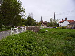
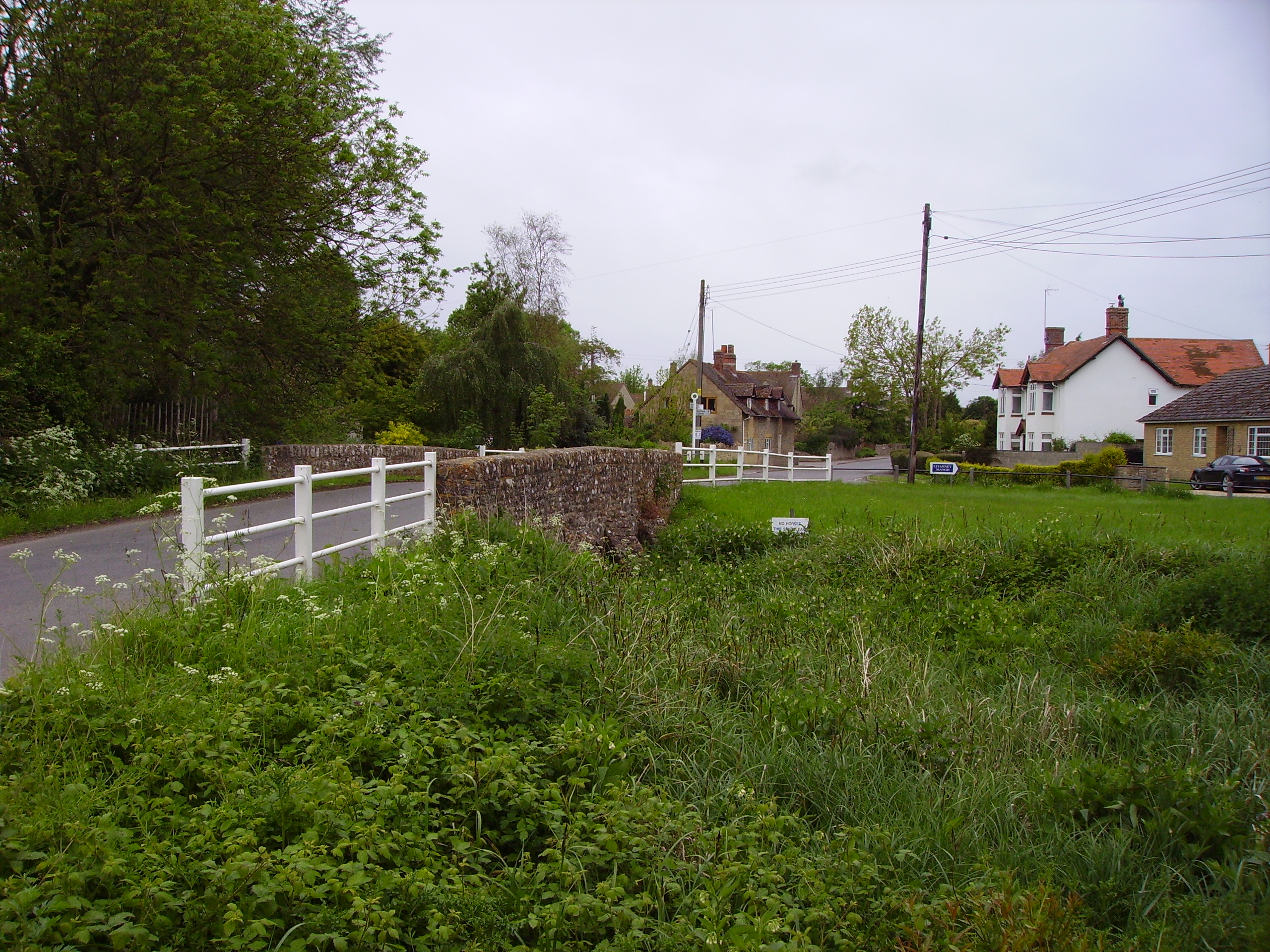
Charney Bassett, from the bridge over the mill stream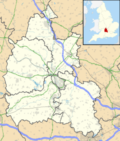
 Charney Bassett
Charney Bassett shown within OxfordshirePopulation 271 (2001 census)[1] OS grid reference SU3794 Parish Charney Bassett District Vale of White Horse Shire county Oxfordshire Region South East Country England Sovereign state United Kingdom Post town Wantage Postcode district OX12 Dialling code 01235 Police Thames Valley Fire Oxfordshire Ambulance South Central EU Parliament South East England UK Parliament Wantage Website Charney Bassett Parish Council List of places: UK • England • Oxfordshire Charney Bassett is a village and civil parish about 4.5 miles (7 km) north of Wantage and 6 miles (10 km) east of Faringdon in the Vale of White Horse. It was part of Berkshire until the 1974 boundary changes transferred it to Oxfordshire.
Contents
Archaeology
In 1978 Thames Water dredged a prehistoric flint axe-head from the River Ock in the parish.[2]
About 1 mile (1.6 km) north of the village, between Charney and Pusey is Cherbury Camp, an Iron Age earthwork. It looks like the nearby hill forts on the Berkshire Downs but is unusual in being built on more or less level ground, away from any hill. Cherbury means "fort beside the River Cearn". It is larger than Uffington Castle hill fort.
History
Charney Bassett has been settled since Anglo-Saxon era. The earliest known records of the locality's history records a grant of land to the Abbot of Abingdon Abbey in AD 811. The surrounding area was largely marshland and the meaning of Charney is "island in the River Cearn". This was an alternative name for the River Ock, that runs close by and which supplies the mill stream.
Notable buildings and structures
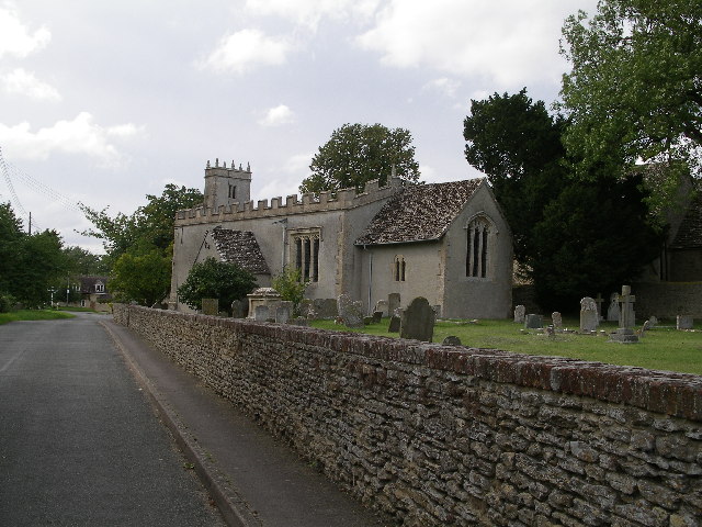
 St. Peter's parish church
The Church of England parish church of Saint Peter is Grade I listed. It has some 12th century parts and a turret containing two medieval chiming bells. Along with the churches of Longworth, Hinton Waldrist, Lyford, Buckland, Pusey and Littleworth, it is part of the Benefice of Cherbury with Gainfield.[3]
On the village green stands a medieval stone pillar mounted upon three steps. This may have been a market cross where goods could be offered for sale at certain times of the year.[citation needed] A sundial was later added to the top and this would have been used as the village time-piece. After the First World War the centre step was replaced with a dressed stone memorial to the fallen, whose names are inscribed thereon.
Charney Manor is a Grade I listed building. It was built in the 13th century as a grange for Abingdon Abbey, which then owned extensive land around the village. It is now owned by the Quakers.
Charney Water Mill and its adjoining cottage are Grade II listed. The mill is owned by Oxfordshire County Council and leased to the parish council. The machinery is mainly intact and the mill has been undergoing restoration by the Vale of White Horse Industrial Archaeology Group since about 1975.[4]
The village has several further Grade II listed buildings.[5]
Amenities
Charney Bassett has a public house, the Chequers Inn.[6]
References
- ^ "Area selected: Vale of White Horse (Non-Metropolitan District)". Neighbourhood Statistics: Full Dataset View. Office for National Statistics. http://neighbourhood.statistics.gov.uk/dissemination/viewFullDataset.do?instanceSelection=03070&productId=779&$ph=60_61&datasetInstanceId=3070&startColumn=1&numberOfColumns=4&containerAreaId=790499. Retrieved 30 March 2010.
- ^ Stebbing, Nancy (1979). "An Axe-Head from Charney Bassett". Oxoniensia (Oxfordshire Architectural and Historical Society) XLIV: 92.
- ^ The Benefice of Cherbury with Gainfield
- ^ Vale & Downland Museum: Charney Bassett Water Mill
- ^ British Listed Buildings
- ^ The Chequers Inn
Further reading
- Page, W.H.; Ditchfield, P.H., eds (1924). A History of the County of Berkshire, Volume 4. Victoria County History. pp. 466–471.
- Pevsner, Nikolaus (1966). Berkshire. The Buildings of England. Harmondsworth: Penguin Books. pp. 112–113.
External links
 Media related to Charney Bassett at Wikimedia CommonsCategories:
- Villages in Oxfordshire
- Civil parishes in Oxfordshire


Wikimedia Foundation. 2010.