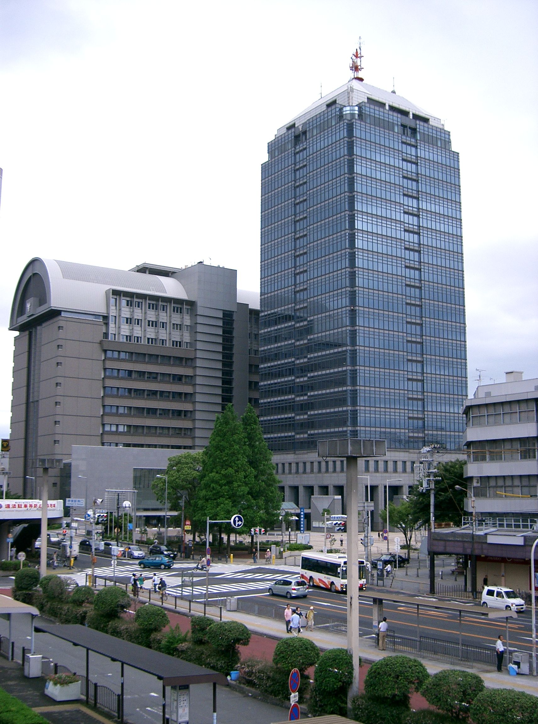
- Keihanshin
-
Keihanshin
Osaka-Kobe-KyotoKobe Osaka
Osaka
Country  Japan
Japan
Major Cities Osaka
Kobe
Kyoto
SakaiArea – Metro 11,169 km2 (4,312 sq mi) Population (Population Census of Japan 2000)[1] – Metro 18,643,915 – Metro density 1,669/km2 (4,322/sq mi) Keihanshin (京阪神, Kyoto-Osaka-Kobe) is a Japanese metropolitan region encompassing the metropolitan areas of the cities of Osaka in Osaka prefecture, Kobe in Hyōgo Prefecture, and Kyoto in Kyoto prefecture. The entire region has a population (as of 2000) of 18,644,000 over an area of 11,170 km².[2] It is Japan's second most populated urban region after the Greater Tokyo Area, containing approximately 15% of Japan's population.
The GDP in this area (Osaka and Kobe) is $341 billion, making it one of the world's most productive regions, a match with Paris and London.[3] Mastercard Worldwide reported that Osaka is the 19th ranking city of the world's leading global cities and has an instrumental role in driving the global economy.[4]
The name Keihanshin is constructed by extracting a representative kanji from Kyoto (京都), Osaka (大阪), and Kobe (神戸), but using the On-yomi (Chinese reading) instead of the corresponding Kun-yomi (Japanese reading) for each of the characters taken from Osaka and Kobe, and the kan-on Chinese reading of the character for Kyoto instead of the usual go-on Chinese reading.
Contents
Definitions
Range of distance
The Japan Statistics Bureau defines the set of municipalities that are entirely or mostly within 50 kilometers of the Municipal Office of Osaka as one measure of the metropolitan area. As of 2000, the population for this region was 16,566,704.[5]
Urban Employment Area
The Urban Employment Area is a metropolitan area definition developed at the Faculty of Economics of the University of Tokyo.[6] This definition is analogous to the Metropolitan Statistical Area concept used to delineate metropolitan areas in the United States. The basic building blocks are municipalities.
The core area is the set of municipalities that contain a densely inhabited district (DID) with a population of 10,000 or more. The Urban Employment Area is called Metropolitan Employment Area, when its core area has 50,000 DID population or more. Otherwise, the area is called Micropolitan Employment Area. A DID is a group of census enumeration districts inhabited at densities of 4,000 or more persons per km². Outlying areas are those municipalities where 10% or more of the employed population work in the core area or in another outlying area. Overlaps are not allowed and an outlying area is assigned to the core area where it has the highest commuter ratio.
This definition assigns a Metropolitan Employment Area to the following cities of the Keihanshin region: Osaka, Kobe, Kyoto, Himeji, and Wakayama. The lists below indicate which cities belong to which metropolitan area. Towns and villages are not listed.
 A map showing Osaka , Kobe, and Kyoto Urban Employment Areas.
Osaka Metropolitan Employment Area
The Osaka Metropolitan Employment Area has a population (as of 2000) of 12,116,540[7] and consists of the following cities:
- Core cities: Osaka, Higashiosaka, Kadoma, Moriguchi
- Outlying cities:
- Osaka Prefecture (entire prefecture)
- Hyōgo Prefecture (southeastern part): Amagasaki, Nishinomiya, Ashiya, Itami, Takarazuka, Kawanishi, Sanda
- Nara Prefecture (northern part): Nara, Tenri, Yamatotakada, Yamatokoriyama, Kashihara, Sakurai, Gose, Ikoma, Kashiba, Katsuragi
- Other cities: Nabari (Mie), Yawata (Kyoto), Hashimoto (Wakayama)
Kyoto Metropolitan Employment Area
The Kyoto Metropolitan Employment Area has a population (as of 2000) of 2,583,304[7] and consists of the following cities:
- Core cities: Kyoto
- Outlying cities
Kobe Metropolitan Employment Area
The Kobe Metropolitan Employment Area has a population (as of 2000) of 2,296,268[7] and consists of the following cities:
- Core cities: Kobe
- Outlying cities
Himeji Metropolitan Employment Area
The Himeji Metropolitan Employment Area has a population (as of 2000) of 741,759[7] and consists of the following cities:
Wakayama Metropolitan Employment Area
The Wakayama Metropolitan Employment Area has a population (as of 2000) of 573,308[7] and consists of the following cities:
Immediate commuter sphere
Major Metropolitan Area
 A map of Keihanshin Major Metropolitan Area.
The Japan Statistics Bureau defines the Major Metropolitan Area or MMA (大都市圏) as the set of municipalities where at least 1.5% of the resident population aged 15 and above commute to school or work in a designated city (defined as the core area).[8] If multiple designated cities are close enough to have overlapping outlying areas, they are combined into a single multi-core area. In the 2000 census, the designated cities used to define the Keihanshin MMA were Osaka, Kobe, and Kyoto. Sakai has subsequently become a designated city.
This region consists of the combination of the metropolitan areas of Osaka, Kobe, Kyoto, and Himeji, and additionally includes several periurban areas (particularly in southern Shiga Prefecture) that are not part of the four metropolitan areas.
As of 2000, the entire Keihanshin region had a population of 18,643,915 over an area of 11,169 km².[2]
Cities
Core cities
The core cities formed Keihanshin are government ordinance cities. These cities designated the three largest cities as special cities with Tokyo in 1889. Kobe designated the six largest cities as special cities in 1922, and adopted the ward system in 1931. Following the World War II, the six largest cities was replaced by the government designated city system in 1956. Afterwards, Sakai became the government designated city in 2006.
The core cities of Keihanshin are:
- Osaka (population 2.65 million)
- Kobe (population 1.53 million)
- Kyoto (population 1.46 million)
- Sakai (population 830,000)
Cities outside core cities
The other cities in Osaka, Hyogo, Kyoto and Nara Prefectures are:
- Nishiwaki
- Ono
- Ōsakasayama
- Sakurai
- Sanda
- Sasayama
- Sennan
- Settsu
- Shijōnawate
- Suita (pop 360,000)
- Takaishi
- Takarazuka
- Takasago
- Takatsuki (pop 350,000)
- Tatsuno
- Tenri
- Tondabayashi
- Toyonaka (pop 390,000)
- Uda
- Uji
- Yamatokōriyama
- Yamatotakada
- Yao
- Yawata
source: stat.go.jp census 2005
Additional cities
In the major metropolitan area (MMA) definition used by the Japanese Statistics Bureau, the following cities in Mie, Shiga, Wakayama Prefectures are included:
Mie Prefecture
Shiga Prefecture
- Ōtsu (pop 350,000)
- Ōmihachiman
- Rittō
- Takashima
- Yasu
Wakayama Prefecture
Border areas
Keihanshin is bordered by metropolitan areas of Hikone-Nagahama (approx. 340,000) to the northeast, Iga (approx. 50,000) to the east, Himeji-Ako (approx. 800,000) to the west, Greater Wakayama (approx. 570,000 people) on the south, and Fukuchiyama (approx. 150,000) to the north. If these areas are included, Greater Keihanshin's population would be around 19-20 million.
Transportation
Main article: Transportation in Greater Osaka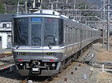

Air
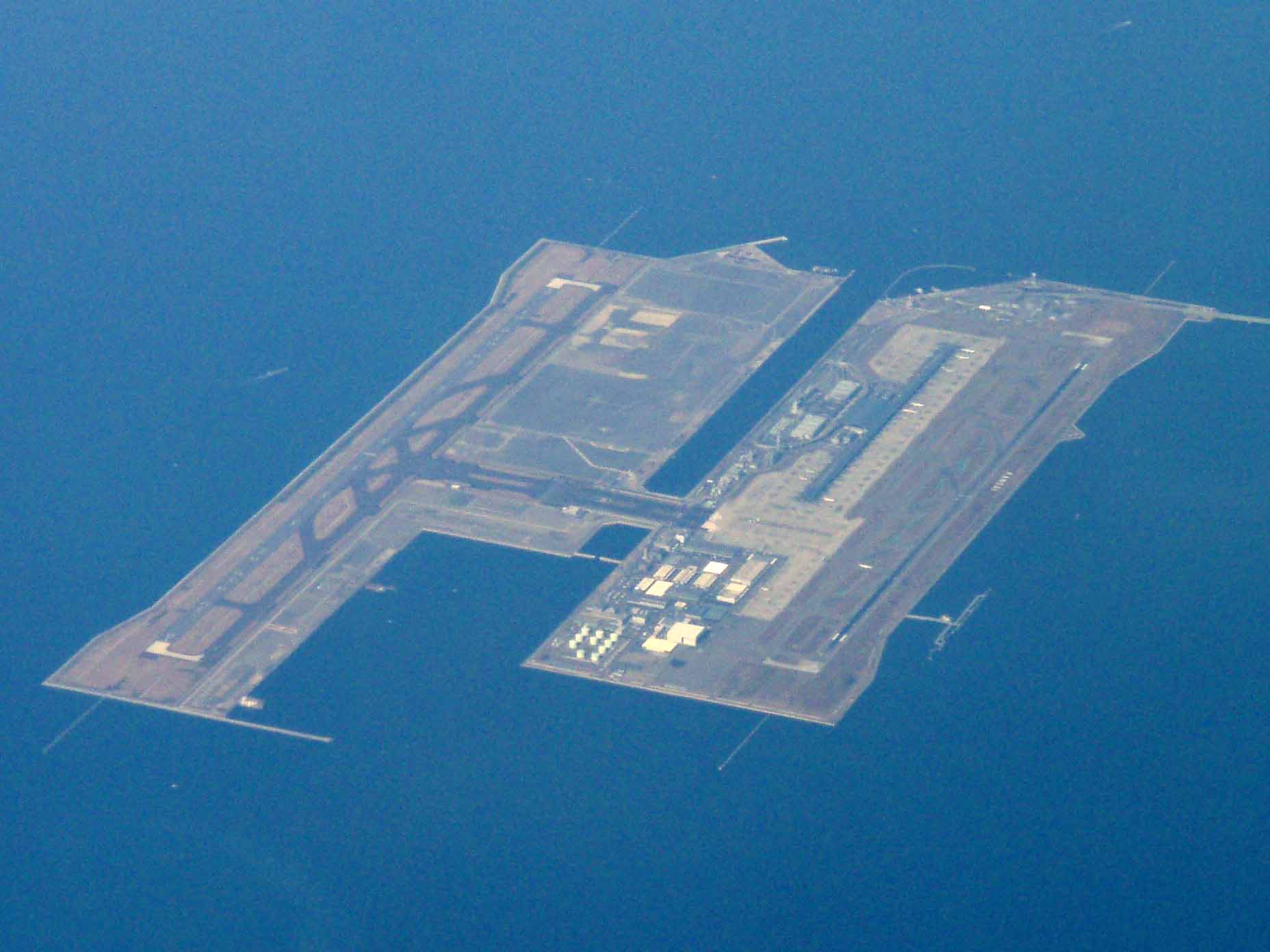
Kansai International Airport opened in 1994 and is now the main international airport for the region. It sits on an artificial island off-shore in Osaka Bay and serves the city of Osaka and its surrounding cities of Nara, Kobe, and Kyoto. Kansai is the geographical term for the area of western Honshū surrounding Osaka. The airport is linked by direct train service to Osaka and Kyoto, and bus service to many major nearby centres, including Kobe.
Osaka International Airport, laid over the border between the cities of Itami and Toyonaka, still houses most of the domestic service from the metropolitan region.
Kobe Airport, built on a reclaimed island south of Port Island opened in 2006, offering domestic flights.
Rail
Greater Osaka has a very extensive network of railway lines, comparable to that of Greater Tokyo. Main rail terminals in the city include, Umeda, Namba, Tennoji, Kyobashi, and Yodoyabashi.
High Speed Rail
See also: Central Japan Railway Company and West Japan Railway CompanyJR Central and JR West operate high-speed trains on the Tōkaidō-Sanyō Shinkansen line. Shin-Ōsaka Station acts as the Shinkansen terminal station, though the two lines are physically joined, and many trains offer through service. This station is connected to Ōsaka Station at Umeda by the JR Kyoto Line and the subway Midōsuji Line. Shinkansen services also stop at Kyoto Station and Shin-Kobe Station.
All Shinkansen trains including Nozomi stop at Shin-Ōsaka Station and provide connections to other major cities in Japan, such as Kyoto, Nagoya, Yokohama and Tokyo to the east, and Kobe, Okayama, Hiroshima, Kitakyushu and Fukuoka to the west.
Commuter Rail
See also: Keihan Electric Railway, Hankyu Railway, Hanshin Electric Railway, Kintetsu Corporation, and Nankai Electric RailwayBoth JR West and private lines connect Osaka and its suburbs. The commuter rail network of JR West is called the Urban Network. Major stations on the JR Osaka Loop Line include Osaka (Umeda), Tennōji, Tsuruhashi, and Kyōbashi. JR West competes with such private rail operators as Keihan Electric Railway, Hankyu Railway, Hanshin Railway, Kintetsu Corporation, and Nankai Electric Railway. The Keihan and Hankyu lines connect to Kyoto; the Hanshin and Hankyu lines connect to Kobe; the Kintetsu lines connect to Nara, Yoshino, Ise and Nagoya; and the Nankai lines connect to Osaka's southern suburbs and Kansai International Airport as well as Wakayama and Mt. Koya. Many lines in Greater Osaka accept either ICOCA or PiTaPa contactless smart cards for payment.[9]
Municipal Subway
The Osaka Municipal Subway system is a part of Osaka's extensive rapid transit system. The Metro system alone ranks 13th in the world by annual passenger ridership, serving over 912 million people annually (a quarter of Greater Osaka Rail System's 4 billion annual riders), despite being only 8 of more than 70 lines in the metro area (see map).
Economy
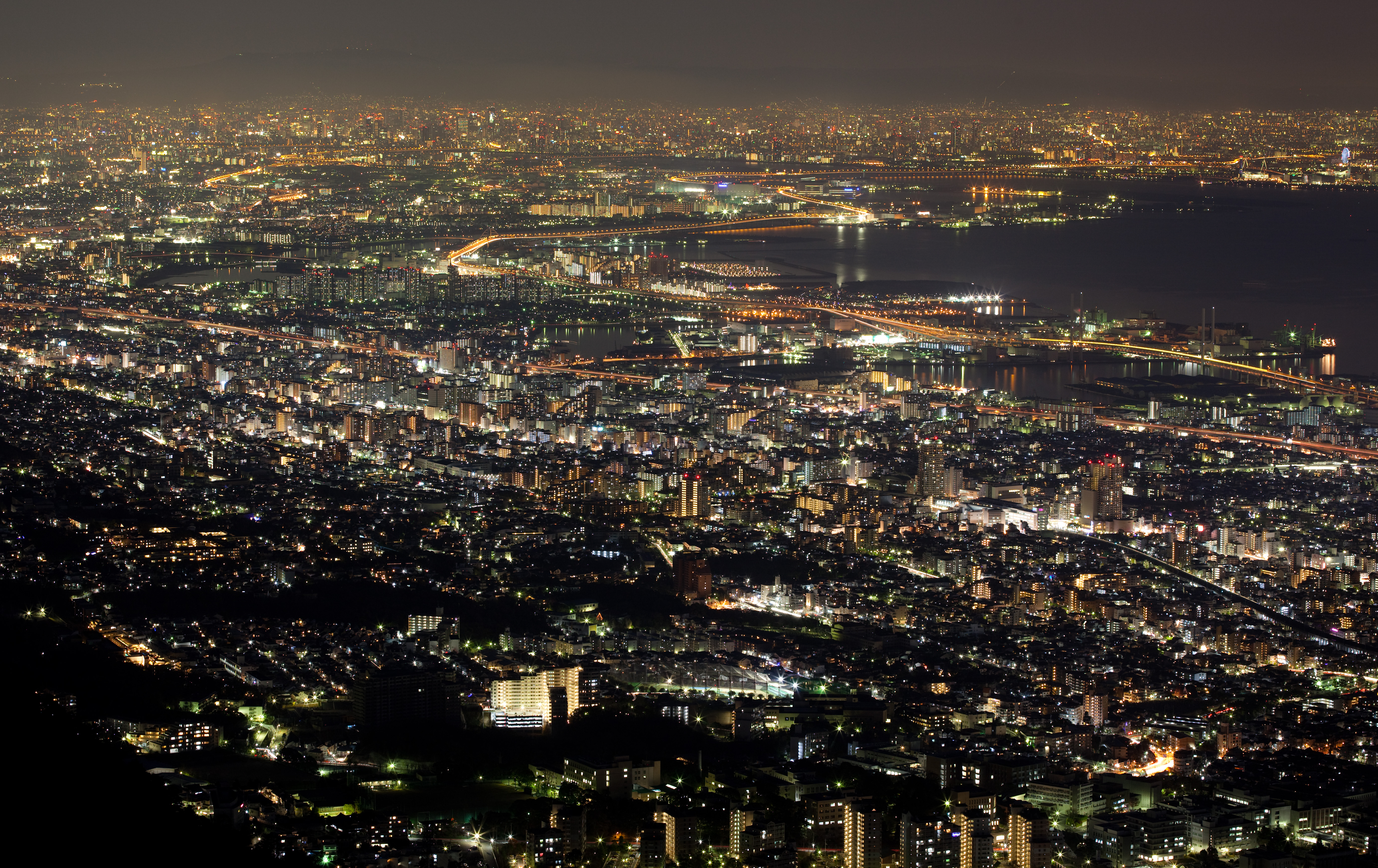
Keihanshin Area 2006
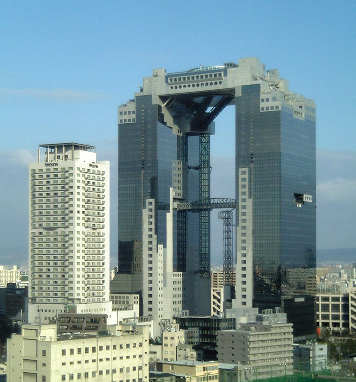
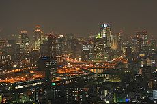 Osaka at night
- 2006 average exchange rate (1 US Dollar = 116.30 Yen)[10]
Prefecture Gross Prefecture Product
(in billion Yen)Gross Prefecture Product
(in billion US$) Osaka
Osaka38,809 334  Hyōgo
Hyōgo19,647 169  Kyoto
Kyoto10,236 88  Shiga
Shiga6,086 52  Nara
Nara3,738 32  Wakayama
3,469 30 Kansai Region 81,985 705 Source [11]
GDP(nominal) 2006
Keihanshin and Top 20 Countries.[12]
Rank Country GDP (in billion US$) 1  United States
13,202 2 Japan4,340 ・・・ 11  Russia
987 12  India
India906 13  South Korea
888 14  Mexico
839 15  Australia
768 (Kansai Region) 705 16  Netherlands
658 17  Turkey
403 18  Belgium
392 19  Sweden
385 20  Switzerland
380 GDP (purchasing power parity) 2005
Compared with other urban regions of the world, the agglomeration of Osaka is the seventh largest economy, in terms of gross metropolitan product at purchasing power parity (PPP), in 2005 according to a study by PricewaterhouseCoopers.[13]
Rank Urban agglomerations Country GDP(PPP)
(in billion US$)1 Tokyo Japan1,191 2 New York City United States1,133 3 Los Angeles United States639 4 Chicago United States460 5 Paris  France
460 6 London  United Kingdom
452 7 Osaka Japan341 8 Mexico City Mexico315 9 Philadelphia United States312 10 Washington, D.C. United States299 See also
- Hanshin Industrial Region (Osaka and Kobe area)
- Kansai Science City
- Kansai region
- Kamigata
- List of metropolitan areas by population
- List of metropolitan areas in Asia by population
- List of metropolitan areas in Japan by population
References
- ^ Statistics Bureau of Japan
- ^ a b Japan Statistics Bureau - "2000 Census: Table 92. Population in Major Metropolitan Areas and Metropolitan Areas", retrieved February 8, 2007
- ^ - PWC report 2007, retrieved October 9, 2007
- ^ Mastercard Worldwide - "Worldwide Centers of Commerce Index 2008" page 8 and 22, retrieved June 11, 2008
- ^ Japan Statistics Bureau - Basic Figures for Range of Distance
- ^ University of Tokyo - Overview of Urban Employment Areas
- ^ a b c d e University of Tokyo - Urban Employment Area Code Tables
- ^ Japan Statistics Bureau - Definition of Major Metropolitan Area
- ^ JR West. "JRおでかけネット - きっぷ・サービス案内 - ご利用可能エリア 近畿圏エリア" (in Japanese). http://www.jr-odekake.net/guide/icoca/areamap01.html. Retrieved 2008-02-25.
- ^ Annual Average Exchange Rate
- ^ [1]
- ^ GDP(nominal) 2006
- ^ The 150 richest cities in the world by GDP in 2005
World's twenty most populous metropolitan areas 16
 Cairo
Cairo
17 Buenos Aires
18 London
19 Beijing
20 Karachi
World's fifty most-populous urban areas Categories:- Metropolitan areas of Japan
- Kansai region
- Greater Osaka Area


Wikimedia Foundation. 2010.