- Magnetic Island
-
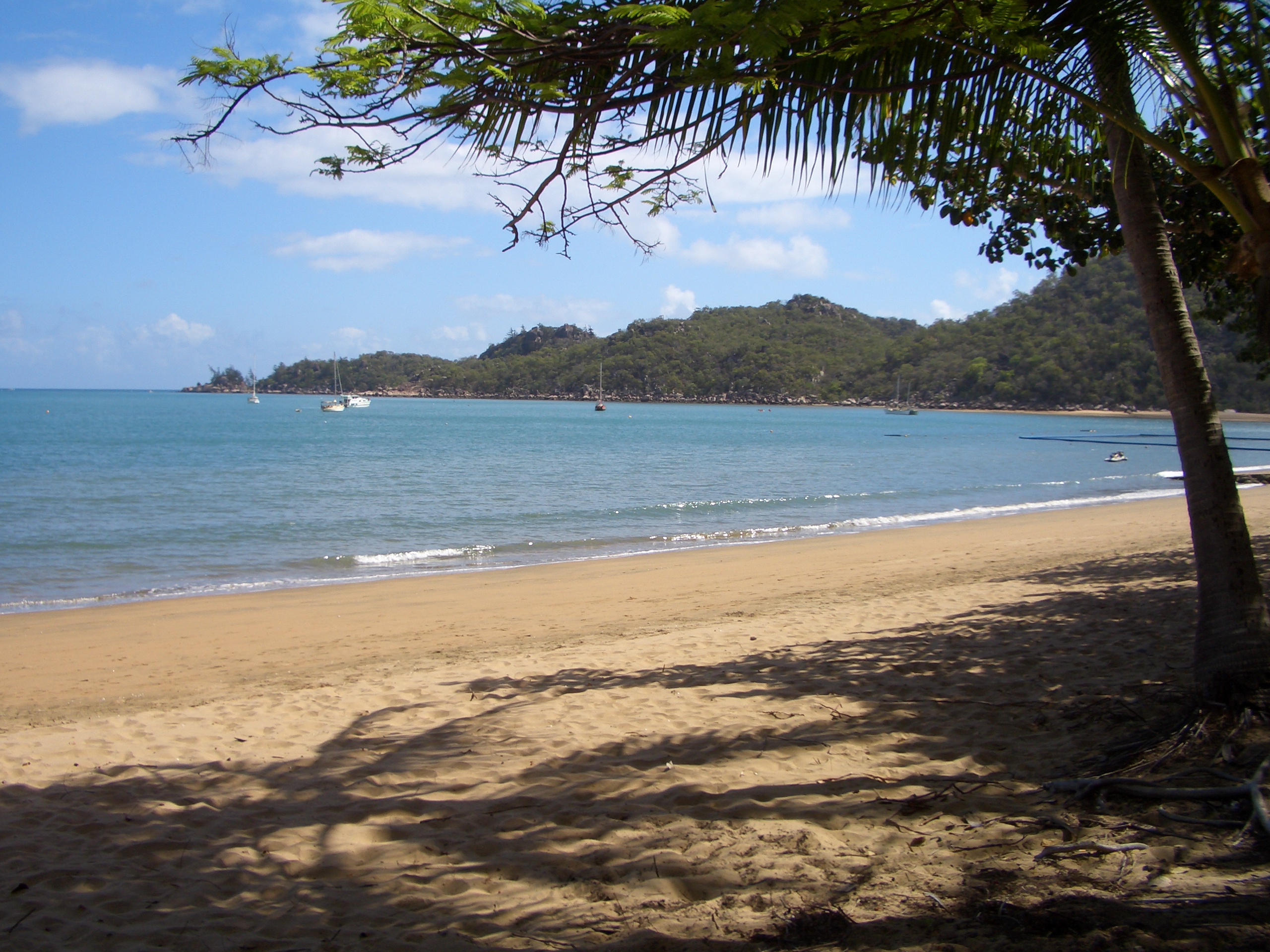
Magnetic Island 
Magnetic Island with Townsville suburbs in the foreground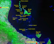
Palm Islands locationGeography Location Coral Sea Area 52 km2 (20.1 sq mi) Highest elevation 497 m (1,631 ft) Highest point Mount Cook Country AustraliaDemographics Population 2,107 (as of 2006) Density 40 /km2 (100 /sq mi) Magnetic Island is an island 8 kilometres (5.0 mi) offshore from the city of Townsville, Queensland, Australia. This 52 km2 (20.1 sq mi) mountainous island in Cleveland Bay has effectively become a suburb of Townsville, with 2,107 permanent residents.[1] The island is accessible from Townsville Breakwater to Nelly Bay Harbour by ferry. There is a large 27 km2 (10.4 sq mi) World Heritage National Park and bird sanctuary and excellent walking tracks can be taken between the populated bays and to a number of tourist destinations such as the World War II forts.
The island has long become established as a holiday destination with many hotels and several resorts in operation to cater for all levels of service. The public facilities and infrastructure on the island are managed by the Townsville City Council. The island is part of the Electoral district of Townsville in the Queensland Legislative Assembly. The island is also part of the Federal seat of Herbert, which is represented by Ewan Jones.
Contents
Naming
The name of the island came about because of the apparent "magnetic" effect it had on the ship's compass of Captain Cook as he passed the island when sailing up the east coast of Australia in 1770.[2] People have since explored the general area of Magnetic Island with various instruments to discover what might have caused the effect that Cook reported, but nothing has been discovered.
Natural heritage
The island is a haven for wildlife. 54% of the island is Magnetic Island National Park, which is mostly located on the steep hilly interior and rugged north-western side. The highest point on the island is Mount Cook reaching 497 m (1,631 ft) above sea level.[2]
Magnetic Island is famous for its angling opportunities. Fish around the island include: Blue and Black Marlin, Sailfish, Mackerel, Wahoo, Giant Trevally, Dogtooth Tuna, Coral Trout, Mahi Mahi, Tuna, Red Emperor and Sea Perch.
The pressure of coastal development has, in recent years, begun to make a significant impact on the island, which lies in the World Heritage listed Great Barrier Reef Marine Park. At present many millions of dollars in development are planned for the island and the impact of these has led to considerable opposition from some residents who fear the effects this development will have on the environmental values of Magnetic's lowlands which are not protected by the national park; these areas represent only 20% of the whole island, and of this 20%, most is freehold land and is already developed.
History
Pre-European settlement
Yunbunam, as Magnetic Island was known by the island's traditional inhabitants, had a semi-permanent population of Australian Aborigines well before European exploration of the area. These populations were known to have permanent camps at a number of bays, and had the ability to travel to the mainland using canoes. A number of Aboriginal burial sites are known to exist on the island, but have so far not been discovered by European development or exploration of the island. Aboriginal middens and cave drawings can still be found in a number of bays around Magnetic Island. Folklore of the Wulguru tribe, who inhabited the island, recounts a long history of inhabitation and annual migration to the mainland to avoid the traveling tribes from Papua New Guinea and the Torres Strait, who used the northern trade winds to travel south from their native lands in order to head-hunt indigenous tribes along the northern coasts of Australia. This head-hunting activity near-ceased following the arrival of missionaries, led by Samual MacFarlane to the Torres Straits in 1871.[3]
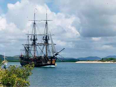
The first European accounts of the island come from Captain James Cook who, in 1770, while navigating the Australian coast, called the island Magnetical Island, as a magnetic pull interfering with his vessel's compass appeared to emanate from the island. J.M. Black, funded by Robert Towns, founded the township of Townsville on the mainland nearby. As Townsville developed though the mid-19th century, Magnetic Island became a valuable location for the gathering of hoop pine and granite, the latter of which was used in the reclamation of land for the Port of Townsville, and for construction of Townsville's Customs House.[3]
European settlement and development
Picnic Bay was named after its popularity as a picnic spot for European tourists from the mainland during the 19th century, before Magnetic Island was first inhabited by Europeans. In the mid-19th century the island became a popular location for the collection of stone and coral needed for development on the mainland. In 1875 the island was set aside as a quarantine station although it took another ten years for the proper facilities to be set up at West Point.
By 1890 a resort had been started in Picnic Bay. In 1898 Robert Hayles Sn. was so impressed by the potential of Magnetic Island he sold his other interests to build a resort on the island. Hayles was responsible for much of the development of Magnetic Island through tourism. In 1901 he started a regular ferry service to the island with his ship the Bee. Twelve months later this ship was wrecked on the rocks at Nobby Head, Picnic Bay and the Phoenix was built by Hayles' sons to replace the vessel. The Hayles company remained operating services to Magnetic Island with a large number of different vessels until the 1970s.
World War II
 The observation post overlooking Cleveland Bay, "Magnetic Battery"
Magnetic Island became an important defensive position during World War II due to its proximity to Townsville, an important military base, and its views over Cleveland Bay, a significant anchorage and assembly point for large fleets and convoys operating in the south Pacific. As such, the Magnetic Battery, an artillery battery and observation post, was built in the hinterland of Florence, Horseshoe and Arthur Bays. Picnic Bay also became a popular defence force rest and relaxation camp following the commandeering of a resort in the bay in 1939.
Post-war era
The island slowly expanded following the end of the Second World War. In late December 1971 Cyclone Althea hit the North Queensland coast directly crossing Magnetic Island. The island, along with much of the mainland, was devastated with 90% of the island's houses damaged or destroyed, some simply lifted off their foundations and tossed into trees. The island, along with the mainland, soon recovered.
Villages
 Horseshoe Bay
The four villages of the island, which contain the lion's share of the population of 2107 (as of the census of population 2006) are all located in the eastern part along the coast, from north to south: Horseshoe Bay, Arcadia Bay, Nelly Bay, Picnic Bay. Additionally, there is a small settlement West Point, that stretches southward from the namesake West Point of the island and contains the remaining 35 inhabitants.
Nr. Community Area
km²[4]Population
2006[5]Population
Density1 Horseshoe Bay 9.7 484 49.9 2 Arcadia Bay 5.2 257 49.4 3 Nelly Bay 5.2 973 187.1 4 Picnic Bay 2.8 359 128.2 5 West Point 28.4 35 1.2 Magnetic Island 51.3 2107 41.1 Annual events
Annual events include:[6]
- Great Tropical Jazz Party (August)
• Bay Days Festival (September - October)
See also
References
- ^ Australian Bureau of Statistics (25 October 2007). "Magnetic Island (Statistical Local Area)". 2006 Census QuickStats. http://www.censusdata.abs.gov.au/ABSNavigation/prenav/LocationSearch?collection=Census&period=2006&areacode=345057031&producttype=QuickStats&breadcrumb=PL&action=401. Retrieved 2007-06-27.
- ^ a b "Magnetic Island". Encyclopædia Britannica. Encyclopædia Britannica Online. http://www.britannica.com/EBchecked/topic/357193/Magnetic-Island. Retrieved 2009-07-03.
- ^ a b Barnes, Tom (1997). Peaceful Isle - Story of Magnetic Island from 1960s. Magnetic Island, Queensland, Australia.
- ^ [http://www.censusdata.abs.gov.au/ABSNavigation/prenav/LocationSearch?locationLastSearchTerm=Arcadia+Bay&locationSearchTerm=Magnetic+Island&searchButton=Search&newarea=UCL301600&mapdisplay=on&collection=Census&period=2006&areacode=UCL301600&geography=&method=&productlabel=&producttype=Community+Profiles&topic=&navmapdisplayed=true&javascript=true&breadcrumb=PL&topholder=14&leftholder=0¤taction=104&action=104&textversion=false&subaction=1 Community Profile, Sheet B01]
- ^ 2006 Census: QuickStats
- ^ annual events and the daily what's on calendar
External links
Coordinates: 19°08′S 146°50′E / 19.133°S 146.833°E
Suburbs of Townsville | North Queensland | Queensland Urban Aitkenvale · Annandale · Belgian Gardens · Bohle · Castle Hill · Cluden · Condon · Cranbrook · Currajong · Douglas · Garbutt · Gulliver · Gumlow · Heatley · Hermit Park · Hyde Park · Idalia · James Cook University · Kelso · Kirwan · Lavarack Army Barracks · Mount Louisa · Mount St John · Mount Stuart · Mundingburra · Murray · Mysterton · North Ward · Oonoonba · Pallarenda · Pimlico · Railway Estate · Rasmussen · Rosslea · Rowes Bay · Shaw · South Townsville · Thuringowa Central · Townsville City · Vincent · West End · Wulguru
Rural Alice River · Alligator Creek · Balgal Beach · Black River · Blue Hills · Bluewater Park · Bohle Plains · Brookhill · Calcium · Cape Cleveland · Cleament · Crimea · Crystal Creek · Cungulla · Hervey Range · Hidden Valley · Julago · Lynam · Majors Creek · Mount Elliot · Mutarnee · Nome · Oak Valley · Orpheus Island · Palm Island · Partington · Pinnacles · Rangewood · Reid River · Rollingstone · Roseneath · Rupertswood · Stuart · Toomulla · Toonpan · Woodstock
Northern Beaches Beach Holm · Bluewater · Burdell · Bushland Beach · Deeragun · Jensen · Mount Low · Purono Park · Saunders Beach · Toolakea · Yabulu
Magnetic Island Arcadia · Cockle Bay · Horseshoe Bay · Magnetic Island · Nelly Bay · Picnic Bay
Categories:- Islands of Queensland
- North Queensland
- Suburbs of Townsville


Wikimedia Foundation. 2010.