- Perth South, Ontario
-
Perth South — Township — 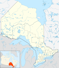
 Perth South
Coordinates: 43°18′N 81°09′W / 43.3°N 81.15°WCoordinates: 43°18′N 81°09′W / 43.3°N 81.15°W Country  Canada
Province  Ontario
County Perth Settled Formed January 1, 1998 Government – Mayor Robert Wilhelm – Federal riding Perth—Wellington – Prov. riding Perth—Wellington Area[1] – Land 393.01 km2 (151.7 sq mi) Population (2006)[1] – Total 4,132 – Density 10.5/km2 (27.2/sq mi) Time zone EST (UTC-5) – Summer (DST) EDT (UTC-4) Postal Code N0K Area code(s) 519 and 226 Website www.perthsouth.ca Perth South is a township in southwestern Ontario, Canada, at the confluence of the River Thames and the Avon River in the County of Perth.
Contents
Communities
The township encompasses the communities of Anderson, Avonbank, Avonton, Conroy, Flannigan Corners, Harmony, Metropolitan, Rannoch, Science Hill, Sebringville and St. Pauls Station.
Demographics
According to the 2006 Statistics Canada Census:[1]
- Population: 4,132
- % Change (2001-2006): -3.9
- Area (km².): 393.01
- Density (persons per km².): 10.5
- Private dwellings occupied by usual residents: 1411 (total dwellings: 1481)
Population trend:[2]
- Population in 2006: 4132 (2001 to 2006 population change: -3.9 %)
- Population in 2001: 4304 (or 4299 when adjusted for 2006 boundaries)
- Population in 1996: 4343
References
- ^ a b c "Perth South community profile". 2006 Census data. Statistics Canada. http://www12.statcan.gc.ca/census-recensement/2006/dp-pd/prof/92-591/details/page.cfm?Lang=E&Geo1=CSD&Code1=3531013&Geo2=PR&Code2=35&Data=Count&SearchText=Perth%20South&SearchType=Begins&SearchPR=01&B1=All&Custom=. Retrieved 2011-01-31.
- ^ Statistics Canada: 1996, 2001, 2006 census
External links

West Perth Stratford, Perth East South Huron 
 Perth South (completely surrounds St. Marys)

Lucan Biddulph, Thames Centre Zorra Independent North Perth Atwood • Britton • Donegal • Gowanstown • Kurtzville • Listowel • Monkton • Newry • Teviotdale • Trowbridge • WallacePerth East Amulree • Brunner • Dorking • Milverton • Millbank • Newton • Gads Hill • Poole • Rostock • Shakespeare • WartburgPerth South West Perth Roads Perth County RoadsCategories:- Municipalities in Perth County, Ontario
- Township municipalities in Ontario
- Western Ontario geography stubs

Wikimedia Foundation. 2010.