- Nambour, Queensland
-
Nambour
Sunshine Coast, Queensland
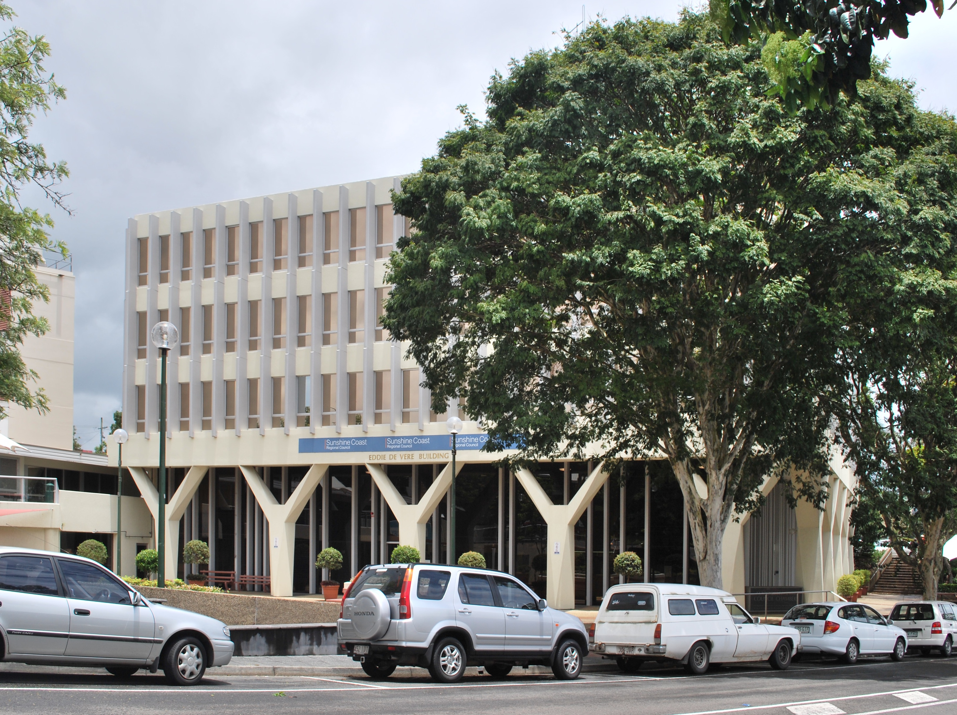
Nambour's Sunshine Coast Regional Council Offices
 Nambour
Population: 9,774(2006 census)[1] Established: 1870 Postcode: 4560 Coordinates: 26°37′37″S 152°57′32″E / 26.627°S 152.959°ECoordinates: 26°37′37″S 152°57′32″E / 26.627°S 152.959°E Elevation: 369 m (1,211 ft) Area: 14.9 km² (5.8 sq mi) Time zone: AEST (UTC+10) Location: - 104 km (65 mi) N of Brisbane
- 30 km (19 mi) SW of Noosa
- 13 km (8 mi) NW of Maroochydore
LGA: Sunshine Coast State District: Nicklin Federal Division: Fairfax Mean max temp Mean min temp Annual rainfall 25.8 °C
78 °F14.0 °C
57 °F1,694 mm
66.7 inSuburbs around Nambour: Image Flat
HighworthParklands Burnside Nambour Rosemount
Bli BliPerwillowen
Towen Mountain
West WoombyeCoes Creek
WoombyeKiels Mountain Nambour is a town in South East Queensland, Australia, 101 kilometres north of the state capital, Brisbane. The town lies in the sub-tropical hinterland of the Sunshine Coast at the foot of the Blackall Range and has a population of 9,774. It was the administrative centre and capital of the Maroochy Shire and is now the administrative centre of the Sunshine Coast Region. The greater Nambour region includes the surrounding suburbs such as Burnside, Coes Creek, Highworth, and Perwillowen, for example, and has an estimated population of 15,550.[2]
Contents
Etymology

The name is derived from the Aboriginal word "naamba", referring to the red-flowering tea tree Callistemon viminalis.[3]
History


Panoramic view of Currie Street in Nambour circa 1932  Main street in 1905
 South Sea Islanders in Nambour 1906
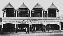 Commercial Hotel 1917
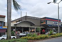 Commercial Hotel today
The area now known as Nambour, was first settled in 1870. The town was then called Petrie's Creek. In 1890 the Maroochy Divisional Board was established. In 1891 the rail link with Brisbane was completed, and at its opening Petrie's Creek was renamed "Nambour", after the Nambour cattle station.
Along the middle of the roadway of Mill, Currie and Howard Streets, a piece of Queensland Rail history is still on display - the Nambour to Coolum Tramline. The Tramline was used to transport passengers and sugar cane in the early 1920s. The Tramline forms part of the Moreton Central Sugar Mill Cane Tramway,[4] most of which has now been removed; although the track and signal lighting still remain. The town was bypassed by the Bruce Highway on 16 October 1990.
The Nambour & District Historical Museum, more widely known as the Nambour Museum, is located in the centre of town at 18 Mitchell Street. The museum is open to the public every Wednesday and Saturday between 1pm and 4pm. At other times, access may be arranged for group visitors such as retirement villages, schools and tour operators.[5]


The Royal George Hotel, the Club Hotel and the Post Office on Currie Street as seen today Demographics
In the 2006 census, 47.2% of the population were males, and 52.8% were females. The median age was 39 and 14.1% were born overseas (main responses included England, New Zealand, Germany, Scotland, Philippines). Aboriginals and Torres Strait Islanders comprised 3.2% of the population.[6]
Politics
Nambour is represented by the following politicians:
Government Division Member Party Term Federal Fairfax Alex Somlyay Liberal National 1990 - present State Nicklin Peter Wellington Independent 1998 - present Local Sunshine Coast Jenny McKay Economy
 The Big Pineapple
 The Big Cow
Nambour's primary industry has been sugar, with extensive cane fields surrounding the town, and the Moreton Sugar Mill in the town centre. The mill itself was closed in 2003, and the long term future of the sugar industry in the area is in doubt. Other industries in the area include tourism, and the growing of tropical fruits.
The Big Pineapple tourist attraction on the southern outskirts of the town (closed in October 2010 following its sale) reflects both of these pursuits. Other tourist attractions include Thrill Hill Waterslide Park,[7] the Big Cow, and the Big Macadamia nut.[8]
Situated near Nambour is the Queensland Government's Maroochy Research Station which is a major subtropical fruit and nut research and extension centre. The 61 ha research facility was established in 1945, and has an office and laboratory complex, glasshouses, netted orchards, postharvest coolrooms and a biotechnology facility. With access to national and international funding sources, specialist staff often work in conjunction with investigators from other research agencies.[9]
The main shopping areas in Nambour are Nambour Plaza on Ann Street which has approximately 40 stores, Centenary Square Shopping Centre on Currie Street, and Nambour Central Mall on the corners of Lowe, Short & Ann Street.
Nambour is a Transition Town which means that it is part of a world wide, grass roots community movement that seeks to raise awareness and create positive outcomes to help mitigate the ongoing effects of climate change and peak oil within the local community. The Transition Town Nambour group meets at 7pm on the 4th Wednesday of each month at the CWA Hall, on Short Street next to the Town Square.[10]
Infrastructure
Transport
 Railway lines run through the centre of Nambour
The TransLink Transit Authority (known as TransLink) is the authority that coordinates and integrates the public rail and bus services in South-East Queensland, of which Nambour is in Zone 17.
Nambour is serviced by several Queensland Rail passenger trains, including the Tilt Train and is approximately one and a half hours north of Brisbane by rail.
For more information on rail transport in Nambour, see Nambour railway station and the Nambour and Gympie North railway line.
The car is a popular mode of transport for Nambour residents, with the region connected to Brisbane via the Bruce Highway which forms part of the M1 motorway.
Many intercity and interstate coach operators also operate daily bus services to Brisbane using the major corridors. The local bus service is operated by Sunbus which has various routes between Nambour and Noosa and the Sunshine Coast, including one via Eumundi.
Nambour is also served by Sunshine Coast Airport, with direct flights to and from Sydney, Melbourne and Lady Elliot Island. The airport is approximately 25 minutes east of Nambour by car. Brisbane Airport is approximately one hour and ten minutes south of Nambour by car.
Health
Nambour Hospital is located on Hospital Road and provides, among other services, diagnostic, surgical, general medical, emergency, intensive care, and aged care services for the Sunshine Coast-Wide Bay Health Service District.[11]
Nambour Selangor Private Hospital is located on Netherton Street. It provides a range of health care services, including gynaecological, obstetric and maternity services and a special care nursery. The Hospital also houses two operating theatres, medical and surgical wards, a maternity unit, a specialised renal dialysis unit, an intensive care unit and day surgery services. Private specialists’ consulting suites and radiology services are co-located within the Hospital campus.[12]
Utilities
The distribution network company that provides electricity to Nambour residents is Energex.
On July 1, 2010, Sunshine Coast Regional Council's Water Services (along with Moreton Bay Regional Council), moved over to the recently created water body, Unity Water. Unity Water was created by the Queensland Government as part of the State's takeover of South East Queensland's water facilities, dams and water supply networks. Moreton Bay and Sunshine Coast Regional Councils own 50% of Unity Water.
Culture
Arts and Entertainment
 A sculpture in Nambour
The Nambour Civic Centre, located on Civic Way, is an arts and entertainment venue that includes cinema, music, theatre, dance and other events.[13] The Nambour Lind Lane Theatre, located on Mitchell Street, is another live theatre venue.[14]
Nambour Originals (sibling of Peregian Originals held at Peregian Beach) is an open air community event that involves live music in a picnic style format. It is held at 1pm every 2nd and 4th Sunday of each month at Quota Park Amphitheatre on Matthews Street. The facilities at Quota Park include barbecues, a sheltered area, shady trees, a kids play area, toilets and parking.[15]
Nambour’s Moonlight Markets are held in the Town Square on Lowe Street on the final Friday of every month from 5 to 9pm.[16]
The Nambour Festival, which began as the Nambour Sugar Festival in the 1980s, has been held at Quota Park since 2008. The festival showcases local musicians, entertainers, cooking demonstrations, local produce, a diverse range of activities for children, and market stalls.[17]
The Sunshine Coast Agricultural Show was first held in 1905 in Woombye. The first show in Nambour was held in 1909. Today, the Sunshine Coast Agricultural Show is a modern three day show full of agricultural, community and entertainment events.[18]
The Queensland Home Garden Expo is a 3 day gardening event held at the Nambour Showgrounds.[19]
The Suncoast Growers Markets are held at the Suncoast Christian College car park, on the Nambour Connection Road at nearby Woombye, on Saturdays from 6:30am to 12pm.[20]
The Nambour Orchid Society was founded in 1955 and meets at 2pm every fourth Saturday of the month, except during December, in the Buffalo Lodge Hall on Price Street.[21]
Nambour is the fifth town mentioned in the original (Australian) version of the song "I've Been Everywhere".
Media
The daily local newspaper is the Sunshine Coast Daily which is published by APN News & Media. There is also a weekly news service provided by the Nambour Weekly which is published on Wednesdays.[22] The Nambour Chronicle was published from 1903 until it ceased publication in the 1980s.[23]
Nambour is served by the following television channels:
Channel Definition Organisation Ownership Notes ABC1 HD Australian Broadcasting Corporation Government ABC2 SD Australian Broadcasting Corporation Government ABC3 SD Australian Broadcasting Commission Government ABC News 24 HD Australian Broadcasting Commission Government SBS One SD Special Broadcasting Service Government Simulcast in high definition on SBS HD SBS Two SD Special Broadcasting Service Government 7 SD Seven Queensland Private Regional affiliate of the Seven Network in Brisbane 7Two SD Seven Network Private 7mate SD Seven Network Private 9 SD WIN Television Private Regional affiliate of the Nine Network in Brisbane Nine HD HD Nine Network Private GO SD Nine Network Private GEM SD Nine Network Private 10 SD Southern Cross Ten Private Regional affiliate of Network Ten One HD HD Network Ten Private Eleven SD Network Ten Private Nambour is also in the television broadcast licence areas of Brisbane (metro), enabling most areas of the Sunshine Coast to receive the commercial Brisbane stations. Subscription television services Foxtel and Austar are also available.
Nambour is served by the following radio stations:
Channel Band Name Organisation Ownership Notes 88.7 FM ABC Classic FM Australian Broadcasting Corporation Government 89.5 FM Triple J Australian Broadcasting Corporation Government 90.3 FM ABC Coast FM Australian Broadcasting Corporation Government 91.1 FM Hot FM Prime Television Private 91.9 FM Sea FM Macquaries Southern Cross Media Network Private 92.7 FM Mix FM Macquaries Southern Cross Media Network Private 96 FM Zinc96 Prime Television Private Many community access stations, as well as some Brisbane stations can also be received.
Sport
 Nambour Rugby Union Premiers 1912
The Nambour-Yandina United Football Club is located at North Street in nearby Yandina. [24] The Nambour Wildcats Football Club is part of the Sunshine Coast Churches Football Association.[25]
The Nambour Crushers Rugby League Club was established in 1985. The grounds are situated at 22 Crusher Park Drive. The Crushers have teams in all grades from Under 7s to A Grade and number approximately 300 players.[26]
The Nambour Rugby Union Club entered the Sunshine Coast District Rugby Union Competition in 1981. The club is known as the "Toads". The club`s ground is situated on Laidlaw Road in nearby Woombye. Nambour fields four "Senior" sides in the Sunshine Coast Competition: A Grade, Reserve Grade and U19`s as well as a women's team. A junior club with teams from under 7s through to under 17s also runs. Nambour were local premiers in 1912 and 1913.[27]
The Nambour and Districts Netball Association is made up of clubs from Yandina, Burnside, Nambour, Woombye, Palmwoods and the school based Saints club. [28]
Nambour Cricket Club is part of the Sunshine Coast Cricket Association and has played on the Nambour showgrounds since the early 1890s when a Nambour team competed against teams from nearby towns. The club caters for players of all age groups from six year olds to all standards of senior players.[29]
Nambour has two tennis clubs. The Nambour and District Tennis Association is located on Washington Street. The Nambas Tennis Club is located at the Nambour Showgrounds, on Coronation Avenue.
The Nambour Golf Club is located on Nambour Connection Road, Nambour.[30]
The Nambour Aquatic Centre is located in Petrie Park and has heated pools all year round. The complex offers a variety of activities including a 50m heated pool, a 25m heated enclosed pool, toddler pools and fountains/play area, a learn to swim program, aqua aerobics classes, and a poolside cafe.[31]
The Sunshine Coast Police Citizens Youth Club is located on Youth Avenue in Nambour and includes activities such as basketball, boxing, gymnastics, judo, a recording studio, squash, tennis, swimming, volleyball, after school and vacation care, gymnasium and weights, and fitness classes. [32]
People
Nambour is where tennis star, Pat Rafter, made his debut.[33] His name has been on the wall of the local tennis club since he won the junior championship as a sixteen year old. Pat went on to win the U.S. Open twice. His large family is still well known and respected in the district.
Famous people born in Nambour include National Rugby League player Billy Slater, cricketer Ashley Noffke, professional surfer Joel Parkinson, former Prime Minister Kevin Rudd, Deputy Prime Minister and Treasurer Wayne Swan, 1991 British Open winner Ian Baker-Finch, internationally successful music producer and songwriter Mike Chapman, Powderfinger drummer Jon Coghill and Queensland Bulls Batsman Lee Carseldine.
Kevin Rudd attended Nambour State High School as did Wayne Swan and Queensland Nationals deputy leader Fiona Simpson.[34]
Max Gaylard, United Nations Assistant Secretary-General currently working as Deputy Special Coordinator for the Middle East Peace Process and United Nations coordinator for humanitarian and development activities in the Occupied Palestinian Territory is also from Nambour.[35]
Education
- Nambour Special School is located on Windsor Drive and is for children aged 5 to 18 years.[36]
The following primary schools are in, or near to, Nambour:
- Nambour State School is located on Coronation Avenue.[37]
- Burnside State School is located on Blaxland Road.[38]
- Blackall Range Independent School is located on Mapleton Road, Kureelpa.[39]
- St Joseph's Primary School is located on Currie Sreet. [40]
The following secondary schools are in, or near to, Nambour:
- Nambour State High School is located on Carroll Street.[41]
- Burnside State High School is located on Blaxland Road.[42]
- St John's College is located on Perwillowen Road.[43]
- Nambour Christian College is located on McKenzie Road, Woombye.[44]
- Suncoast Christian College is located on the corner of Schubert and Kiel Mountain Roads, Woombye.[45]
- Blackall Range Independent School is located on Mapleton Road, Kureelpa.[39]
The following tertiary institutions are in, or near to, Nambour:
- Sunshine Coast Institute of TAFE has its largest campus in Nambour on Windsor Road set in landscaped grounds, with gardens, lawns, native trees and a winding creek. The Nambour Campus offers courses including child care, community welfare work, lifestyle and leisure, conservation and land management, horticulture, construction, fashion, graphic design, music, photography, interior design, renewable energy, and building design and technology.[46]
- University of the Sunshine Coast is located in nearby Sippy Downs.
Climate
Climate data for Nambour DPI Month Jan Feb Mar Apr May Jun Jul Aug Sep Oct Nov Dec Year Average high °C (°F) 29.3
(84.7)28.8
(83.8)27.9
(82.2)26.2
(79.2)23.7
(74.7)21.6
(70.9)21.1
(70.0)22.5
(72.5)24.8
(76.6)26.7
(80.1)27.9
(82.2)29.1
(84.4)25.8 Average low °C (°F) 19.3
(66.7)19.6
(67.3)18.2
(64.8)15.4
(59.7)12.0
(53.6)9.2
(48.6)7.6
(45.7)7.9
(46.2)10.5
(50.9)13.8
(56.8)16.2
(61.2)18.0
(64.4)14.0 Precipitation mm (inches) 229.5
(9.035)259.1
(10.201)227.9
(8.972)143.7
(5.657)135.4
(5.331)87.9
(3.461)82.6
(3.252)59.8
(2.354)49.2
(1.937)104.0
(4.094)137.9
(5.429)174.4
(6.866)1,693.8
(66.685)Avg. precipitation days 11.1 12.8 13.3 9.8 9.0 6.3 5.5 5.0 5.3 8.0 8.9 9.9 104.09 Source: Bureau of Meteorology[47] See also
Notes
- ^ Australian Bureau of Statistics (25 October 2007). "Nambour (Maroochy Shire) (State Suburb)". 2006 Census QuickStats. http://www.censusdata.abs.gov.au/ABSNavigation/prenav/LocationSearch?collection=Census&period=2006&areacode=SSC36971&producttype=QuickStats&breadcrumb=PL&action=401. Retrieved 24 October 2009.
- ^ Queensland Government Population Estimates accessed 25 March 2011
- ^ Sunshine Coast Regional Council Library - Local Histories - Nambour accessed 26 March 2011
- ^ Cane Tramways of Moreton Central Mill Co. Ltd Singleton, C.C. Australian Railway Historical Society Bulletin, October, 1957 pp153-157
- ^ Nambour Museum accessed 27 March 2011
- ^ Census 2006 Nambour (Maroochy Shire) accessed 25 March 2011
- ^ Thrill Hill Waterslide Park accessed 25 March 2011
- ^ "Big Macadamia" (Travel guide). Travelmate. http://www.travelmate.com.au/BigThings/BigThings.asp?Type=Show&ToDoId=167878. Retrieved 2008-10-15.
- ^ Maroochy Research Station accessed 16 March 2011
- ^ Transition Town Nambour accessed 13 April 2011
- ^ Nambour Hospital
- ^ Nambour Selangor Private Hospital
- ^ Nambour Civic Centre accessed 7 March 2011
- ^ Nambour Lind Lane Theatre accessed 11 March 2011
- ^ Nambour Originals accessed 24 March 2011
- ^ Moonlight Markets accessed 7 March 2011
- ^ Nambour Festival accessed 24 March 2011
- ^ Nambour Show accessed 24 March 2011
- ^ Queensland Home Garden Expo accessed 24 March 2011
- ^ Suncoast Growers Market accessed 24 March 2011
- ^ Nambour Orchid Society accessed 29 March 2011
- ^ Nambour Weekly accessed 27 March 2011
- ^ Nambour Chronicle accessed 27 March 2011
- ^ Nambour-Yandina United Football Club accessed 19 March 2011
- ^ Nambour Wildcats accessed 31 March 2011
- ^ Nambour Crushers accessed 25 March 2011
- ^ Nambour Rugby Union Club accessed 27 March 2011
- ^ Nambour and Districts Netball accessed 27 March 2011
- ^ Nambour Cricket Club accessed 27 March 2011
- ^ Nambour Golf Club accessed 19 March 2011
- ^ Nambour Aquatic Centre accessed 25 March 2011
- ^ Sunshine Coast Police Citizens Youth Club accessed 19 March 2011
- ^ Enough Rope with Andrew Denton transcript accessed 24 December 2006
- ^ Carolyn Tucker (1 December 2007). "High and mighty Nambour". The Daily. http://www.thedaily.com.au/news/2007/dec/01/high-and-mighty-nambour/. Retrieved 8 January 2008.
- ^ UN Bio Note
- ^ Nambour Special School accessed 28 March 2011
- ^ Nambour State School accessed 27 March 2011
- ^ Burnside State School accessed 27 March 2011
- ^ a b Blackall Range Independent School
- ^ St Joseph's Primary School accessed 2 April 2011
- ^ Nambour State High School accessed 27 March 2011
- ^ Burnside State High School accessed 31 March 2011
- ^ St John's College accessed 27 March 2011
- ^ Nambour Christian College accessed 31 March 2011
- ^ Suncoast Christian College accessed 31 March 2011
- ^ Nambour Campus accessed 27 March 2011
- ^ "Climate statistics for Australian locations". Bureau of Meteorology. http://reg.bom.gov.au/climate/averages/tables/cw_040282.shtml. Retrieved 2011-01-30.
External links
- Nambour travel guide from Wikitravel
- University of Queensland: Queensland Places:Nambour
- Nambour on the Australian Explorer website
- Nambour Chronicle
- Nambour on The Age Traveller
- Nambour Weekly
Categories:- Suburbs of the Sunshine Coast, Queensland
- Towns in Queensland
- Australian Aboriginal placenames


Wikimedia Foundation. 2010.