- Duck, North Carolina
-

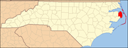
Duck, North Carolina — Town — Motto: Paradise Found Coordinates: 36°1′32″N 75°40′12″W / 36.02556°N 75.67°W Area – Total 2.416 sq mi (6.3 km2) – Land 1.114 sq mi (2.9 km2) – Water 1.302 sq mi (3.4 km2) Elevation 7 ft (2 m) Population (2010) – Total 520 – Density 250/sq mi (96.5/km2) Time zone Eastern (EST) (UTC-5) – Summer (DST) EDT (UTC-4) ZIP code 27949 Area code(s) 252 FIPS code 37-35720[1] GNIS feature ID 1025849[2] Website [1] Duck is a town in Dare County, North Carolina/Dare County, North Carolina, United States. The population was 520 at the 2010 census.
Contents
Geography
According to the United States Census Bureau, the city has a total area of 2.416 square miles (6.26 km2), 1.302 is water.
along the northern Outer Banks. Originally part of Currituck County to the north, the stretch of the Outer Banks which includes Duck was transferred to Dare County in the early 20th century. The region was named for the many ducks and waterfowl in the area.. During the peak vacation season the population increases to over 20,000.
The area nearby was sparsely populated until the 1970s (during the 1950s, nearby land was used as a bombing range by naval aircraft). The growing community remained unincorporated until 2002, when North Carolina General Assembly House Bill 882 was passed, incorporating the town. Duck is now home to about 500 permanent residents and the U.S. Army Corps of Engineers Duck Field Research Pier, which conducts coastal research. It has a higher seasonal population.
Awards and regonizations
- Duck was ranked one of America's Top 10 Best Beaches in 2002 by The Travel Channel
References
- ^ "American FactFinder". United States Census Bureau. http://factfinder.census.gov. Retrieved 2008-01-31.
- ^ "US Board on Geographic Names". United States Geological Survey. 2007-10-25. http://geonames.usgs.gov. Retrieved 2008-01-31.
External links
Municipalities and communities of Dare County, North Carolina Towns Duck | Kill Devil Hills | Kitty Hawk | Manteo | Nags Head | Southern Shores
Unincorporated
communitiesThe Outer Banks of North Carolina Landforms Places Currituck County · Dare County · Hyde County · Carteret County
Carova Beach · Corolla · Duck · Southern Shores · Kitty Hawk · Kill Devil Hills · Nags Head · Manteo · Wanchese · Rodanthe · Waves · Salvo · Avon · Buxton · Frisco · Hatteras · Ocracoke · PortsmouthWaterways Lighthouses Protected areas Transportation History Categories:- Beaches of North Carolina
- Towns in North Carolina
- Populated places in Dare County, North Carolina
- Outer Banks
- Populated places established in 2002
- North Carolina geography stubs

Wikimedia Foundation. 2010.