- Santiago Metro
-
Metro de Santiago 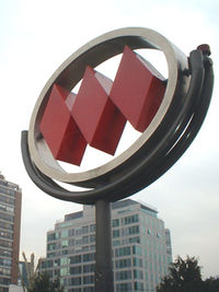
Info Locale Santiago Transit type Rapid transit Number of lines 5 Number of stations 108 Daily ridership 2.3 million daily Operation Began operation September 15, 1975 Operator(s) Empresa de Transporte de Pasajeros Metro S.A. Technical System length 103 km Metro de Santiago is South America's most extensive metro system with 5 lines, 108 stations and 103 kilometres of track[1] making it the second longest in Latin America after that of Mexico City. The metro system serves the city of Santiago, Chile. Three of the lines are rubber-tyred metro. 4-Line and 4A-Line are traditional steel wheels. The system services around 2,300,000 passengers per day.[2] The system is administered by the state-owned Metro S.A.. Along with Metro Valparaíso in the city of Valparaíso and the Biotren in Concepción, it is one of the three metropolitan railway systems in Chile.
Contents
History
 NS07 Train (with rubber tires) in Hernando de Magallanes station (Line 1).
Origin and first project
It serves a city of 6 million inhabitants. Since its opening in 1975, el Metro has changed the city; it is one of Chile's most important construction projects. While lines 1, 2, and 5 use rubber tire stock, lines 4 and 4A use steel wheels in order to increase capacity.[citation needed] The rapid growth of the population in the city (in 1920, 507,296 inhabitants; in 1940, 1,073,699 inhabitants) was the principal factor in the birth of the idea. The first plan was in 1944, but only in 1968 did work begin. The original plan was for 5 lines:
- Line 1, between San Pablo and Los Dominicos by the Alameda, Providencia and Apoquindo Avenues.
- Line 2, between Conchalí and San Miguel by Vivaceta, Panamerican Highway and Gran Avenida.
- Line 3, (planned, no construction date set) between Mapocho and Ñuñoa, by Ahumada and the avenues Matta and Irarrázaval.
- Line 4, between Tobalaba (Providencia) and Puente Alto, to the South
- Line 5, between Maipú and La Florida.
Extension
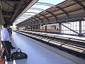
 Interior of a metro car.
On September 15, 1975, Augusto Pinochet opened the first section of the underground railway between San Pablo and La Moneda on Line 1. Line 2 was opened in 1978 between Los Héroes and Lo Ovalle, and Line 1 was extended to Escuela Militar in 1980. Line 2 was extended to the north and found the remains of the Cal y Canto Bridge (built in 1782 and destroyed in 1880). The extension between Los Héroes and Puente Cal y Canto (former Mapocho Station) was inaugurated in 1987.
The city had changed since 1968 and the plan had to be changed too. La Florida had become the most populous zone of the city, and the Metro needed to go there. Line 5 was built south from Baquedano along Vicuña Mackenna Avenue and was opened in 1997. Line 5 was extended in 2000 to the west and entered the historical centre of the city (Plaza de Armas station), and in 2004 the extensions of Line 2 to the north and south and Line 5 to the west were opened.
In 2002 the construction of Line 4 and Line 4A began, in order to connect Puente Alto and the southeast of the City to the metro system.
Near the end of 2005, President Ricardo Lagos said that the government will start to plan the construction of another extension of line 5. It would reach Maipú, one of the municipalities that is further away from the centre of Santiago.
At the end of 2009, former President Michelle Bachelet announced the construction of Line 6.[3] The new line will connect eight communities with 12 stations over 14.8 kilometres. In October 2010, President Sebastián Piñera announced that Line 3 is in planning.[4] Both lines are projected to be in operation by 2014.
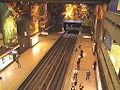
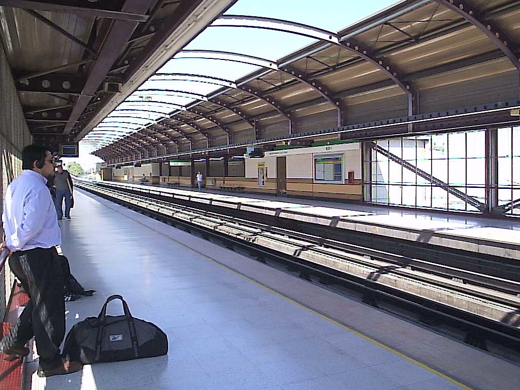
 Metro map
Nowadays, Metro consists of five lines which total 84 kilometres and a total of 82 stations and seven transfer stations: Los Héroes, Baquedano, Santa Ana, Tobalaba, Vicente Valdés, Vicuña Mackenna and La Cisterna. Seven new stations are opened on February 3, 2011.
Line Length Stations Opening Date Type 
San Pablo - La Moneda 8,2 km 12 15 Sept, 1975 Underground La Moneda- Salvador 3,2 km 5 31 Mar, 1977 Underground 
Los Héroes - Franklin 4,9 km 4 31 Mar, 1978 Ground Level Franklin - Lo Ovalle 4.8 km 6 21 Dec, 1978 Underground Salvador - Escuela Militar 4,5 km 6 22 Aug, 1980 Underground Los Héroes - Puente Cal y Canto 1,7 km 2 15 Sept, 1987 Ground level 
Baquedano - Bellavista de La Florida 10,3 km 11 5 Apr, 1997 Viaduct Baquedano - Santa Ana 2,7 km 2 4 Mar, 2000 Underground Santa Ana - Quinta Normal 1,9 km 2 31 Mar, 2004 Underground Puente Cal y Canto - Cerro Blanco 1,6 km 2 8 Sept, 2004 Underground Lo Ovalle - La Cisterna 2,1 km 2 22 Dec, 2004 Underground Cerro Blanco - Einstein 1,9 km 2 25 Nov, 2005 Underground Bellavista de La Florida- Vicente Valdés 0,6 km 1 30 Nov, 2005 Underground 
Vicente Valdés - Plaza de Puente Alto 10,9 km 9 30 Nov, 2005 Viaduct Tobalaba - Grecia 7,7 km 7 30 Nov, 2005 Underground Grecia - Vicente Valdés 6,1 km 5 2 Mar, 2006 Ground level 
Vicuña Mackenna - La Cisterna 7,7 km 6 16 Aug, 2006 Ground level Einstein - Vespucio Norte 3,6 km 3 21 Dec, 2006 Underground San José de la Estrella 0 km 1 5 Nov, 2009 Viaduct Escuela Militar - Los Dominicos 4 km 3 7 Jan, 2010 Underground Quinta Normal - Pudahuel 5,8 km 5 12 Jan, 2010 Underground Pudahuel - Plaza de Maipú 8 km 7 3 Feb, 2011 Viaduct 
Pedro Aguirre Cerda - Los Leones 14,8 km 10 2016 Underground 
Huechuraba - Larraín 21 km 18 2017 Underground Rolling Stocks
Stations
In bold are junction stations. In grey are stations currently under construction.

San Pablo
- Neptuno
- Pajaritos
- Las Rejas
- Ecuador
- San Alberto Hurtado
- Universidad de Santiago
- Estación Central
- Unión Latinoamericana
- República
- Los Héroes

- La Moneda
- Universidad de Chile

- Santa Lucía
- Universidad Católica
- Baquedano
- Salvador
- Manuel Montt
- Pedro de Valdivia

- Los Leones
- Tobalaba

- El Golf
- Alcántara
- Escuela Militar
- Manquehue
- Hernando de Magallanes
- Los Dominicos
- Vespucio Norte
- Zapadores
- Dorsal
- Einstein
- Cementerios
- Cerro Blanco
- Patronato
- Puente Cal y Canto
- Santa Ana
- Los Héroes

- Toesca
- Parque O'Higgins
- Rondizzoni
- Franklin
- El Llano
- San Miguel
- Lo Vial
- Departamental
- Ciudad del Niño
- Lo Ovalle
- El Parrón
- La Cisterna

- Universidad de Chile
- Tobalaba
- Cristóbal Colón
- Francisco Bilbao
- Príncipe de Gales
- Simón Bolívar
- Plaza Egaña
- Los Orientales
- Grecia
- Los Presidentes
- Quilín
- Las Torres
- Macul
- Vicuña Mackenna
- Vicente Valdés
- Rojas Magallanes
- Trinidad
- San José de la Estrella
- Los Quillayes
- Elisa Correa
- Hospital Sótero del Río
- Protectora de la Infancia
- Las Mercedes
- Plaza de Puente Alto
- La Cisterna
- San Ramón
- Santa Rosa
- La Granja
- Santa Julia
- Vicuña Mackenna
- Plaza de Maipú
- Santiago Bueras
- Del Sol
- Monte Tabor
- Las Parcelas
- Laguna Sur
- Barrancas
- Pudahuel
- San Pablo
- Lo Prado
- Blanqueado
- Gruta de Lourdes
- Quinta Normal
- Cumming
- Santa Ana
- Plaza de Armas
- Bellas Artes
- Baquedano
- Parque Bustamante
- Santa Isabel
- Irarrázaval
- Ñuble
- Rodrigo de Araya
- Carlos Valdovinos
- Camino Agrícola
- San Joaquín
- Pedrero
- Mirador
- Bellavista de La Florida
- Vicente Valdés
-
Universidad de Chile
-

Santa Ana
-

Vicuña Mackenna
-
Ñuble
Art in the Metro
Art is quite a present element in the stations. The station Universidad de Chile has a giant mural created by Mario Toral and represents the history of the country. Other pieces of art are in Baquedano (featuring modern art and a concert space), Bellas Artes (multimedia art), Santa Lucía (Portuguese azulejos, a gift made by the Lisbon Metro), La Moneda (with realistic painting representing typical landscape), and various other stations.
Pricing and working hours
Metro is part of Transantiago, the integrated public transport system that serves the capital using also feeder and main bus routes. Transantiago works with an integrated fare system, which allows passengers to make bus-bus or bus-metro transfers on a two-hour time limit for the price of one ticket, using a contactless smart card called "Bip! card". These cards are available in all the ticketing offices in every station at a cost of $2.000 (approx. US$4.00), including $700 worth of credit. Tickets are sold from 6:00 to 23:00 Monday to Friday, 6:30 to 23:00 on Saturdays, and 8:00 to 22:30 on Sundays and holidays. Cards can be topped up to $20.000, and the credit only expires if the card it is not used in two years.
Metro de Santiago also sells single-trip tickets. These don't allow transfers to buses. Fares depend on the time of the use of the system. The cost of a ticket in the Horario Punta (rush hour, 7:00-8:59 and 18:00-19:59) is $620 (approx. US$1.25); in the Horario Valle (off-peak hours, 6:30-6:59, 9:00-17:59, 20:00-20:44, and all day on weekends and holidays) is $570 (approximately US$1.15); and in the Horario Bajo (low-use hours, 6:00-6:29 and 20:45-23:00) is $520 (approximately US$1.05). Senior citizens (65 and older) and students holding concession cards pay $180 (US $0.35). Senior concession fare does not apply during rush hours.
2011 Shooting
On July 17th, 2011, former janitor for the Policía de Investigaciones (PDI) Israel Huerta opened fire with a 9mm pistol on several people in the last car of the metro train in the Plaza de Maipú station, killing three and wounding four others.
No motive has been established, though it is suspected that Huerta was affected by his mother's death several months before.[5]
See also
References
- ^ "Plan your journey" (in Spanish). Santiago Metro. http://www.metrosantiago.cl/guia-viajero. Retrieved 19 April 2010.
- ^ http://www.metrosantiago.cl/guia-viajero/densidad
- ^ "Presidenta Bachelet anunció construcción de nueva línea de Metro" (in Spanish). http://www.metrosantiago.cl/metro_ciudad_detalle.php?c=8757150decbd89b0f5442ca3db4d0e0e. Retrieved 2009-12-29.
- ^ "Presidente Piñera recorre por primera vez en tren nuevo tramo de Línea 5 de Metro" (in Spanish). http://www.metrosantiago.cl/noticias/detalle/2a9d121cd9c3a1832bb6d2cc6bd7a8a7. Retrieved 2010-10-06.
- ^ http://diario.latercera.com/2011/07/18/01/contenido/pais/31-76889-9-ex-auxiliar-de-la-pdi-protagoniza-inedito-tiroteo-en-el-metro-y-mata-a-dos.shtml
External links
- (Spanish) Metro S.A.
- (English) UrbanRail.net/Santiago
- (Spanish) Tarjeta Bip!
- (Spanish) Plan and Authority of Transit of Santiago de Chile, Transantiago
- (Spanish) Santiago Metro in Wikipedia in Spanish
Categories:


Wikimedia Foundation. 2010.