- Rapid transit
-
This article is about grade-separated rail transport. For other uses, see Rapid transit (disambiguation).
 Interior of a Helsinki Metro train
 Inside an underground tunnel on the Taipei Metro
A rapid transit, underground, subway, elevated railway, metro or metropolitan railway system is an electric passenger railway in an urban area with a high capacity and frequency, and grade separation from other traffic.[1][2] Rapid transit systems are typically located either in underground tunnels or on elevated rails above street level. Outside urban centers, rapid transit lines may run on grade separated ground level tracks.
Service on rapid transit systems is provided on designated lines between stations using electric multiple units on rail tracks, although some systems use guided rubber tyres, magnetic levitation, or monorail. They are typically integrated with other public transport and often operated by the same public transport authorities. Rapid transit is faster and has a higher capacity than trams or light rail, but is not as fast or as far-reaching as commuter rail. It is unchallenged in its ability to transport large amounts of people quickly over short distances with little land use. Variations of rapid transit include people movers, small-scale light metro and the commuter rail hybrid S-Bahn.
The first rapid transit system was the London Underground, which opened in 1863. The technology quickly spread to other cities in Europe, and then to the United States where a number of elevated systems were built. At first these systems used steam locomotives, with the term later coming to entirely mean electric systems. Since then the largest growth has been in Asia and with driverless systems. More than 160 cities have rapid transit systems, totaling more than 8,000 km (5,000 mi) of track and 7,000 stations. Twenty-five cities have new systems under construction.
The biggest metro system in the world by length of routes and number of stations is the New York Subway; by length of lines the largest are the Shanghai Metro[3] and London Underground. The busiest metro systems in the world by daily and annual ridership are the Tokyo subway, Moscow Metro and Seoul Metropolitan Subway.
Contents

Terminology
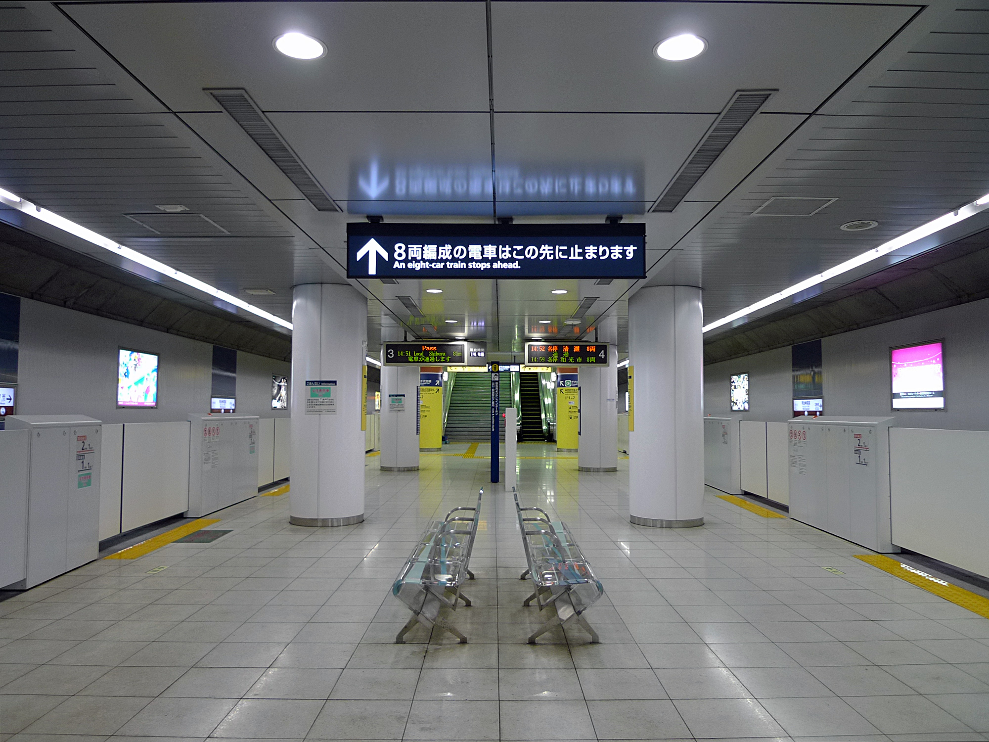
 Meiji-jingumae station Fukutoshin Line platform in the Tokyo Metro
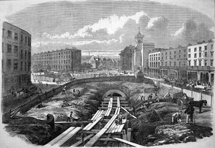
 An engraving from the Illustrated London News showing the initial construction stages of London's Metropolitan Railway at King's Cross St. Pancras in 1861Main article: Passenger rail terminology
Metro is the most common term for underground rapid transit systems.[4] Rapid transit systems may be named after the medium through which their busier inner-city sections travel: use of tunnels inspires names such as subway,[5] underground,[6] Untergrundbahn (U-bahn) in German,[7] or Tunnelbana (T-bana) in Swedish;[8] use of viaducts inspires names such as elevated (el or L), skytrain,[9] overhead or overground. One of these terms may apply to an entire system, even if a large part of the network (for example, in outer suburbs) runs on ground level.
In English English a subway is a pedestrian underpass, so the expressions underground and tube may be preferred. In Scotland, Glasgow's underground rapid transit system is called the Glasgow Subway.
History
Main article: History of rapid transitRapid transit evolved from steam railways during the late 19th century. In 1890 the City & South London Railway in London was the first electric rapid transit railway.[10] The electric railway eventually was merged into London Underground. The technology swiftly spread to other cities in Europe, as in Budapest, Hungary in 1896, and then to the United States. A number of elevated systems were built, starting with the 1893 100% designed electric Liverpool Overhead Railway. The elevated railways in Chicago and New York were converted to electric from steam propulsion.[11]
By 1940, there were 19 systems, and by 1984, there were 66. This included smaller cities like Oslo and Marseille which opened extensive systems in the 1960s. More recently the growth of new systems has been concentrated in Southeast Asia and Latin America.[7] Western Europe and North America have instead seen a revival of the tram, with light rail systems supplementing full scale urban railways, and less focus on building rapid transit.[12] At the same time, technological improvements have allowed new driverless lines and systems. Hybrid solutions have also evolved, such as tram-train and premetro, which have some of the features of rapid transit systems.[10]
Operation
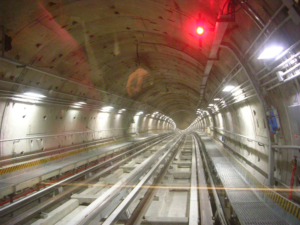
 Inside a tunnel on the Turin Metro
Rapid transit is used in cities, agglomerations and metropolitan areas to transport large numbers of people at high frequency. The extent of the rapid transit system varies greatly between cities, with several transport strategies: in larger metropolitan areas the underground system may extend only to the limits of the inner city, or to its inner ring of suburbs with trains making frequent station stops. The outer suburbs may then be reached by a separate commuter rail network, where more widely spaced stations allow higher speeds. These trains are often more expensive and less frequent, and in some cities operate only during rush hour periods. They may or may not satisfy the criteria for an urban rapid transit system, and in some cases the differences between urban and suburban rapid transit systems are not clear. See also the Variations and Comparison sections below.[2]
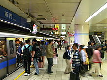 Ximen Station on the Blue Line of the Taipei Metro. Rapid transit allows for high passenger throughput.
Rapid transit systems are often supplemented by other systems, either buses, trams or commuter rail. This combination of transit modes serves to offset certain limitations of rapid transit, such as limited stops and long walking distances within station infrastructure between outside access points and the vehicle itself, (sometimes involving long vertical distances if the station is in a deep-level tunnel or on a high overpass). Given these limitations, combined with the high density nature of many urban environments, short trips are often more easily performed on trams or buses. Many cities have chosen to operate a tram system in the city core with the metro expanding beyond it,[8] although many cities (especially outside of Europe) later converted their surface systems from trams to buses in the 1950s and 60s. Another common strategy is to use a bus or tram feeder system to transport people to rapid transit stops, freeing the suburban or feeder system from the requirement to drive all the way to the city centre.[13] Surface route terminals connected directly to rapid transit stations, provided especially in newer systems with single, consolidated transit agencies turn rapid transit stations into neighbourhood centres - nodes of activity that can blossom into satellite business districts of their own. This scheme promotes transit ridership in lower-density outlying neighbourhoods that do not have the population density or sufficient attractions to support their own rapid transit lines by offering a connection to business districts that saves users from driving in big city traffic conditions, and reduces congestion in urban centres by consolidating passengers into dedicated high-frequency, high-capacity corridors, instead of being reliant on city centre streets, which are often among the oldest in their respective cities and were often never designed to accommodate modern traffic volumes.
In Toronto, Canada, over 50% of Toronto subway and RT stations have bus and streetcar terminals within the fare-paid zone, providing a connection without requiring proof-of-payment, and speeding boarding by allowing passengers to board through all doors. Several subway stations, especially current or former termini for their respective lines, have developed significant satellite commercial districts of their own.
Rapid transit systems have high fixed costs. Most systems are publicly owned, by either local governments, transit authorities or national governments. Investments are often financed by taxation, rather than by passengers, but must often compete with funding for roads. The systems may be operated by the owner or by a private company through a public service obligation. The owners of the systems often also own the connecting bus or rail systems, or are members of the local transport association, allowing for free transfers between modes. Almost all systems operate at a deficit, requiring fare revenue, advertising and subsidies to cover costs. The farebox recovery ratio, a ratio of ticket income to operating costs, is often used to assess operational profitability, with some systems including Hong Kong's MTR Corporation,[14] and Taipei[15] achieving recovery ratios of well over 100%. This ignores both heavy capital costs incurred in building the system, which are often subsidized with soft loans[16] and whose servicing is excluded from calculations of profitability, as well as ancillary revenue such as income from real estate portfolios.[14] Some metros, including Hong Kong, are even financed by the sale of land whose value has been increased by the building of the system.[17]
Lines

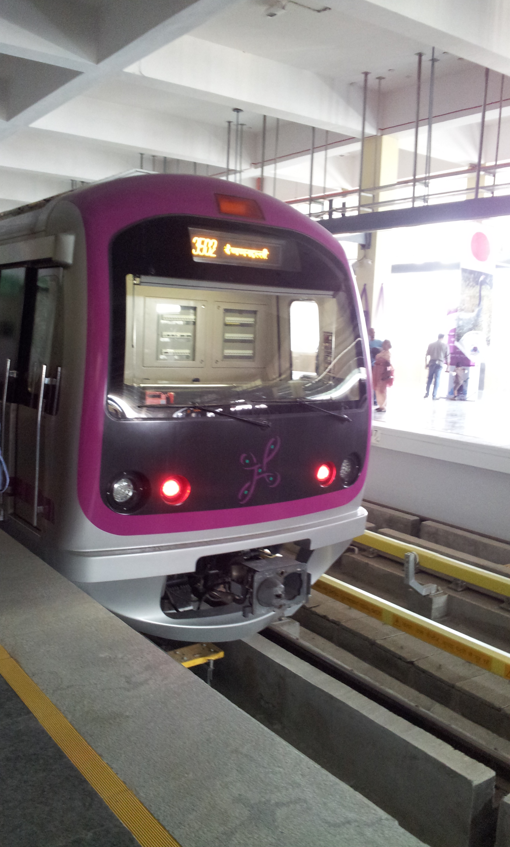
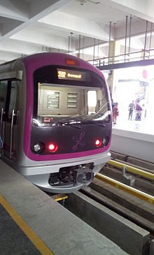 A Bangalore Metro train running on the purple line
Each rapid transit system consists of one or more lines. Each line is serviced by at least one specific route with trains stopping at all or some of the line's stations. Most systems operate several routes, and distinguish them by colors, names, numbering, or a combination thereof. Some lines may share track with each other for a portion of their route, or operate solely on their own right-of-way. Often a line running through the city center forks into two or more branches in the suburbs, allowing a higher service frequency in the center. This arrangement is used by many systems, such as the Copenhagen Metro.[18] Alternatively there might be a single central terminal (often shared with the central railway station), or multiple interchange stations between lines in the city centre, for instance in the Prague Metro.[19] The London Underground[20] and Paris Métro[21] are densely built systems with a matrix of crisscrossing lines throughout the cities. Other systems, such as the New York City Subway [22] are also densely built and their layout facilitate trips to a central area, such as Manhattan, the city's business and cultural center. The Chicago 'L' has most of its lines converging on The Loop, the main business, financial, and cultural section. Some systems have a circle line around the city center connecting the radially arranged outward lines, such as the Moscow Metro's Koltsevaya Line and Tokyo's Yamanote Line.
The capacity of a line is obtained by multiplying together the car capacity, train length and service frequency. Heavy rapid transit trains might have six to twelve cars, while lighter systems may use only four or fewer cars. Cars have a capacity of 100 to 150, varying with the seated to standing ratio—more standing gives higher capacity. Bilevel cars, used mostly on German S-Bahn type systems, have more space, allowing the higher seated capacity needed on longer journeys. The minimum time interval between trains is shorter for rapid transit than for mainline railways owing to the use of block signaling: the minimum headway might be 90 seconds, which might be limited to 120 seconds to allow for recovery from delays. Typical capacity lines allow 1200 people per train, giving 36,000 people per hour. The highest attained capacity is 80,000 people per hour by the MTR Corporation in Hong Kong.[23]
 A fictional schematic diagram representing a section of a transit map
Passenger information
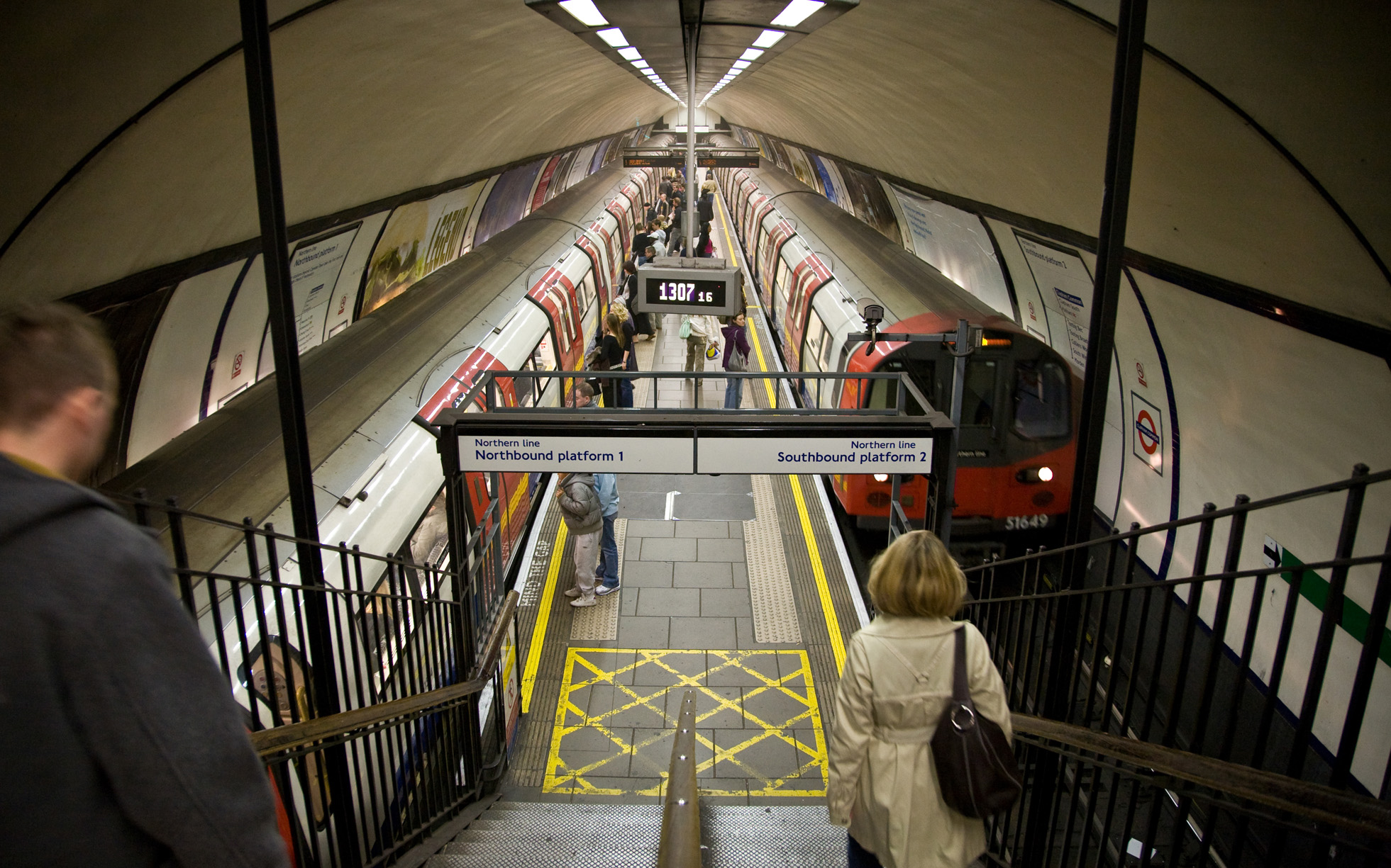
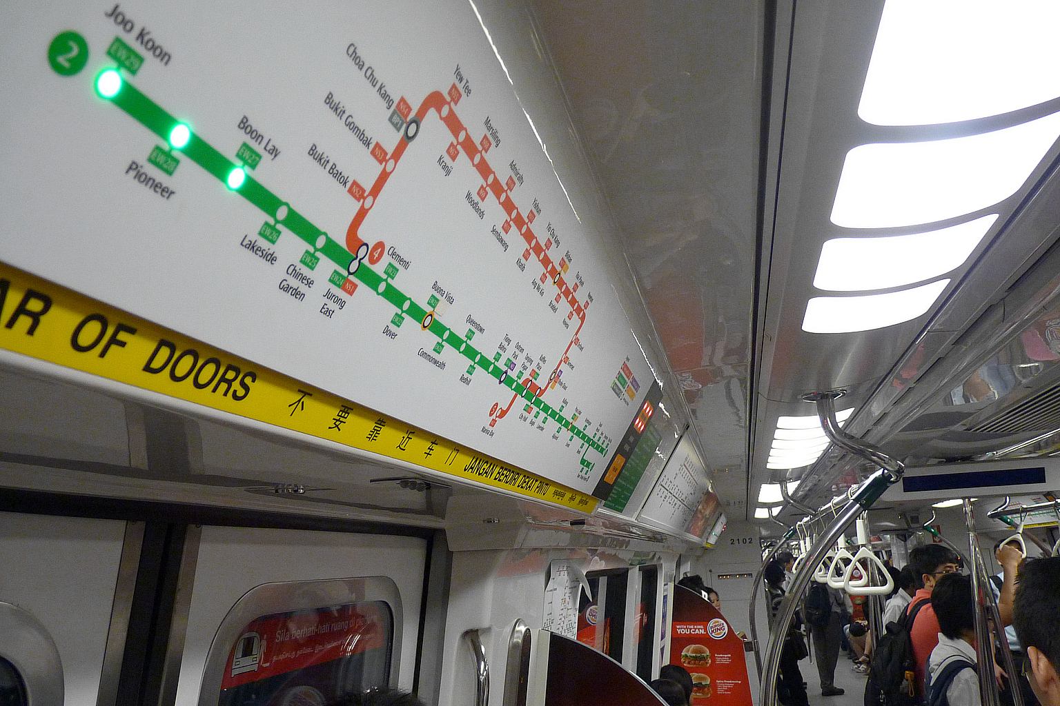
 Information panel showing the current location and upcoming stops of an East-West Singapore MRT train.
Rapid transit operators often have built up strong brands; in particular the use of a single letter as a station sign has become widespread, with systems identified by the letters L, M, S, T and U, among others.[24] Branding has focused on easy recognition—to allow quick identification even in the vast array of signage found in large cities—combined with the need to communicate speed, safety and authority.[25] In many cities, there is a single corporate image for the entire transit authority, but the rapid transit uses its own logo that fits into the profile.
A transit map is a topological map or schematic diagram used to show the routes and stations in a public transport system. The main components are color-coded lines to indicate each line or service, with named icons to indicate stations. Maps may show only the rapid transit, or also include other modes of public transport.[26]
Transit maps can be found in the transit vehicles, on the platforms, elsewhere in stations and in printed timetables. Their primary function is to help users of the system: for instance they show the interchange stations where passengers can transfer between lines. Unlike conventional maps, transit maps are usually not geographically accurate: instead they use straight lines and fixed angles, and often a fixed distance between stations, to simplify the display of the system. Often this has the effect of compressing stations in the outer area of the system and expanding those close to the center.[26] Timetables are mostly only published if the service frequency is so low that passengers can profitably time their arrival at the station; if the service is frequent enough (say 6 or more trains an hour) passengers will never have to wait long, and will not need a timetable.[27]
Safety and security
Rapid transits are a public space, and may suffer from security problems: petty crimes such as pickpocketing and baggage theft, and more serious crimes such as violence. Security measures include video surveillance, security guards and conductors. In some countries a transit police may be established. These security measures are normally integrated with measures to protect revenue by checking that passengers are not traveling without paying.[28] Rapid transits have been subject to terrorism with many casualties, such as The 1995 Tokyo subway sarin gas attack.[29]
Main article: Classification of railway accidentsCompared to other modes of transport, rapid transit has a good safety record, with few accidents. Rail transport is subject to strict safety regulations, with requirements for procedure and maintenance to minimize risk. Head-on collisions are rare due to use of double track, and low operating speeds reduce the occurrence and severity of rear-end collisions and derailments. Fire is more of a danger underground, and systems are built to allow evacuation of trains at many places throughout the system.[30][31]
Infrastructure
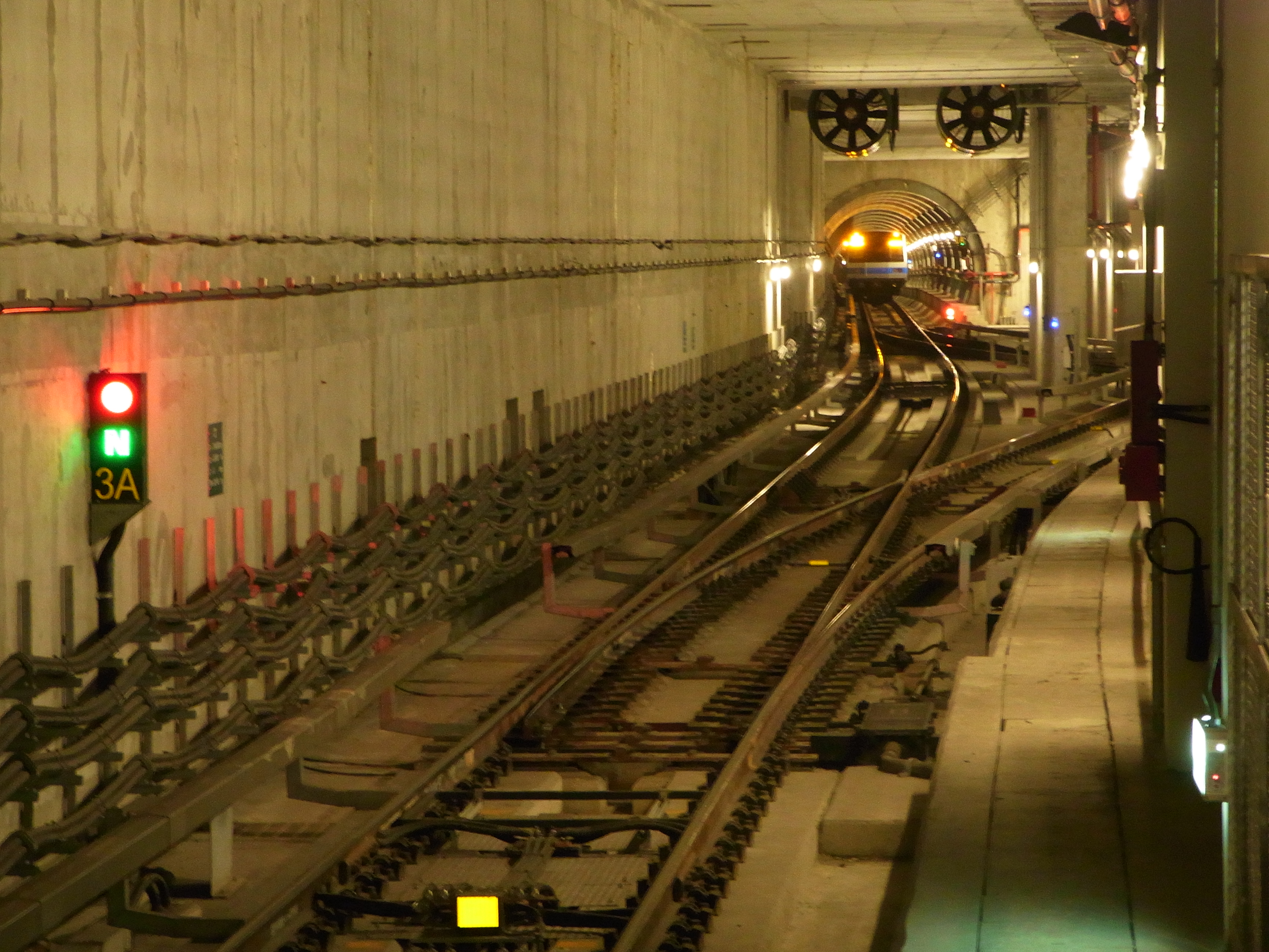
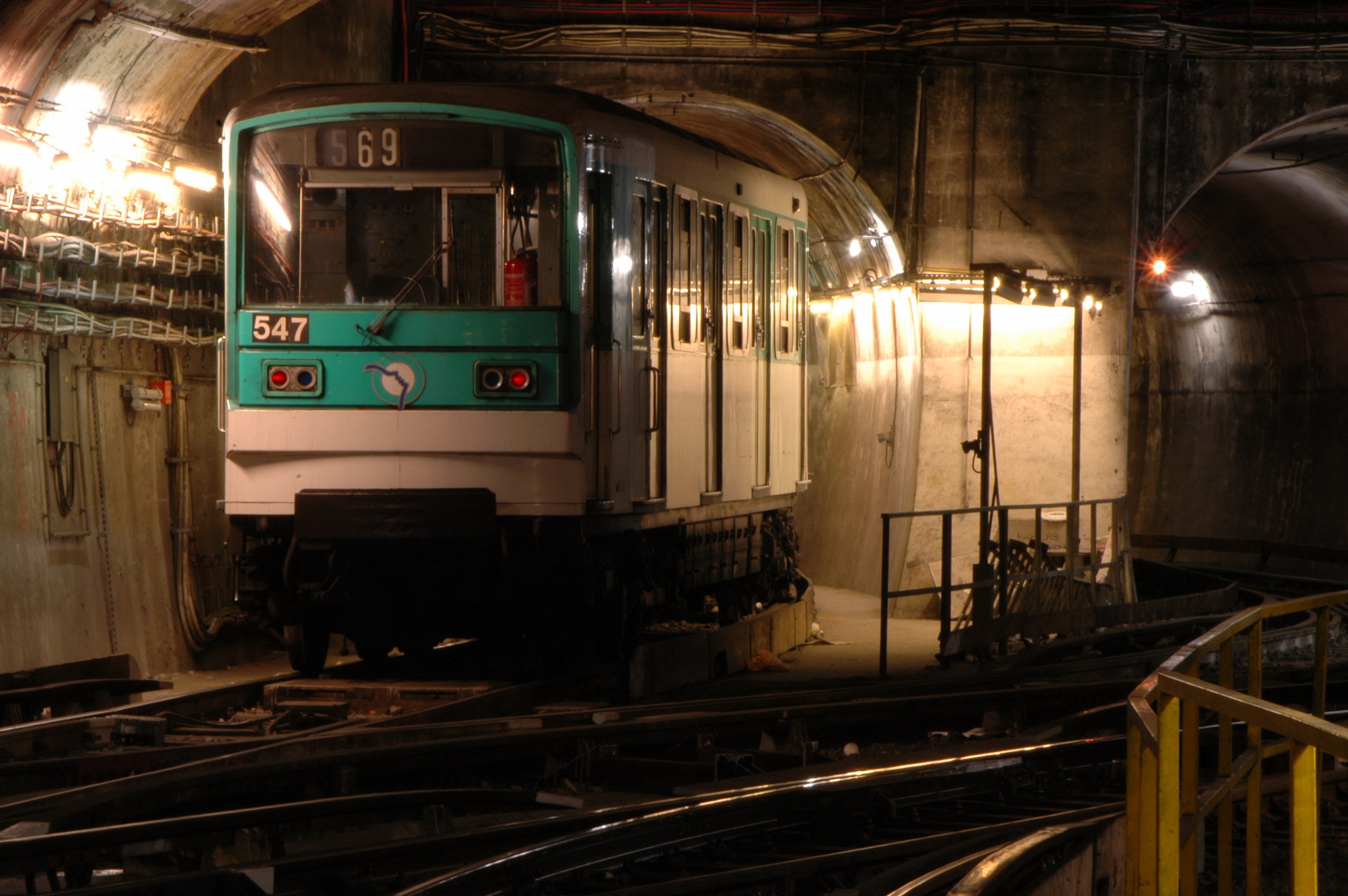
Main article: Rapid transit technology The Paris Metro runs mostly underground.
Most rapid transit trains are electric multiple units with lengths from three to beyond ten cars.[32] Power is commonly delivered by a third rail or by overhead wires, the whole London Underground network uses fourth rail and others use the linear motor for propulsion.[33] Most run on conventional steel railway tracks, although some use rubber tires such as the Montreal Metro and Mexico City Metro. Rubber tires allow steeper gradients and a softer ride, but have higher maintenance costs and are less energy efficient. They also lose friction when weather conditions are wet or icy, preventing above ground use of the Montréal Metro but not rubber-tired systems in other cities.[34] Crew sizes have decreased throughout history with some modern systems now running completely unstaffed trains.[35] Other trains continue to have drivers, even if their only role in normal operation is to open and close the doors of the trains at stations.
Variations
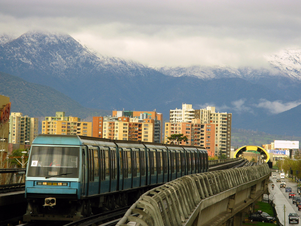
Main article: List of metro systems 5-Line of Metro de Santiago (Chile) combines rubber tire traction with elevated right-of-way.
Underground tunnels move traffic away from street level, leaving more land available for buildings and other uses. In areas of high land prices and dense land use, tunnels may be the only economic route for mass transportation. Cut-and-cover tunnels are constructed by digging up city streets, which are then rebuilt over the tunnel; alternatively tunnel-boring machines can be used to dig deep-bore tunnels that lie further down in bedrock.[10]
Street level railways are used only outside dense areas, since they create a physical barrier that hinders the flow of people and vehicles across their path. This method of construction is the cheapest, as long as land values are low. It is often used for new systems in areas that are planned to fill up with buildings after the line is built.[17]
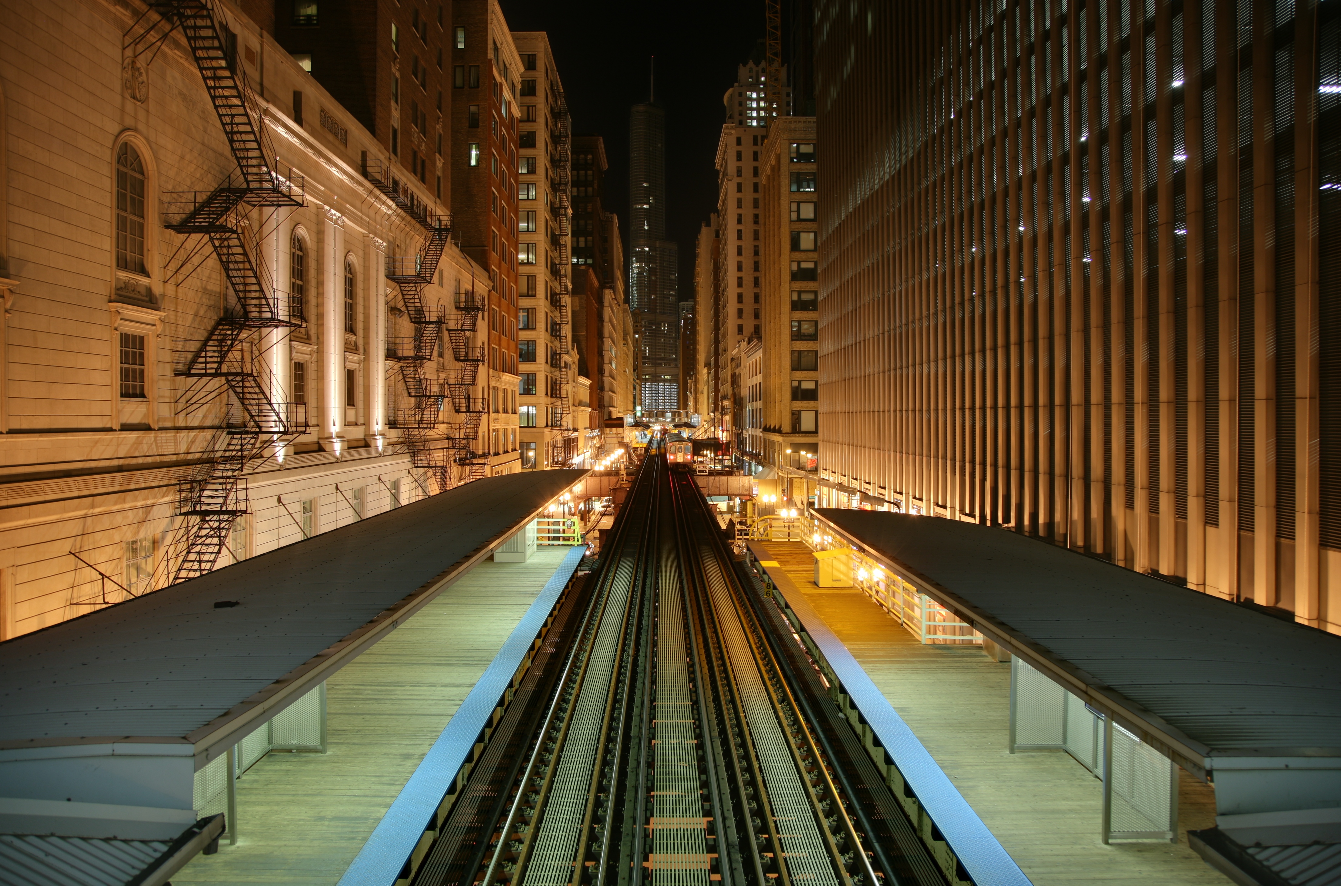
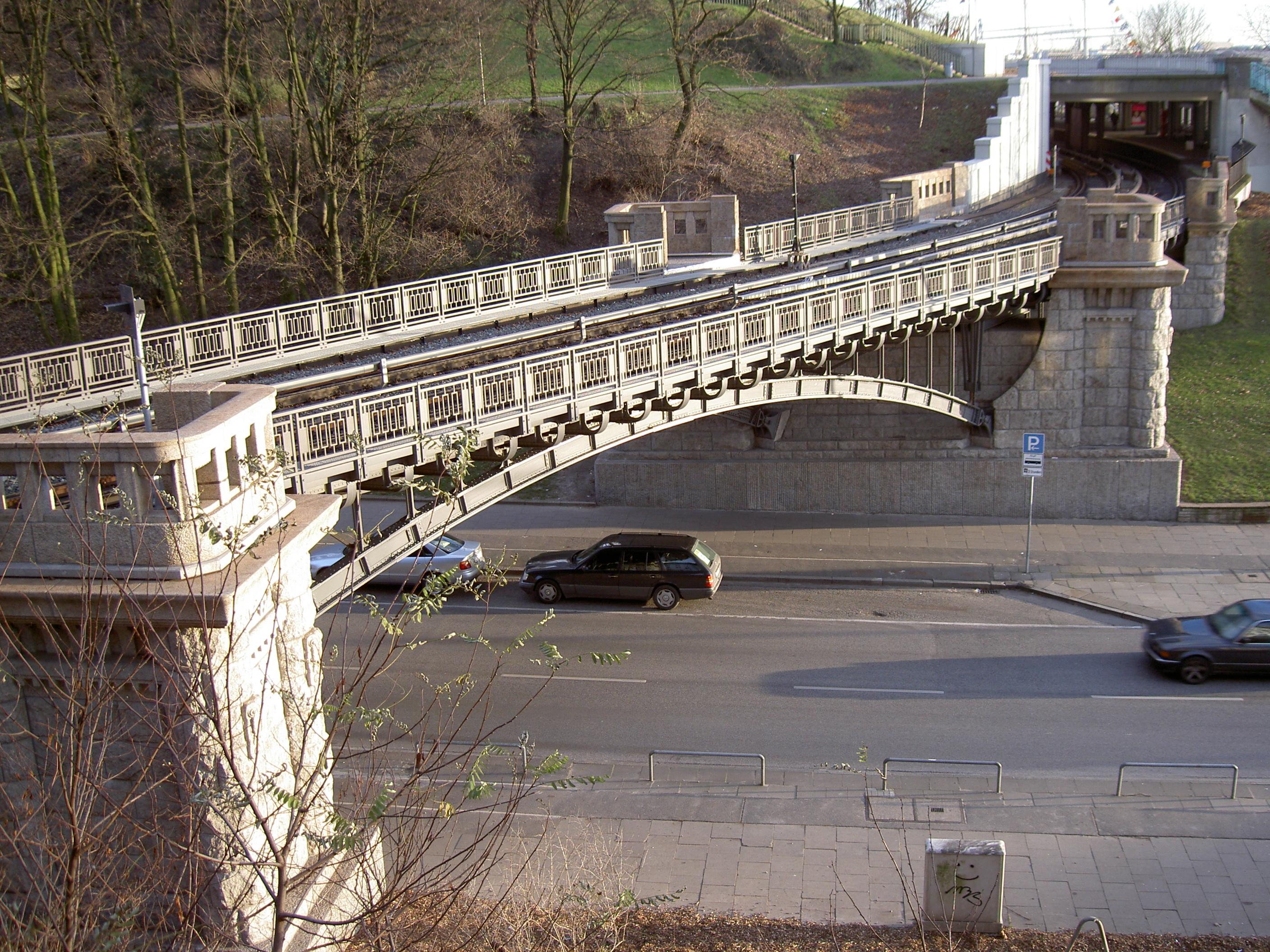
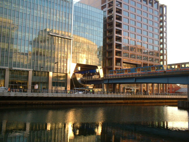
Elevated railways are a cheap and easy way to build an exclusive right-of-way without digging expensive tunnels or creating barriers. They were popular around the beginning of the 20th century, but fell out of favor; they came back into fashion in the last quarter of the century—often in combination with driverless systems, for instance Vancouver's SkyTrain, London's Docklands Light Railway[36] and the Bangkok Skytrain.[37]
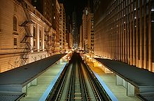
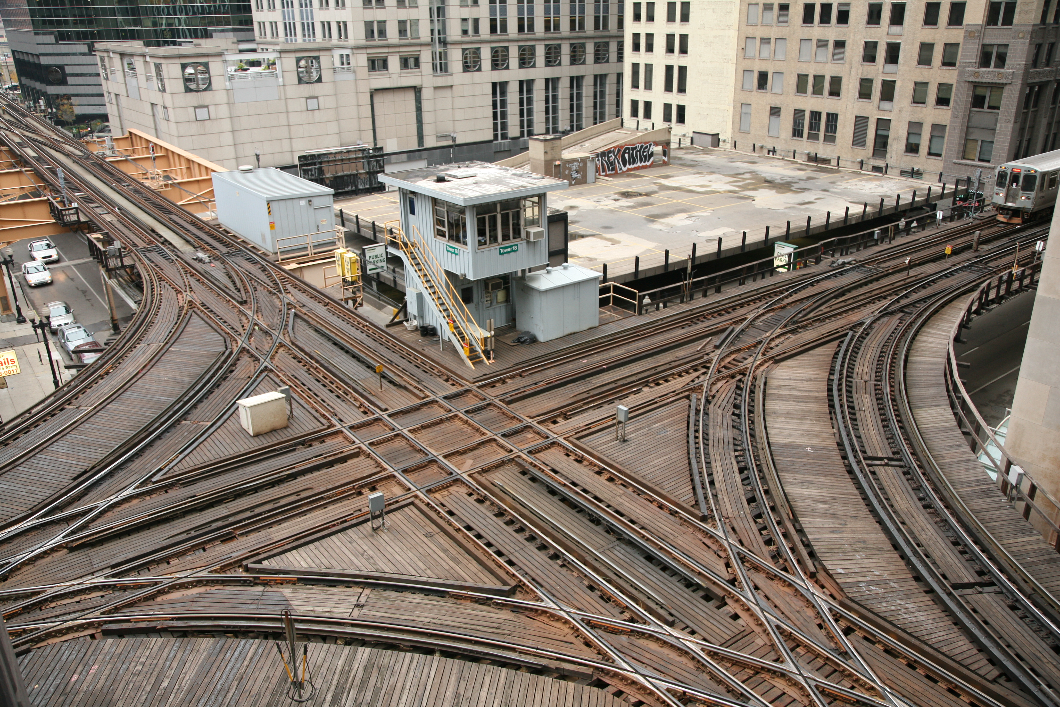
 Chicago Transit Authority control tower 18 guides elevated Chicago 'L' north and southbound Purple and Brown lines intersecting with east and westbound Pink and Green lines and the looping Orange line above the Wells and Lake street intersection in the loop.
People mover systems are self-contained rapid transit systems serving relatively small areas such as airports, downtown (central) districts or theme parks, either as independent systems or as shuttle services feeding other transport systems. They are usually driverless and normally elevated. Monorails have been built as both conventional rapid transits and as people movers, either elevated or underground. Monorail technology has proved difficult to commercialize and its use has been limited. The Berlin M-Bahn was the only commercial maglev rapid transit to operate, but has been closed.[38]
Light metro is used when the speed of rapid transit is desired, but for smaller passenger numbers. It often has smaller trains, of typically two to four cars, lower frequency and longer distances between stations, though it remains grade separated. Light metros are sometimes used as shuttles feeding into the main rapid transit system.[39] Some systems have been built from scratch, others are former commuter rail or suburban tramway systems that have been upgraded, and often supplemented with an underground or elevated downtown section.[8]
Stations
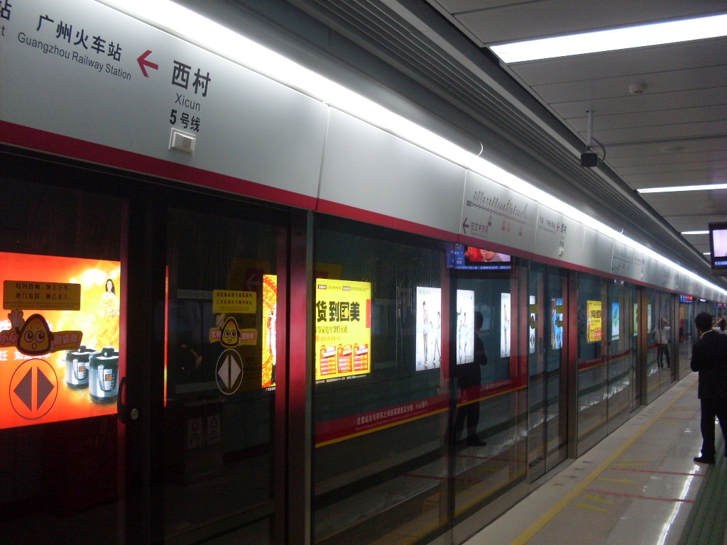
Main article: Metro station Xicun Station on Line 5, Guangzhou Metro, China
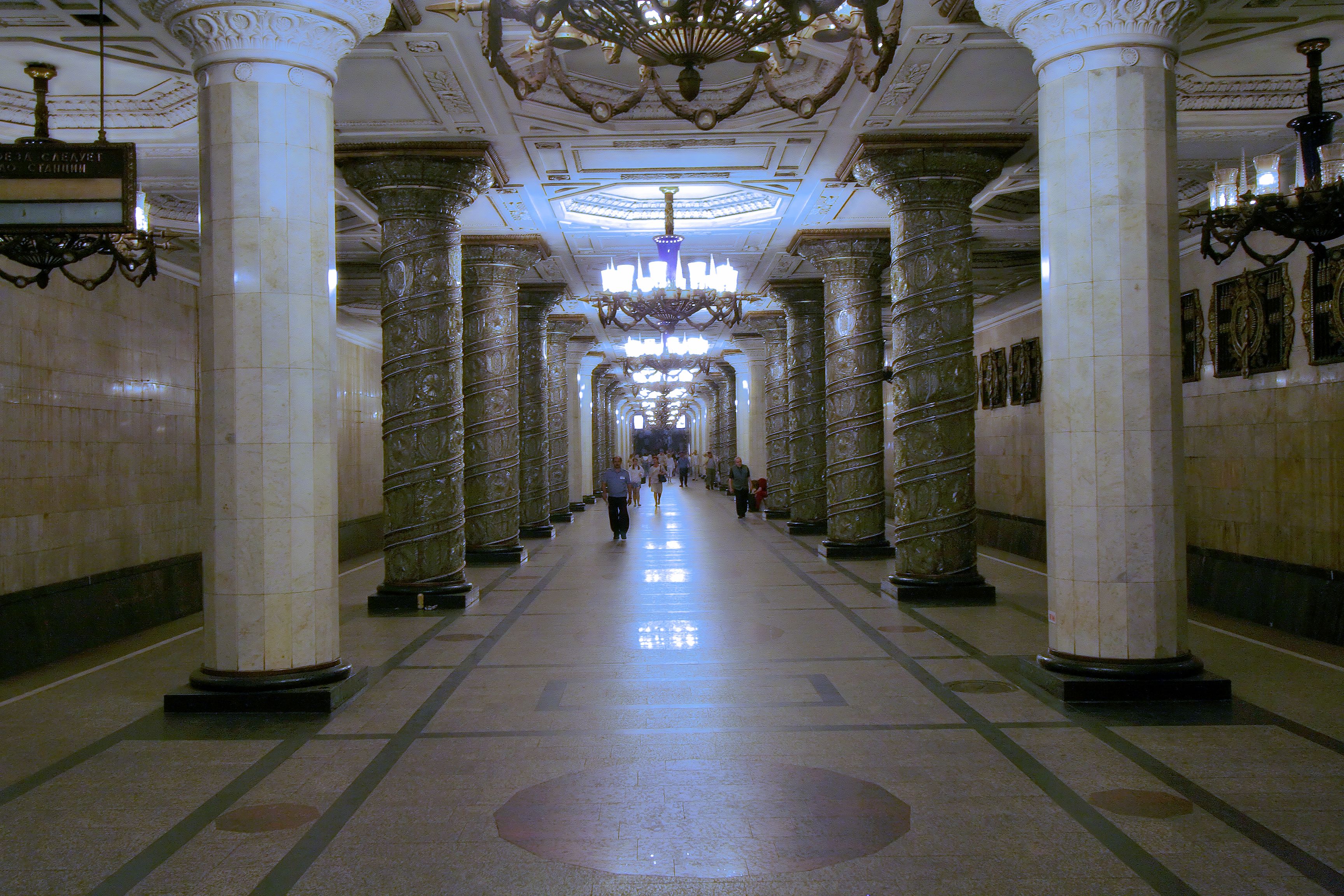
 The Soviet Union filled its deep-bored stations with ornate architectural and decorative detail.
 Some Manila Metro Rail Transit System stations are above the ground and sometimes connects to malls and shopping centers
Stations function as hubs to allow passengers to board and disembark from trains. They are also payment checkpoints and allow passengers to transfer between modes of transport, for instance to buses or other trains. Access is provided via either island- or side platforms.[40] Underground stations, especially deep-level ones, increase the overall transport time: long escalator rides to the platforms mean that the stations can become bottlenecks if not adequately built. Some underground stations are integrated into shopping centers, or have underground access to large nearby commercial buildings.[41] In suburbs, there may be a "park and ride" connected to the station.[42]
To allow easy access to the trains, the platform height allows step-free access between platform and train. If the station complies with accessibility standards, it allows both disabled people and those with wheeled baggage easy access to the trains,[43] though if the track is curved there can be a gap between the train and platform. Some stations use platform screen doors to increase safety by preventing people falling onto the tracks, as well as reducing ventilation costs.[44]
Particularly in the former Soviet Union and other Eastern European countries, but to an increasing extent elsewhere, the stations were built with splendid decorations such as marble walls, polished granite floors and mosaics—thus exposing the public to art in their everyday life, outside galleries and museums. The systems in Moscow and St. Petersburg are widely regarded as some of the most beautiful in the world,[45] but several other cities such as Stockholm, Montreal, Lisbon, and Los Angeles have also focused on art, which may range from decorative wall claddings, to large, flamboyant artistic schemes integrated with station architecture, to displays of ancient artifacts recovered during station construction.[46] It may be possible to profit by attracting more passengers by spending relatively small amounts on grand architecture, art, cleanliness, accessibility, lighting and a feeling of safety.[47]
Comparison
Main article: Urban rail transitSince the 1980s trams have incorporated several features of rapid transit: light rail systems (trams) run on their own rights-of-way, thus avoiding congestion; they remain on the same level as buses and cars. Some light rail systems have elevated or underground sections. Both new and upgraded tram systems allow faster speed and higher capacity, and are a cheap alternative to construction of rapid transit, especially in smaller cities.[12]
 Stratford Station in London is shared by London Underground trains (left) and National Express East Anglia rail services (right), as well as the Docklands Light Railway (not shown).
Premetro means that an underground rapid transit is built in the city center, but only a light rail or tram system in the suburbs. Conversely, other cities have opted to build a full metro in the suburbs, but run trams in city streets to save the cost of expensive tunnels. In North America, interurbans were constructed as street-running suburban trams, without the grade-separation of rapid transit. Premetros also allow a gradual upgrade of existing tramways to rapid transit, thus spreading the investment costs over time. They are most common in Germany with the name Stadtbahn.[32]
Suburban Commuter rail is a heavy rail system that operates at a lower frequency than urban rapid transit, with higher average speeds, often only serving one station in each village and town. Commuter rails of some cities (such as German S-Bahns, Merseyrail, Chennai rail, Australian cityrails (Transperth, Metro Trains Melbourne, Queensland Rail (Brisbane), CityRail (Sydney)), Danish S-tog etc. widely provide a mass transit within city as urban metro systems. As opposition, in some cities (such as PATH in New York, Dubai Metro, Mecca Metro, Los Teques Metro, Tyne & Wear Metro, some of other Brazilian metros, MetroSur and other lines of Madrid Metro, Singapore MRT, Taipei Metro, Kuala Lumpur's RapidKL Light Rail Transit etc.) the mainly urban rapid transit systems branch out to the nearest suburbs. Some cities have opted for a hybrid solution, with two tiers of rapid transit: an urban system (such as the Paris Métro, Berlin U-Bahn, London Underground) and a suburban system with lower frequency (such as their counterparts RER, S-Bahn, future Crossrail, respectively). The suburban systems run on their own tracks with high frequency, but are often quite similar to commuter rail, and are often operated by the national railways. In some cities the national railway runs through tunnels in the city center; sometimes commuter trains have direct transfer to the rapid transits, on the same or adjoining platforms.[48][49] California's BART system functions as a hybrid of the two: in the suburbs, it functions like a commuter rail, with longer trains, longer intervals, and longer distance between stations; in downtown San Francisco, many lines join and intervals drop to normal subway levels, and stations become closer together. Also, some other urban or "near urban" rapid transit systems (GuangFo Metro Line 1, East Rail Line in Hong Kong, Guarenas-Guatire metro, Mumbai-Thane rail, Chennai MRTS (not to be confused with Chennai rail), Korail Bundang Line, Sin Bundang Line, Jungang Line, Gyeongui Line, and Gyeongchun Line in the Seoul Metropolitan Area, etc.) serves the bi- and multi- nucleous agglomerations.
 The Docklands Light Railway in London allows for dense land use, while retaining a high capacity
Costs, benefits, and impacts
Main article: Transport planningMore than 160 cities have built rapid transit systems, and about twenty-five have new systems under construction.[50] The capital cost is high, as is risk of cost overrun and benefit shortfall.[51] Public financing is normally required. Rapid transit is sometimes seen as an alternative to an extensive road transport system with many motorways;[52] the rapid transit system allows higher capacity with less land use, less environmental impact, and a lower cost.[53]
Elevated or underground systems in city centers allow the transport of people without occupying expensive land, and permit the city to develop compactly without physical barriers. Motorways often push down nearby residential land values, but proximity to a rapid transit station often triggers commercial and residential growth, with large office and housing blocks being constructed.[52][54]
See also
- Bus rapid transit
- Megaproject
- List of metro systems
- Total rapid transit systems statistics by country
References
- Notes
- ^ "Rapid transit". Merriam-Webster. http://www.merriam-webster.com/dictionary/rapid%20transit. Retrieved 2008-02-27.; "Metro". International Association of Public Transport. http://www.uitp.org/Public-Transport/metro/index.cfm. Retrieved 2008-02-27.
- ^ a b "Glossary of Transit Terminology". American Public Transportation Association. http://www.apta.com/research/info/online/glossary.cfm. Retrieved 2008-02-27.
- ^ "Shanghai now the world's longest metro". 4 May 2010. http://www.railwaygazette.com/news/single-view/view/10/shanghai-now-the-worlds-longest-metro.html. Retrieved 4 May 2010.
- ^ Fjellstrom&Wright, 2002: p.2
- ^ Executive ed.: Joseph P. Pickert... (2000). The American Heritage Dictionary of the English Language, Fourth Edition. Houghton Mifflin Company. ISBN 0-618-08230-1.
- ^ "Definition of "Underground"". Chambers Reference Online. http://www.chambersharrap.co.uk/chambers/features/chref/chref.py/main?query=Underground&title=21st. Retrieved 2006-11-28.
- ^ a b White, 2002: 63
- ^ a b c Ovenden, 2007: 93
- ^ Ovenden, 2007: 16
- ^ a b c Ovenden, 2007: 7
- ^ "Subway". Encyclopædia Britannica online. http://www.britannica.com/eb/article-9070117/subway. Retrieved 2006-12-02.
- ^ a b Pulling, Niel (2008-05-22). "Light Rail – the Solution to Inner-City Chaos?". Railway Technology. http://www.railway-technology.com/features/feature1953/. Retrieved 2008-08-18.
- ^ Cervero, 1998: 13
- ^ a b MTR Corporation (2008-08-05). "Announcement of Unaudited Results for the Six Months Ended 30 June 2008" (PDF). http://www.mtr.com.hk/eng/corporate/file_rep/PR-08-075-E.pdf. Retrieved 2008-08-21.
- ^ "Taipei Rapid Transit Corporation '08 Annual Report". Taipei Rapid Transit Corporation. p. 96. http://english.trtc.com.tw/public/Attachment/9112716543575.pdf. Retrieved 2010-07-06.
- ^ http://cfusrug.org/articles/financing_strat.php
- ^ a b Kjenstad, 1994: 46
- ^ Ovenden, 2007: 84
- ^ Ovenden, 2007: 95
- ^ Ovenden, 2007: 28–31
- ^ Ovenden, 2007: 36–39
- ^ Ovenden, 2007: 32–35
- ^ White, 2002: 65–66
- ^ Ström, 1998: 58
- ^ Ovenden, 2007: 107
- ^ a b Ovenden, 2007: 9
- ^ Oslo Sporveier (2005). "R2010" (in Norwegian) (PDF). pp. 4. http://ruter.no/Global/PDF_filer/rapporter/Strategiplaner/R2010_strategisk_ruteplan_2006-2010.pdf. Retrieved 2008-08-20.[dead link]
- ^ Needle et al., 1997: 10–13
- ^ El Mundo. "El auto de procesamiento por el 11-M" (in Norwegian). http://www.elmundo.es/documentos/2006/04/11/auto_11m.html. Retrieved 2008-09-08.
- ^ Office of Hazardous Materials Safety. "A Comparison of Risk: Accidental Deaths - United States - 1999-2003". U.S. Department of Transportation. Archived from the original on 7 September 2007. http://web.archive.org/web/20070907235322/http://hazmat.dot.gov/riskmgmt/riskcompare.htm. Retrieved 2007-09-10.
- ^ "Office of Rail Regulation". UK. Health & Safety Executive. http://www.rail-reg.gov.uk/. Retrieved 2007-09-10.
- ^ a b White, 2002: 64
- ^ Sato, Yoshihiko; Matsumoto, Akira and Knothe, Klaus (2002). "Review on rail corrugation studies". Wear 253 (1–2): 130. doi:10.1016/S0043-1648(02)00092-3. http://www.sciencedirect.com/science?_ob=ArticleURL&_udi=B6V5B-45Y00VJ-7&_user=10&_rdoc=1&_fmt=&_orig=search&_sort=d&view=c&_version=1&_urlVersion=0&_userid=10&md5=692937bbd448cc2810f44d44e25f9456. Retrieved 2008-08-21.
- ^ Société de transport de Montréal (pdf). The Montreal Métro, a source of pride. pp. 6. ISBN 2-921969-08-4. http://www.stm.info/English/en-bref/a-notrefierte.pdf.
- ^ Railway Technology. "Toulouse Metro, France". http://www.railway-technology.com/projects/toulouse/. Retrieved 2008-08-20.
- ^ "Docklands Light Railway - About DLR". Archived from the original on 27 October 2006. http://web.archive.org/web/20061027170620/http://www.tfl.gov.uk/dlr/about/facts.shtml. Retrieved 2006-12-04.
- ^ "Bangkok Mass Transit System Company Limited - BTS SkyTrain". http://www.bts.co.th/en/btstrain.asp. Retrieved 2006-12-04.
- ^ Vuchic, Vukan and Casello, Jeffrey (2002). "An Evaluation of Maglev Technology and Its Comparison With High Speed Rail" (PDF). Transportation Quarterly 56 (2): 33–49. http://thetransitcoalition.us/LargePDFfiles/maglev-EvalandComparisonHSR.pdf.
- ^ White, 2002: 64–65
- ^ Uslan et al., 1990: 71
- ^ Cervero, 1998: 8
- ^ Cervero, 1998: 226
- ^ Boorse, Jack W. (1999). "Dual-Mode Traction Power Distribution for Light Rail Transit: A Design Option". Transportation Research Record 1677: 67–72. doi:10.3141/1677-09.
- ^ Ming-Tsun Ke, Tsung-Che Cheng and Wen-Por Wang (2002). "Numerical simulation for optimizing the design of subway environmental control system". Building and Environment 37 (11): 1139–1152. doi:10.1016/S0360-1323(01)00105-6.
- ^ "Metro Arts and Architecture". Metro Bits. http://mic-ro.com/metro/metroart.html. Retrieved 2006-12-04.
- ^ Storstockholms Lokaltrafik. "Konståkning i världens längsta konstutställning" (in Swedish). http://www.sl.se/templates/Page.aspx?id=1669. Retrieved 2008-08-20.
- ^ "10 Ways to Enhance Your Community: Unleash the Power of Public Transportation" (PDF). Archived from the original on 17 October 2006. http://web.archive.org/web/20061017031905/http://www.apta.com/research/info/online/documents/10ways.pdf. Retrieved 2006-12-04.
- ^ White, 2002: 63–64
- ^ Cervero, 1998: 21
- ^ "World Metro List". Metro Bits. http://mic-ro.com/metro/metrolist.html. Retrieved 2006-12-04.
- ^ Bent Flyvbjerg, "Cost Overruns and Demand Shortfalls in Urban Rail and Other Infrastructure," Transportation Planning and Technology, vol. 30, no. 1, February, pp. 9-30.
- ^ a b Banister and Berechman, 2000: 258
- ^ Cervero, 1998: 26
- ^ European Conference of Ministers of Transport, 2003: 187
- Bibliography
- Banister, David and Berechman, Joseph (2000). Transport Investment and Economic Development. Routledge. ISBN 0419255907. http://books.google.com/?id=g1UClQCOdE4C.
- Cervero, Robert (1998). The Transit Metropolis. Island Press. ISBN 1559635916. http://books.google.com/?id=bLs3H_IWr3wC.
- European Conference of Ministers of Transport (2003). Safe & Sustainable Transport. Paris: OECD Publishing. ISBN 92-821-1303-5. http://books.google.com/?id=I-Ny0W7XN6QC.
- Flyvbjerg, B. "Cost Overruns and Demand Shortfalls in Urban Rail and Other Infrastructure," Transportation Planning and Technology, vol. 30, no. 1, February 2007, pp. 9-30.
- Fjellstrom, K.; Wright, L. (2002). "Mass Transit Options". Sustainable Transport: A Sourcebook for Policy-Makers in Developing Cities. Deutsche Gesellschaft für Technische Zusammenarbeit. http://www.gobrt.org/SourcebookMassTransitOptions.pdf. Retrieved 2009-07-09.
- Kjenstad, Rune (1994) (in Norwegian). På skinner i Bymarka. Oslo: Baneforlaget. ISBN 82-91448-01-9.
- Ovenden, Mark (2007). Transit Maps of the World. London: Penguin. ISBN 978-0-14-311265-5.
- Needle, Jerome A.; Transportation Security Board and Cobb, Renée M. (1997). Improving Transit Security. Transportation Security Board. ISBN 0309060133. http://books.google.com/?id=WfBt0kzz524C.
- Ström, Marianne (1998). Metro Art. ACR Edition. ISBN 286770068X. http://books.google.com/?id=cOkxz36ITdoC.
- White, Peter (2002). Public Transport: Its Planning, Management, and Operation. Taylor & Francis. ISBN 0-415-25772-7. http://books.google.com/?id=d1oZxyjPDF4C.
- Uslan, Mark; American Foundation for the Blind, Peck, Alec; Wiener, William and Stern, Arlene (1990). Access to Mass Transit for Blind and Visually Impaired Travelers. American Foundation for the Blind. ISBN 0891281665.
- Executive ed.: Joseph P. Pickert... (2000). The American Heritage Dictionary of the English Language, Fourth Edition. Houghton Mifflin Company. ISBN 0-618-08230-1.
External links
 Media related to Rapid transit at Wikimedia Commons
- (Jane's) Urban Transit Systems
Categories:- Rapid transit
- Passenger rail transport


Wikimedia Foundation. 2010.