- Dusheti
-
Dusheti
დუშეთიLocation of Dusheti in Georgia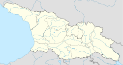
 Dusheti
დუშეთიCoordinates: 42°5′0″N 44°42′0″E / 42.083333°N 44.7°ECoordinates: 42°5′0″N 44°42′0″E / 42.083333°N 44.7°E Country  Georgia
Mkhare Mtskheta-Mtianeti Elevation 900 m (2,953 ft) Population (2002) - Total 4,600 Time zone Georgian Time (UTC+4) Dusheti (Georgian: დუშეთი) is a town in Georgia, situated in the Mtskheta-Mtianeti region, 54 km northeast of the nation’s capital of Tbilisi.
Dusheti is located on both banks of the small mountainous river of Dushetis-Khevi at the foothills of the Greater Caucasus crest at an elevation of 900 m above sea level. It functions as the center of the Dusheti Municipality which, beyond the town itself, includes several villages of the historical community of Pkhovi (Pshavi and Khevsureti). As of the 2002 all-Georgia census, the town had a population of about 4,600.
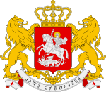
 The Dusheti coat of arms, devised adopted in 1875 and used under the Imperial Russian rule.
Dusheti first appears in Georgian written records in 1215. In the 17th century, it served as a residence of the local mountainous lords – the dukes of Aragvi – whose defiance to the Georgian crown more than once led to invasions and devastation of the town by the royal troops. After the abolition of the duchy of Aragvi in the 1740s, Dusheti passed to the crown but significantly declined. In 1801, the Russians took over and granted Dusheti a town status. Next year, it became the center of the Dushet uyezd. The town and its environs were a scene of disturbances during the Russian Revolution of 1905, the peasants’ revolt in 1918, and an armed clash during the 1924 August Uprising against the Soviet rule. Dusheti was a home to nutrition and light industry during the Soviet era, but suffered an economic decline and the population outflow in the years of post-Soviet crisis. Now most people work in service industries (banks, schools, mechanics, and storeowners) as well as subsistence farming. The town is also known for its production of khinkali, a meat-filled dumpling very popular in Georgia.
There are several historical and recreational places in and around Dusheti such as the Ananuri castle and the Bazaleti Lake. The town itself houses a 9th-10th-century church of St. George and the 18th-century palace of the Chilashvili family.
Notable people
- Shota Khinchagashvili - a retired Georgian football player.
- Grdzelidze,Merab Tarielovitch
See also
Cities and towns in Georgia Autonomous Republic of Abkhazia Sokhumi · Akhali Atoni · Gagra · Gali · Gudauta · Ochamchire · Tkvarcheli · Bichvinta · Gantiadi · Gulripshi · Leselidze · Miusera.
Autonomous Republic of Adjara Guria Imereti Kakheti Mtskheta-Mtianeti Samegrelo-Zemo Svaneti Samtskhe-Javakheti Akhaltsikhe · Akhalkalaki · Borjomi · Ninotsminda · Vale · Abastumani · Adigeni · Akhaldaba · Aspindza · Bakuriani · Bakurianis Andeziti · Tsagveriacha-Lechkhumi and Kvemo Svaneti Kvemo Kartli Shida Kartli Cities with local Government Capital City Categories:- Cities and towns in Mtskheta-Mtianeti
- Georgia (country) geography stubs


Wikimedia Foundation. 2010.