- Boston Harbor
-
This article is about Boston Harbor, Massachusetts. For other uses, see Boston Harbor (disambiguation).
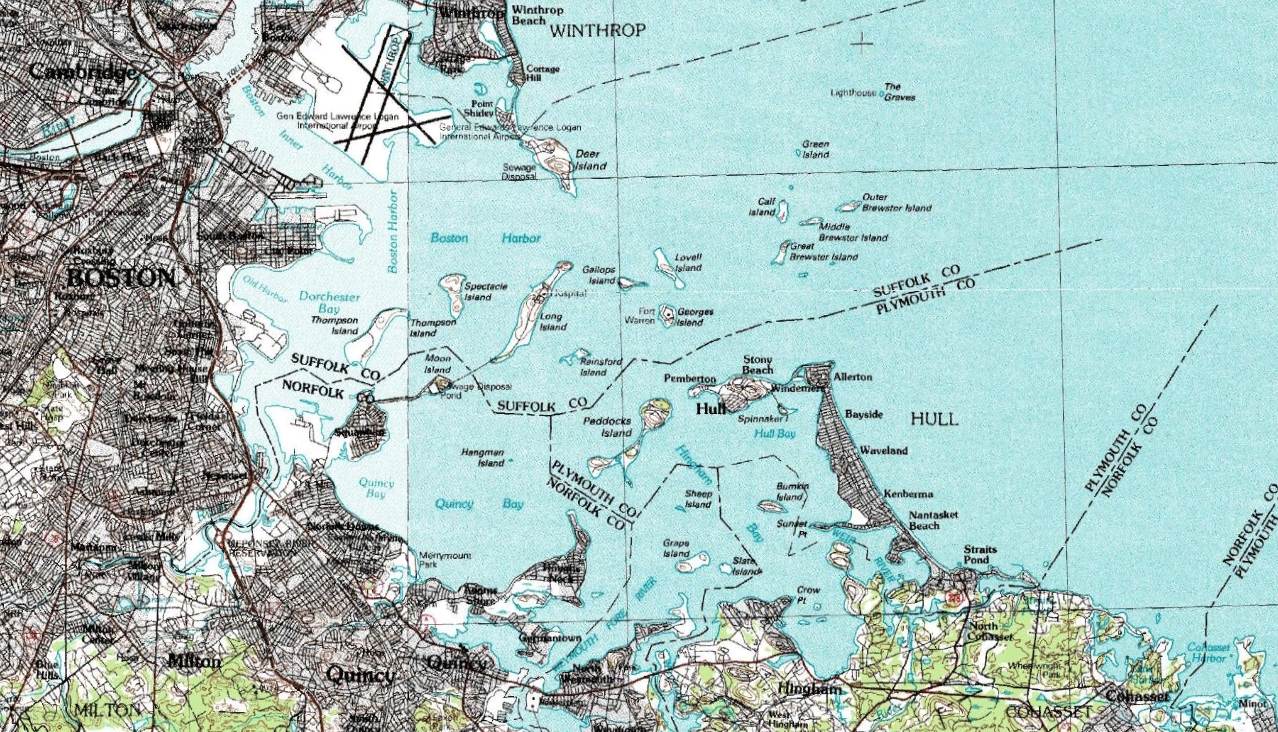
 Topographic map of Boston Harbor
Boston Harbor is a natural harbor and estuary of Massachusetts Bay, and is located adjacent to the city of Boston, Massachusetts. It is home to the Port of Boston, a major shipping facility in the northeast.[1]
Contents
History

Since its discovery by John Smith in 1614,[2] Boston Harbor has been an important port in American history. It was the site of the Boston Tea Party as well as almost continuous backfilling of the harbor until the 19th century. By 1660 almost all imports came to the greater Boston area and the New England coast through the waters of Boston Harbor. A rapid influx of people transformed Boston into a booming city. The health of the harbor quickly decreased as the population of Boston increased. As early as the late 19th century Boston citizens were advised not to swim in any portion of the Harbor. In the 1800s two of the first steam sewage stations were built (one in East Boston and one later on Deer Island). With these mandates the harbor was seeing small improvements, but raw sewage was still continuously pumped into the harbor. In 1919 the Metropolitan District Commission was created to oversee and regulate the quality of harbor water. However, not much improvement was seen and general public awareness of the poor quality of water was very low. In 1972 the Clean Water Act was passed in order to help promote increased national water quality. Boston did not receive a clean water act waiver from the Environmental Protection Agency, leaving Boston with little incentive to increase water quality of the harbor. Since the mid 1970’s organizations within the Boston community have battled for a cleaner Boston Harbor.
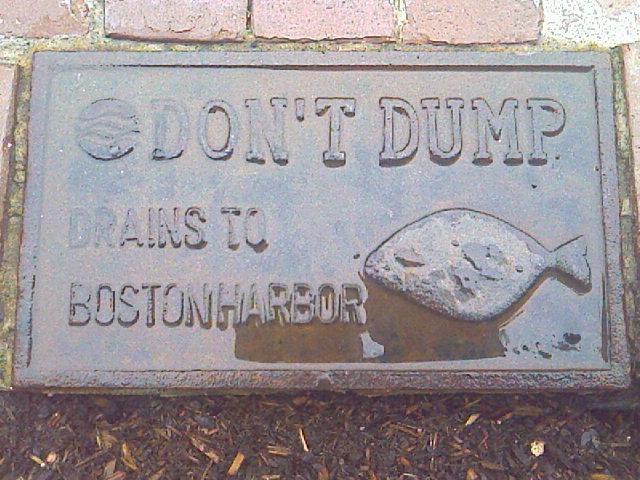
 Storm drain signage on the streets of Boston.
More recently, the harbor was the site of the $4.5 billion dollar Boston Harbor Project. Failures at Nut Island sewage treatment plant in Quincy and the companion Deer Island plant adjacent to Winthrop had far-reaching environmental and political effects. Fecal coliform bacteria levels forced frequent swimming prohibitions along the harbor beaches and the Charles River for many years.[3] The city of Quincy sued the Metropolitan District Commission (MDC) and the separate Boston Water and Sewer Commission in 1982 charging unchecked systemic pollution of the city’s waterfront. That suit was followed by one by the Conservation Law Foundation and finally by the United States government, resulting in the landmark court-ordered cleanup of Boston Harbor.[4] The lawsuits forced then Massachusetts Governor Michael Dukakis to propose separating the water and sewer treatment divisions from the MDC, resulting in the creation of the Massachusetts Water Resources Authority in 1985. The slow progress of the cleanup became a key theme of the 1988 U.S. presidential election as George H.W. Bush defeated Dukakis partly through campaign speeches casting doubt on the governor’s environmental record, which Dukakis himself had claimed was better than that of Bush.[5] The court ordered cleanup continued throughout the next two decades and is still ongoing.[4]
 Rivers emptying to the Harbor.
Before the cleanup projects, the water was so polluted that The Standells released a song in 1966 called Dirty Water about the sorry state of the Charles River. The song is still popular with Red Sox fans and is played regularly at Fenway Park.
Since the writing of the song, the water quality in both the Harbor and the Charles River has significantly improved, and the projects have dramatically transformed Boston Harbor from one of the filthiest in the nation to one of the cleanest. Today Boston Harbor is safe for fishing and for swimming nearly every day, though there are still beach closings after even small rainstorms, caused by bacteria-laden storm water and the occasional combined sewer overflow.
Geography
Boston Harbor is a large harbor which constitutes the western extremity of Massachusetts Bay. The harbor is sheltered from Massachusetts Bay and the open Atlantic Ocean by a combination of the Winthrop Peninsula and Deer Island to the north, the hooked Nantasket Peninsula and Point Allerton to the south, and the harbor islands in the middle. The harbor is often described as being split into an inner harbor and an outer harbor.[6][7][8] The harbor itself comprises fifty square miles with 180 miles (290 km) of shoreline and 34 harbor islands.
Inner harbor
The inner harbor was historically the main port of Boston and is still the site of most of its port facilities as well as the Boston waterfront, which has been redeveloped for residential and recreational uses. inner harbor extends from the mouths of the Charles River and the Mystic River, both of which empty into the harbor, to Logan International Airport and Castle Island, where the inner harbor meets the outer harbor.
Outer harbor
The outer harbor stretches to the south and east of the inner harbor. To its landward side, and moving in a counterclockwise direction, the harbor is made up of the three small bays of Dorchester Bay, Quincy Bay and Hingham Bay. To seaward, the two deep water anchorages of President Roads and Nantasket Roads are separated by Long Island. The outer harbor is fed by several rivers, including the Neponset River, the Weymouth Fore River, the Weymouth Back River and the Weir River.[6][7][8]
Dredged deepwater channels stretch from President Roads to the inner harbor, and from Nantasket Roads to the Weymouth Fore River. Some commercial port facilities are located in the Fore River area, an area which has a history of shipbuilding including the notable Fore River Shipyard.[6][7][8]
Harbor islands
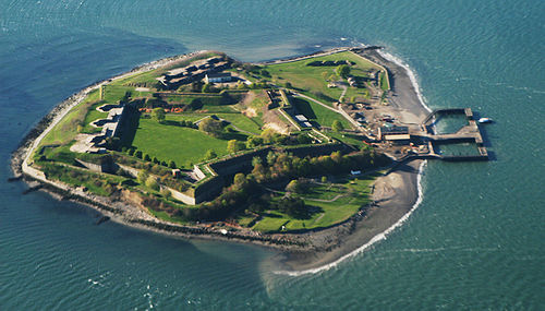 Georges Island
Boston Harbor contains a considerable number of islands, 34 of which are part of the Boston Harbor Islands National Recreation Area since its establishment in 1996. The following islands exist within the harbor:
- Bumpkin Island, Button Island
- Calf Island
- Castle Island
- Gallops Island, Georges Island, Grape Island, Great Brewster Island, Green Island
- Hangman Island
- Langlee Island, Little Brewster Island, Little Calf Island, Long Island, Lovells Island
- Middle Brewster Island
- Moon Island, Nixes Mate
- Outer Brewster Island
- Peddocks Island
- Raccoon Island, Ragged Island, Rainsford Island
- Sarah Island, Shag Rocks, Sheep Island, Slate Island, Snake Island, Spectacle Island, Spinnaker Island
- The Graves, Thompson Island
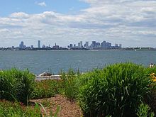 Boston's skyline as seen from Spectacle Island's visitor welcome center.
Two former islands, Castle Island and Deer Island, still exist in a recognizable form. Castle Island was joined to the mainland by land reclamation, while Deer Island ceased to be an island when the channel which formerly separated it from the mainland was filled in by the New England Hurricane of 1938.
Nut Island is a small former island in Boston Harbor that was joined by landfill to the Hough's Neck peninsula in northeastern Quincy by the 1940s for use as the site of a sewage treatment facility.[9]
Two other former islands, Apple Island and Governors Island, have been subsumed into land reclamation for Logan International Airport.
Further information: List of islands of MassachusettsAquaculture
In 1996, the Boston Globe reported that Mayor Thomas Menino and MIT engineer Clifford Goudey were planning a program to use the great tanks on Moon Island as a fish farm or a temporary home for tuna or lobster in an attempt to implement a recirculating aquaculture system in Boston Harbor.[10][11][12] The prices of both these fish types vary by season. The plan was to collect and store fish in the tanks and sell the fish at higher prices when they were out of season. Nothing has come of this plan to date.
See also
References
- ^ Boston Harbor Islands National Recreation Area - Massachusetts, U.S. National Parks Service
- ^ Stark, James Henry (1901). Stark's Antiqve views of ye towne of Boston. Morse-Purce Co. pp. 11. OCLC 4452192. http://books.google.com/?id=XvIsAAAAYAAJ&pg=PA11. Retrieved 2009-07-17.
- ^ "A Spatial and Temporal Analysis of Boston Harbor Microbiological Data" (PDF). Technical Report No. 91-3. Massachusetts Water Resources Authority. June 1991. http://www.mwra.com/harbor/enquad/pdf/1991-03.pdf. Retrieved 2009-06-11.
- ^ a b Mazzone, Hon. A. David. "Mazzone, Judge A. David : Chamber Papers on the Boston Harbor Clean Up Case, 1985-2005". http://www.lib.umb.edu/node/1620. Retrieved 2009-06-11.
- ^ Butterfield, Fox (April 6, 1991). "Boston Harbor cleanup haunts a new governor". The New York Times. http://www.nytimes.com/1991/04/06/us/boston-harbor-cleanup-haunts-a-new-governor.html. Retrieved 2009-06-11.
- ^ a b c "Boston". GlobalSecurity.org. http://www.globalsecurity.org/military/facility/boston.htm. Retrieved October 12, 2006.
- ^ a b c "Through the Eyes of a Mariner: Touring the Port of Boston". Massachusetts Office of Coastal Zone Management. http://www.mass.gov/czm/coastlines/2003/c6.htm. Retrieved October 12, 2006.
- ^ a b c "Boston Harbor and Approaches." Coast Pilot 1 - 35th Edition, 2005. NOAA Office of Coast Survey. 35th Edition. May 15, 2005.
- ^ Levy, Paul F. (March 1, 2001). "The Nut Island Effect: When Good Teams Go Wrong". Harvard Business Review (Boston: Harvard Business School Publishing). http://hbr.harvardbusiness.org/2001/03/when-good-teams-go-wrong/ar/1. Retrieved 2009-06-11.
- ^ Anand, Geeta, "Harbor island studied for fish farm Mayor envisions raising flounder, tuna and lobsters", The Boston Globe, October 13, 1996. Quoting from the article: "The Boston mayor and the MIT engineer were talking fish. With the city's skyline in the distance, they stood beside one of four long trenches on Moon Island that may soon be teeming with lobsters, bluefin tuna and summer flounder. For nearly two years, Mayor Thomas M. Menino and MIT engineer Clifford Goudey have shared a dream. Now they are wedded to a plan. Together, they are trying to turn the century-old sewage trenches on the harbor island into one of the largest fish farms in the country. 'This could be the new industry for the city,' the mayor said. 'We have the ocean, we have the reservoirs for the fish, we have what we need to make this work.'"
- ^ Best, Neil A., "Preliminary Design of a Recirculating Aquaculture System in Boston Harbor", Masters Thesis, Ocean Engineering, MIT, February 1997. Technical Advisor, Clifford A. Goudey.
- ^ Marcus, John, "Scientists Test Once-Polluted Harbor’s Crop Potential", Los Angeles Times, Sunday, January 11, 1998
External links
- Save the Harbor / Save the Bay
- The Boston Harbor Association
- Boston Harbor resources site
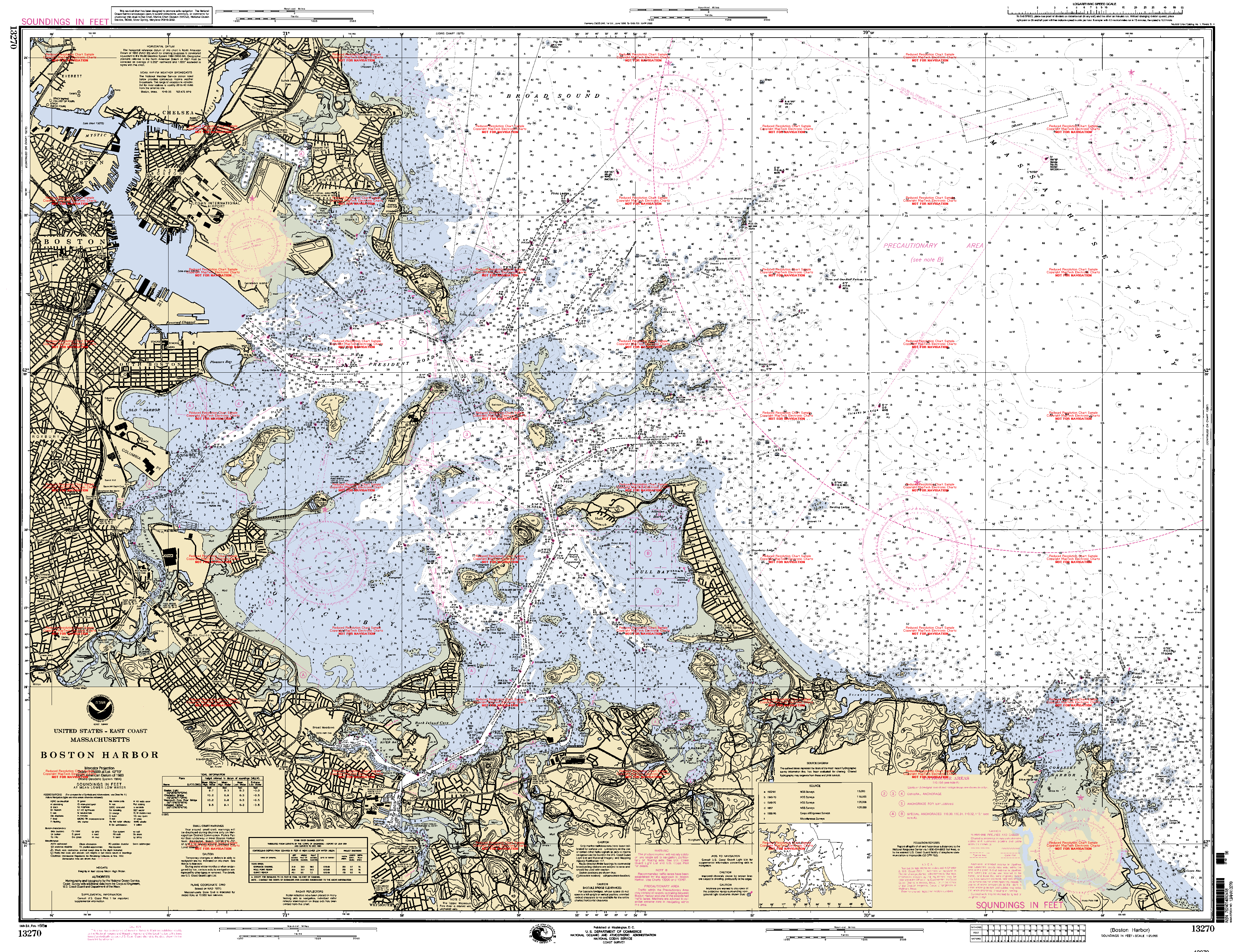
- NOAA Soundings Map of Boston Harbor
- Flickr.com, Photos, January 2009.
- Flickr.com, Photos, November 2009.
- Flickr.com, Photos, February 2010.
Image gallery
-

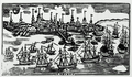
"South East View of the Great Town of Boston," by John Carwitham, ca. 1765
-

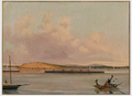
View from Beacon Hill, ca.1770s (Library of Congress Prints and Photographs Division Washington)
-
Boston Harbor, ca.18th c., by Nathaniel Dearborn after Paul Revere (Museum of Fine Arts, Boston)
-

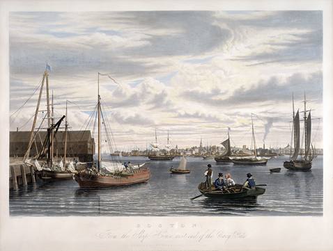
Boston, from the Ship House, West End of the Navy Yard, by William James Bennett, 1833
-
Boat Race, Boston Harbor, by A. A. Lawrence, 1852 (Museum of Fine Arts, Boston)
-

Boston Harbor by Fitz Hugh Lane, 1854
-
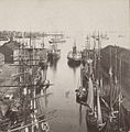
Boston harbor and East Boston from State Street Block, by John P. Soule, 19th c.
-
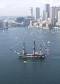
U.S.S. Constitution, 2005
Coordinates: 42°20′30″N 70°57′58″W / 42.34167°N 70.96611°W
Categories:- Boston Harbor
- Geography of Boston, Massachusetts
- Ports and harbors of Massachusetts
- Estuaries of Massachusetts
- Landforms of Norfolk County, Massachusetts
- Landforms of Plymouth County, Massachusetts
- Landforms of Suffolk County, Massachusetts


Wikimedia Foundation. 2010.