- Colfax County, New Mexico
-
Colfax County, New Mexico 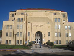 Colfax County Courthouse in Raton, New Mexico
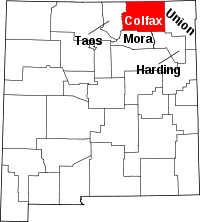
Location in the state of New Mexico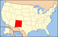
New Mexico's location in the U.S.Founded January 25, 1869 Seat Raton Largest city Raton Area
- Total
- Land
- Water
3,768 sq mi (9,759 km²)
3,757 sq mi (9,731 km²)
11 sq mi (28 km²), 0.30%Population
- (2000)
- Density
14,189
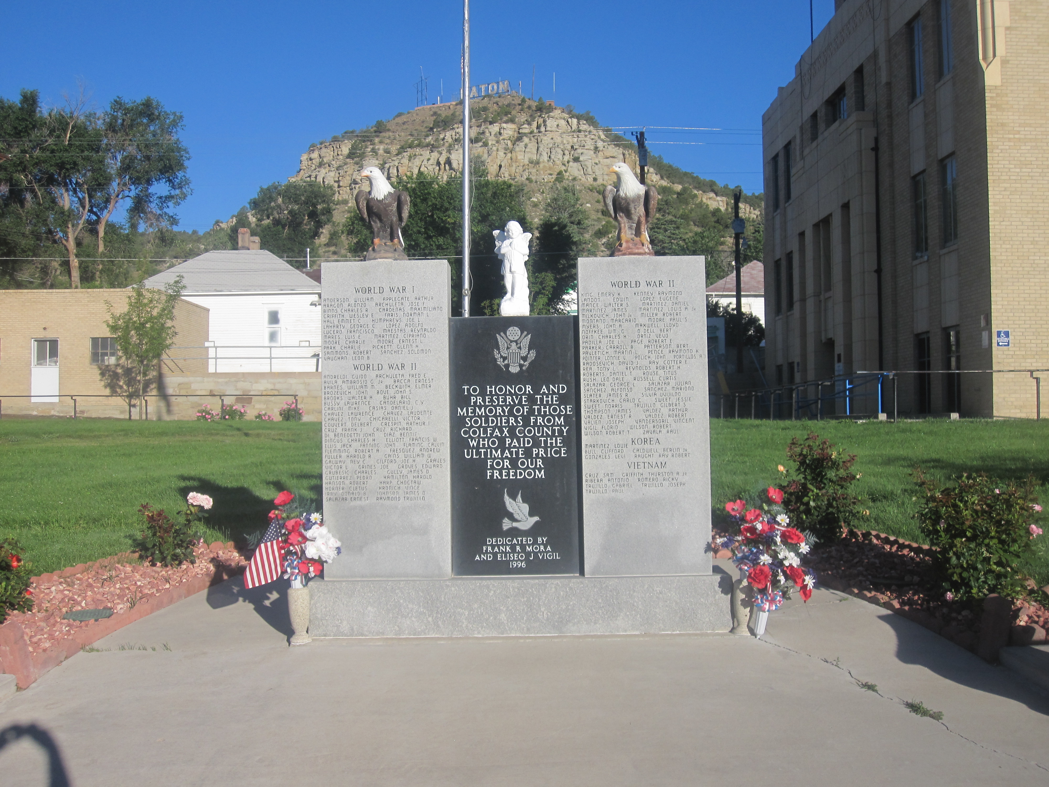
3/sq mi (1/km²)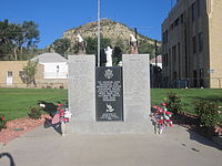 Veterans Monument at Colfax County Courthouse in Raton
 Former Atchison, Topeka, and Santa Fe Railroad car displayed at Raton
Colfax County is a county located in the U.S. state of New Mexico. As of 2000, the population was 14,189. Its county seat is Raton.[1] It is the home of Philmont Scout Ranch. The county was named for Schuyler Colfax (1823-1885), seventeenth Vice President of the United States under U.S. President Ulysses S. Grant.
Contents
Geography
According to the U.S. Census Bureau, the county has a total area of 3,768 square miles (9,759.1 km2), of which 3,757 square miles (9,730.6 km2) is land and 11 square miles (28.5 km2) (0.30%) is water.
A large portion of the County lies in the Sangre de Cristo Mountains. Geography ranges from prairies, to pinon forests, to alpine meadows.
The County contains numerous state parks, ski resorts, national forests, scenic vistas, and outdoor recreational activities.
Adjacent counties
- Taos County, New Mexico - west
- Mora County, New Mexico - south
- Harding County, New Mexico - south
- Union County, New Mexico - east
- Las Animas County, Colorado - north
- Costilla County, Colorado - northwest
National protected areas
History
Colfax County was originally part of Taos County, one of the original nine counties created by the New Mexico Territory in 1852. In 1859, the eastern part of Taos County, including all of the territory of Colfax County, was split off to form Mora County. Colfax County was established on January 25, 1869 from the northern part of Mora County. The original county seat was the gold mining town of Elizabethtown.[2]:37-38
By 1872, when the gold rush in Elizabethtown had died down, the county seat was moved to Cimarron. Cimarron was on the stage coach route along the Mountain Branch of the Santa Fe Trail, and was the headquarters of the Maxwell Land Grant. The Colfax County Courthouse in Cimarron is a contributing structure in the Cimarron Historic District, and is still in use as a Masonic lodge.
In 1881, the county seat was moved from Cimarron to Springer, located on the former Atchison, Topeka, and Santa Fe Railroad, since 1996 part of the Burlington Northern Railroad. The Colfax County Courthouse in Springer was the site of one of the last important shoot-outs in the Colfax County War.[2]:122-124 This former courthouse, which is on the National Register of Historic Places is now the home of a museum devoted to the Santa Fe Trail.
The eastern portions of Colfax, Mora, and San Miguel counties were severed to form Union County in 1893.
After a referendum and a bitter legislative fight, the county seat moved from Springer to Raton in 1897.[3]:23-24 Raton was an important coal-mining town, and was also a railroad center. The citizens of Raton raised $8000 to pay one third of the costs of a new courthouse. That courthouse was replaced in 1932 by the current Colfax County Courthouse (Raton, New Mexico), an art-deco WPA structure that also is on the National Register of Historic Places.[4]
Demographics
Historical populations Census Pop. %± 2000 14,189 — 2010 13,750 −3.1% 2010
Whereas according to the 2010 U.S. Census Bureau:
- 83.8% White
- 0.5% Black
- 1.5% Native American
- 0.4% Asian
- 0.1% Native Hawaiian or Pacific Islander
- 3.6% Two or more races
- 10.1% Other races
- 47.2% Hispanic or Latino (of any race)
2000
As of the census[5] of 2000, there were 14,189 people, 5,821 households, and 3,975 families residing in the county. The population density was 4 people per square mile (1/km²). There were 8,959 housing units at an average density of 2 per square mile (1/km²). The racial makeup of the county was 81.50% White, 0.32% Black or African American, 1.47% Native American, 0.32% Asian, 0.01% Pacific Islander, 12.80% from other races, and 3.59% from two or more races. 47.49% of the population were Hispanic or Latino of any race.
There were 5,821 households out of which 30.30% had children under the age of 18 living with them, 52.80% were married couples living together, 10.30% had a female householder with no husband present, and 31.70% were non-families. 27.70% of all households were made up of individuals and 11.90% had someone living alone who was 65 years of age or older. The average household size was 2.37 and the average family size was 2.86.
In the county the population was spread out with 25.10% under the age of 18, 6.90% from 18 to 24, 24.50% from 25 to 44, 26.50% from 45 to 64, and 16.90% who were 65 years of age or older. The median age was 41 years. For every 100 females there were 102.70 males. For every 100 females age 18 and over, there were 98.30 males.
The median income for a household in the county was $30,744, and the median income for a family was $36,827. Males had a median income of $26,736 versus $19,644 for females. The per capita income for the county was $16,418. About 12.00% of families and 14.80% of the population were below the poverty line, including 21.20% of those under age 18 and 9.00% of those age 65 or over.
Communities
City
Town
Villages
Other localities
- Black Lake
- Carisbrook
- Colmar
- Dawson
- Dillon
- Elizabethtown
- Farley
- Miami
- Pittsburg
- Rayado
- Sunny Side
- Sweetwater
- Ute Park
- Van Houten
- Philmont Scout Ranch
See also
References
- ^ "Find a County". National Association of Counties. http://www.naco.org/Counties/Pages/FindACounty.aspx. Retrieved 2011-06-07.
- ^ a b Pike, David (2004). Roadside New Mexico: a guide to historic markers. Albuquerque, NM: University of New Mexico Press. pp. 434 p. ISBN 0826331181.
- ^ Conway, Jay T. (1930). A brief community history of Raton, New Mexico. Raton: Gazette Print. pp. 17 p.
- ^ "National Register Information System". National Register of Historic Places. National Park Service. 2008-04-15. http://nrhp.focus.nps.gov/natreg/docs/All_Data.html.
- ^ "American FactFinder". United States Census Bureau. http://factfinder.census.gov. Retrieved 2008-01-31.
External links

Costilla County, Colorado Las Animas County, Colorado Taos County 
Union County  Colfax County, New Mexico

Mora County and Harding County Municipalities and communities of Colfax County, New Mexico City 
Town Villages Angel Fire | Cimarron | Eagle Nest | Maxwell
Unincorporated
communitiesMiami | Rayado | Sunny Side | Ute Park
Ghost towns  State of New Mexico
Topics Delegations · Geography · Government · History · Landmarks · Military · Natural history · New Mexicans · Settlements · Transportation · Tribes · Visitor attractions
Society Culture · Demographics · Economy · Education · Politics
Regions Cities Alamogordo · Albuquerque · Artesia · Carlsbad · Clovis · Corrales · Deming · Española · Farmington · Gallup · Grants · Hobbs · Las Cruces · Las Vegas · Los Alamos · Los Lunas · Lovington · Portales · Raton · Rio Rancho · Roswell · Ruidoso · Santa Fe · Silver City · Socorro · Sunland Park · Taos · Tucumcari
Counties Bernalillo · Catron · Chaves · Cibola · Colfax · Curry · De Baca · Doña Ana · Eddy · Grant · Guadalupe · Harding · Hidalgo · Lea · Lincoln · Los Alamos · Luna · McKinley · Mora · Otero · Quay · Rio Arriba · Roosevelt · Sandoval · San Juan · San Miguel · Santa Fe · Sierra · Socorro · Taos · Torrance · Union · Valencia
Categories:- New Mexico counties
- Colfax County, New Mexico
- Populated places established in 1869


Wikimedia Foundation. 2010.