- Melbourne tram route 70
-
Docklands - Wattle Park 
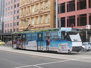
Route Information Route Number 70 Number of stops 119 Timetables Link Route Map Link Zone Location Zone 1 Entire route Tram route 70 is a public transport service in Melbourne, Victoria, Australia. It is operated by Camberwell Depot and runs from the Waterfront City Docklands to Wattle Park in Box Hill South. Like most tram routes in Melbourne, it is entirely within Metcard ticketing Zone 1.
The route runs along Docklands Drive, Harbour Esplanade, Flinders Street in the city, behind Melbourne Park (alongside the railway tracks) at Richmond and then links up to Swan Street, running along Riversdale Road through Hawthorn and Camberwell to the eastern end of Wattle Park, terminating at Elgar Road.
At the city end the tram once ran along Swan Street until reaching the Swan Street Bridge, then ran along Batman Avenue following the Yarra River until it reached the city terminus beside Princes Bridge, opposite Flinders Street Station. The current route was adopted as part of the Exhibition Street Extension project announced by the State Government in April 1998 and completed in October 1999,[1] where a four-lane divided road was built over the Jolimont railyards, enabling Batman Avenue west of Melbourne Park to be closed.
Route
Starts at Waterfront City Melbourne Docklands (stop D11), then runs via:
- Docklands Drive/Harbour Esplanade, Southern Star Observation Wheel
- La Trobe Street, Etihad Stadium, tram route 30 (stop D2)
- Flinders Street (stop D6-8)
- Melbourne Exhibition Centre (stop D6)
- Flinders Street
- Spencer Street, tram routes 75, 96, 109 and 112 (stop 1)
- King Street, Melbourne Aquarium (stop 2)
- Market Street, Banana Alley Vaults, tram route 55 (stop 3)
- Elizabeth Street, tram routes 19, 57 and 59 (stop 4)
- Flinders Street Station (stop 4-5)
- Federation Square, St Paul's Cathedral, tram routes 1, 3, 5, 6, 8, 16, 64, 67 and 72 (stop 5)
- Russell Street, Forum Theatre (stop 6)
- Exhibition Street, tram route 75 (stop 7)
- Melbourne Park
- Rod Laver Arena (stop 7B)
- MCG, Hisense Arena and Olympic Park (stop 7C)
- Swan Street
- Cremorne Street, Richmond station (stop 8)
- Church Street, tram routes 78 and 79 (stop 11)
- Burnley Street, Burnley station (stop 14)
- Riversdale Road
- Glenferrie Road, tram route 16 (stop 32)
- Burke Road, tram routes 72 and 75 (stop 40)
- Riversdale station (stop 46)
Ends at Elgar Road, Wattle Park (stop 61).
References
- ^ "Exhibition Street Extension Opening" (PDF). www.transurban.com.au. October 26, 1999. Archived from the original on 2008-07-20. http://web.archive.org/web/20080720082613/http://www.transurban.com.au/transurban_online/tu_nav_black.nsf/v/EDF0EFBB1424C643CA25707400322082/$file/20-MEDIA-ExhibitionStreetExtensionOpening-26October99.pdf. Retrieved 2008-07-17.
Maps and timetables
- Official timetables
- Official route map
- Official tram network map
- Melbourne tram and train network map from railmaps.com.au
Trams in Melbourne - Yarra Trams Routes Current Tram Fleet W • Z • A • B • C • C2 • DOperator KDR Melbourne (Yarra Trams)Former operators Prahran and Malvern • Hawthorn • Melbourne, Brunswick and Coburg • Fitzroy, Northcote and Preston • Footscray • Northcote Municipality • North Melbourne Electric Tramway and Lighting Company • Melbourne and Metropolitan Tramways Board • Victorian Railways • M>Tram • Transdev TSLTourist services Tram depots Brunswick • Camberwell • East Preston • Essendon • Glenhuntly • Hawthorn • Kew • Malvern • North Fitzroy • Preston Workshops • Newport Workshops • Southbank • South MelbourneMiscellaneous Categories:- Tram routes in Melbourne
- Docklands Drive/Harbour Esplanade, Southern Star Observation Wheel

Wikimedia Foundation. 2010.