- Drexel Heights, Arizona
-
Drexel Heights, Arizona — CDP — Location in Pima County and the state of Arizona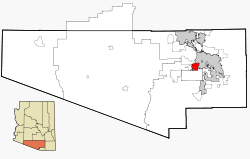
Coordinates: 32°8′20″N 111°2′38″W / 32.13889°N 111.04389°W Country United States State Arizona County Pima Area – Total 19.7 sq mi (51.0 km2) – Land 19.7 sq mi (51.0 km2) – Water 0.0 sq mi (0.0 km2) Elevation 2,526 ft (770 m) Population (2000) – Total 23,849 – Density 1,210.6/sq mi (437.6/km2) Time zone MST (no DST) (UTC-7) FIPS code 04-20540 GNIS feature ID 0025237 Drexel Heights is a census-designated place (CDP) in Pima County, Arizona, United States. The population was 23,849 at the 2000 census.
The area is named after financier Francis Anthony Drexel, the father of Saint Katharine Drexel (who established missions to Blacks and Native Americans throughout the United States). Drexel owned property in the Drexel Heights area and eastward during the late 19th century.
Contents
Geography
Drexel Heights is located at 32°8′20″N 111°2′38″W / 32.13889°N 111.04389°W (32.138989, -111.043926).[1]
According to the United States Census Bureau, the CDP has a total area of 19.7 square miles (51 km2), all of it land.
Demographics
As of the census[2] of 2000, there were 23,849 people, 7,505 households, and 5,988 families residing in the CDP. The population density was 1,212.1 people per square mile (467.9/km²). There were 7,957 housing units at an average density of 404.4/sq mi (156.1/km²). The racial makeup of the CDP was 58.14% White, 2.62% Black or African American, 3.42% Native American, 0.82% Asian, 0.10% Pacific Islander, 31.28% from other races, and 3.62% from two or more races. 60.07% of the population were Hispanic or Latino of any race.
There were 7,505 households out of which 42.0% had children under the age of 18 living with them, 59.8% were married couples living together, 14.3% had a female householder with no husband present, and 20.2% were non-families. 15.5% of all households were made up of individuals and 4.8% had someone living alone who was 65 years of age or older. The average household size was 3.17 and the average family size was 3.53.
In the CDP the population was spread out with 31.9% under the age of 18, 9.4% from 18 to 24, 28.6% from 25 to 44, 22.0% from 45 to 64, and 8.1% who were 65 years of age or older. The median age was 32 years. For every 100 females there were 97.1 males. For every 100 females age 18 and over, there were 92.1 males.
The median income for a household in the CDP was $41,211, and the median income for a family was $42,457. Males had a median income of $31,405 versus $23,353 for females. The per capita income for the CDP was $14,839. About 9.9% of families and 12.1% of the population were below the poverty line, including 15.0% of those under age 18 and 8.2% of those age 65 or over.
References
- ^ "US Gazetteer files: 2010, 2000, and 1990". United States Census Bureau. 2011-02-12. http://www.census.gov/geo/www/gazetteer/gazette.html. Retrieved 2011-04-23.
- ^ "American FactFinder". United States Census Bureau. http://factfinder.census.gov. Retrieved 2008-01-31.
External links
Municipalities and communities of Pima County, Arizona Cities 
Towns CDPs Ajo | Avra Valley | Casas Adobes | Catalina | Catalina Foothills | Corona de Tucson | Drexel-Alvernon | Drexel Heights | East Sahuarita | Flowing Wells | Green Valley | Littletown | Picture Rocks | Pisinemo | Rincon Valley | Santa Rosa | Sells | Summit | Tanque Verde | Three Points | Tortolita | Tucson Estates | Vail | Valencia West
Unincorporated
communitiesIndian reservations Ghost towns Allen | Cerro Colorado | Helvetia | Kentucky Camp | Redington | Total Wreck
Coordinates: 32°08′20″N 111°02′38″W / 32.138989°N 111.043926°W
Categories:- Census-designated places in Pima County, Arizona
- Populated places in the Sonoran Desert
- Populated places in Arizona with Hispanic majority populations


Wikimedia Foundation. 2010.