- Norfork, Arkansas
-
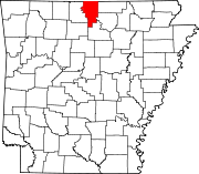
Norfork, Arkansas — City — Jacob Wolfe House, one of te oldest buildings in Arkansas (1829) Location in Baxter County and the state of Arkansas
Coordinates: 36°12′34″N 92°16′54″W / 36.20944°N 92.28167°WCoordinates: 36°12′34″N 92°16′54″W / 36.20944°N 92.28167°W Country United States State Arkansas County Baxter Area – Total 2.5 sq mi (6.4 km2) – Land 2.2 sq mi (5.7 km2) – Water 0.3 sq mi (0.7 km2) Elevation 476 ft (145 m) Population (2000) – Total 484 – Density 193.6/sq mi (75.6/km2) Time zone Central (CST) (UTC-6) – Summer (DST) CDT (UTC-5) ZIP codes 72658-72659 Area code(s) 870 FIPS code 05-50000 GNIS feature ID 0077856 Norfork is a city in Baxter County, Arkansas, United States. The population was 484 at the 2000 census.
Contents
Geography
Norfork is located at 36°12′34″N 92°16′54″W / 36.20944°N 92.28167°W (36.209506, -92.281702)[1].
According to the United States Census Bureau, the city has a total area of 2.5 square miles (6.5 km2), of which, 2.2 square miles (5.7 km2) of it is land and 0.3 square miles (0.78 km2) of it (11.74%) is water.
The White River flows 44 miles from Bull Shoals Dam to its confluence with the North Fork River's tailwater at Norfork.
List Of Highways
 Arkansas Highway 5
 Arkansas Highway 177
School District
Norfork is in the Norfork School District.[2]
Demographics
As of the census[3] of 2000, the population density was 221.5 people per square mile (85.7/km²). There were 283 housing units at an average density of 129.5 per square mile (50.1/km²). The racial makeup of the city was 96.07% White, 0.21% Black or African American, 1.50% Native American, 0.41% Asian, 0.41% from other races, and 1.45% from two or more races. 1.41% of the population were Hispanic or Latino of any race.
There were 224 households out of which 17.0% had children under the age of 18 living with them, 58.5% were married couples living together, 8.5% had a female householder with no husband present, and 31.7% were non-families. 29.9% of all households were made up of individuals and 14.7% had someone living alone who was 65 years of age or older. The average household size was 2.16 and the average family size was 2.65.
In the city the population was spread out with 16.5% under the age of 18, 3.1% from 18 to 24, 16.9% from 25 to 44, 36.4% from 45 to 64, and 27.1% who were 65 years of age or older. The median age was 53 years. For every 100 females there were 95.2 males. For every 100 females age 18 and over, there were 91.5 males.
The median income for a household in the city was $30,192, and the median income for a family was $34,375. Males had a median income of $23,750 versus $19,028 for females. The per capita income for the city was $16,671. About 7.5% of families and 13.0% of the population were below the poverty line, including 18.9% of those under age 18 and 16.5% of those age 65 or over.
References
- ^ "US Gazetteer files: 2010, 2000, and 1990". United States Census Bureau. 2011-02-12. http://www.census.gov/geo/www/gazetteer/gazette.html. Retrieved 2011-04-23.
- ^ US Census Bureau. School District Reference Map (2010 Census) Baxter County, AR (Map). http://www2.census.gov/geo/maps/dc10map/sch_dist/st05_ar/c05005_baxter/DC10SD_C05005_001.pdf. Retrieved 2011-07-12.
- ^ "American FactFinder". United States Census Bureau. http://factfinder.census.gov. Retrieved 2008-01-31.
External links
- Norfork Tailwater river system near Norfolk, AR
- Map of Norfork (US Census Bureau)
- Map of Baxter County (US Census Bureau)
- Norfork School District
- Baxter County Historical and Genealogical Society
Municipalities and communities of Baxter County, Arkansas Cities Cotter | Gassville | Lakeview | Mountain Home | Norfork | Salesville
Towns CDP Unincorporated
communitiesArkana | Buffalo City | Buford | Clarkridge | Gamaliel | Henderson | Hopewell | Monkey Run | Old Joe
Footnotes ‡This populated place also has portions in an adjacent county or counties
Categories:- Populated places in Baxter County, Arkansas
- Cities in Arkansas


Wikimedia Foundation. 2010.