- Estes Park, Colorado
-
Town of Estes Park — Town — Panorama of Estes Park as seen from Rocky Mountains Location of Estes Park in Larimer County, Colorado
Coordinates: 40°22′22″N 105°31′9″W / 40.37278°N 105.51917°WCoordinates: 40°22′22″N 105°31′9″W / 40.37278°N 105.51917°W Country  United States
State  Colorado
County[1] Larimer Founded 1859 Incorporated (town) April 17, 1917[2] Government - Type Statutory Town[1] - Mayor Bill Pinkham Area - Total 5.9 sq mi (15.2 km2) - Land 5.8 sq mi (15.1 km2) - Water 0.1 sq mi (0.1 km2) 0.85% Elevation 7,522 ft (2,293 m) Population (2010) - Total 5,858 - Density 929.5/sq mi (359.1/km2) Time zone MST (UTC-7) - Summer (DST) MDT (UTC-6) ZIP Codes[3] 80517 Area code(s) 970 FIPS code 08-25115 GNIS feature ID 0204674 Website Town of Estes Park  Main Street in 1912. USGS photo.
 Estes Park entrance sign
 The historic Stanley Hotel, which opened in 1909.
Estes Park is a town in Larimer County, Colorado, United States. A popular summer resort and the location of the headquarters for Rocky Mountain National Park, Estes Park lies along the Big Thompson River. Estes Park had a population of 5,858 at the 2010 census. The town is named after Missouri native Joel Estes, who founded the community in 1859.
The town's outskirts include The Stanley Hotel. Once a fine example of Edwardian opulence, the 1909 building had Stephen King as a guest, inspiring him to change the locale for his novel The Shining from an amusement park to the Stanley's fictional stand-in, the Overlook Hotel. Estes Park was also the site of the organization of the Credit Union National Association, an important milestone in the history of American credit unions.[4] Trail Ridge Road, the highest continuous highway in the United States, runs from Estes Park westward through Rocky Mountain National Park, reaching Grand Lake over the continental divide.[5] The town suffered severe damage in July 1982 from flooding caused by the failure of Lawn Lake Dam.[6]
Contents
Geography
Estes Park sits at an elevation of 7,522 feet on the front range of the Rocky Mountains at the eastern entrance of the Rocky Mountain National Park. Its location is 40°22′22″N 105°31′09″W / 40.372856°N 105.519136°W.[7] Its north, south and east extremities border the Roosevelt National Forest. Lumpy Ridge lies immediately north of Estes Park.
According to the United States Census Bureau, the town has a total area of 5.9 square miles (15 km2), of which 5.8 square miles (15 km2) is land and 0.1 square miles (0.26 km2) (0.85%) is water.
Demographics
As of the census[8] of 2010, there were 5,858 people, 2,796 households, and 1,565 families residing in the town. The population density was 929.5 people per square mile (359.1/km²). There were 4,107 housing units at an average density of 570.6 per square mile (220.4/km²). The racial makeup of the town was 91.0% White, 0.3% African American, 0.5% Native American, 1.2% Asian, 2% Pacific Islander, 5.5% from other races, and 1.4% from two or more races. Hispanic or Latino of any race were 14% of the population.
There were 2,541 households out of which 20.5% had children under the age of 18 living with them, 52.3% were married couples living together, 6.6% had a female householder with no husband present, and 38.4% were non-families. 31.0% of all households were made up of individuals and 9.7% had someone living alone who was 65 years of age or older. The average household size was 2.11 and the average family size was 2.61.
In the town the population was spread out with 17.6% under the age of 18, 5.8% from 18 to 24, 26.6% from 25 to 44, 29.4% from 45 to 64, and 20.7% who were 65 years of age or older. The median age was 45 years. For every 100 females there were 92.2 males. For every 100 females age 18 and over, there were 90.7 males.
The median income for a household in the town was $43,262, and the median income for a family was $55,667. Males had a median income of $31,573 versus $20,767 for females. The per capita income for the town was $30,499. About 3.2% of families and 4.5% of the population were below the poverty line, including 4.6% of those under age 18 and 0.8% of those age 65 or over.
Three million tourists visit Rocky Mountain National Park each year; most use Estes Park as their base.[9]
Historic ski areas
Estes Park was home to a number of now defunct ski areas:[10]
- Davis Hill[11]
- Hidden Valley[12]
- Leydman Hill Jump[13]
- Old Man Mountain[14]
Estes Park vicinity was also the home of other resorts and tourist attractions.[10]
Flood of 1982
Main article: Lawn Lake DamThe town flooded in 1982 and suffered extensive damage due to the failure, "after years of disrepair and neglect", of an earthen dam several miles upstream.[6]
Transportation
The main airport serving Estes Park is Denver International Airport, located 75 miles southeast.
Highways
 US 34 is an east-west highway that runs from Granby, Colorado to Berwyn, Illinois. In Colorado, it connects Estes Park to Loveland, Interstate 25, Greeley and Interstate 76.
 US 36 begins at the nearby Rocky Mountain National Park, running to Uhrichsville, Ohio, passing through Kansas, Missouri, Illinois and Indiana. It connects Estes park to Boulder, and Interstates 25 and 76, both near Denver.
 State Highway 7 begins at the junction of US 36 and N St. Vrain Avenue in Estes Park and runs to Boulder, Lafayette and Brighton. Its northwestern segment is part of the Peak-to-Peak Scenic Byway.
Sister city
Estes Park's official sister city is
 Monteverde, Costa Rica.
See also
- Fort Collins-Loveland Metropolitan Statistical Area
- Front Range Urban Corridor
- Colorado municipalities
- Things to do in Estes Park
References
- ^ a b "Active Colorado Municipalities". State of Colorado, Department of Local Affairs. http://www.dola.state.co.us/dlg/local_governments/municipalities.html. Retrieved 2007-09-01.
- ^ "Colorado Municipal Incorporations". State of Colorado, Department of Personnel & Administration, Colorado State Archives. 2004-12-01. http://www.colorado.gov/dpa/doit/archives/muninc.html. Retrieved 2007-09-02.
- ^ "ZIP Code Lookup" (JavaScript/HTML). United States Postal Service. http://zip4.usps.com/zip4/citytown.jsp. Retrieved September 13, 2007.
- ^ Creating CUNA)
- ^ "Rocky Mountain National Park - Park Area: Trail Ridge Road". Rmnp.com. http://www.rmnp.com/RMNP-Areas-TrailRidge.HTML. Retrieved 2009-12-23.
- ^ a b Ann Depperschmidt (2009-07-12). "Path of destruction:Flood of 1982 still evident in hike to Lawn Lake". Reporter-Herald. http://www.reporterherald.com/special/story.asp?sp=149&st=5.
- ^ "US Gazetteer files: 2010, 2000, and 1990". United States Census Bureau. 2011-02-12. http://www.census.gov/geo/www/gazetteer/gazette.html. Retrieved 2011-04-23.
- ^ "American FactFinder". United States Census Bureau. http://factfinder.census.gov. Retrieved 2008-01-31.
- ^ Associated Press, "Rocky Mountain National Park sees more visitors" Nov 25, 2010 Denver Post
- ^ a b TCSP. "''Northern Front Range Resorts''". Colorado Ski History. http://www.coloradoskihistory.com/lost/index_nfr.html. Retrieved 2009-12-23.
- ^ TCSP. "''Davis Hill''". Colorado Ski History. http://www.coloradoskihistory.com/lost/davishill.html. Retrieved 2009-12-23.
- ^ Colorado Ski History: Hidden Valley (Ski Estes Park)
- ^ TCSP. "''Leydman Hill Jump''". Colorado Ski History. http://www.coloradoskihistory.com/lost/leydmanjump.html. Retrieved 2009-12-23.
- ^ TCSP. "''Old Man Mountain''". Colorado Ski History. http://www.coloradoskihistory.com/lost/oldmanmountain.html. Retrieved 2009-12-23.
External links
- Official website
- Estes Park, Colorado eWelcome Center
- Estes Park Public Library Local History FAQ
- CDOT map of Estes Park
- Estes Park Convention and Visitors Bureau
- Rocky Mountain National Park - Estes Park, Colorado
- Park School District R-3
Municipalities and communities of Larimer County, Colorado Cities 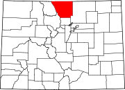
Towns Berthoud‡ | Estes Park | Johnstown‡ | Timnath | Wellington | Windsor‡
CDPs Unincorporated
communitiesBellvue | Buckeye | Campion | Drake | Glen Haven | Kinikinik | Livermore | Manhattan | Masonville | Waverly
Ghost towns Manhattan | Old Roach | Stout | Virginia Dale
Footnotes ‡This populated place also has portions in an adjacent county or counties
Categories:- Towns in Colorado
- Populated places in Larimer County, Colorado
- Tourism in Colorado
- Estes Park, Colorado


Wikimedia Foundation. 2010.