- Cuyuna, Minnesota
-
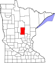
Cuyuna, Minnesota — City — Location of Cuyuna, Minnesota
Coordinates: 46°31′0″N 93°55′26″W / 46.516667°N 93.92389°W Country United States State Minnesota County Crow Wing Area – Total 3.5 sq mi (9.1 km2) – Land 3.3 sq mi (8.5 km2) – Water 0.2 sq mi (0.6 km2) Elevation 1,253 ft (382 m) Population (2010)[1] – Total 332 – Density 100.6/sq mi (39.1/km2) Time zone Central (CST) (UTC-6) – Summer (DST) CDT (UTC-5) ZIP code 56444 Area code(s) 218 FIPS code 27-14428[2] GNIS feature ID 0642570[3] Website http://www.ci.cuyuna.mn.us/ Cuyuna (pronunciation: /kaɪˈjuːnə/ ky-ew-nə) is a city in Crow Wing County, Minnesota, United States. The population was 332 at the 2010 census.[1] It is part of the Brainerd Micropolitan Statistical Area.
The city lies immediately south of its namesake, the Cuyuna Range, a line of iron-bearing hills in central Minnesota. Cuyuna was one of the mining towns along the range, part of a list including Crosby, Ironton, Trommald, and Manganese). The Cuyuna Range saw its heyday in the first half of the 20th century, and mining on the range ceased in 1984. The local economy is now dependent upon tourism; the Cuyuna Country State Recreation Area now encompasses some of the range.
Geography
According to the United States Census Bureau, the city has a total area of 3.5 square miles (9.1 km2), of which, 3.3 square miles (8.5 km2) of it is land and 0.2 square miles (0.52 km2) of it (6.55%) is water.
Demographics
Historical populations Census Pop. %± 1920 417 — 1930 266 −36.2% 1940 176 −33.8% 1950 112 −36.4% 1960 86 −23.2% 1970 82 −4.7% 1980 157 91.5% 1990 172 9.6% 2000 231 34.3% 2010 332 43.7% U.S. Decennial Census As of the census[2] of 2000, there were 231 people, 90 households, and 64 families residing in the city. The population density was 70.6 people per square mile (27.3/km²). There were 113 housing units at an average density of 34.5 per square mile (13.3/km²). The racial makeup of the city was 98.70% White, 0.87% African American, and 0.43% from two or more races. Hispanic or Latino of any race were 0.43% of the population. 33.3% were of German, 11.8% American, 8.7% Swedish, 7.7% Norwegian, 7.2% Irish and 6.7% Italian ancestry according to Census 2000.
There were 90 households out of which 30.0% had children under the age of 18 living with them, 61.1% were married couples living together, 5.6% had a female householder with no husband present, and 27.8% were non-families. 22.2% of all households were made up of individuals and 6.7% had someone living alone who was 65 years of age or older. The average household size was 2.57 and the average family size was 2.95.
In the city the population was spread out with 26.8% under the age of 18, 6.9% from 18 to 24, 26.8% from 25 to 44, 26.0% from 45 to 64, and 13.4% who were 65 years of age or older. The median age was 39 years. For every 100 females there were 106.3 males. For every 100 females age 18 and over, there were 108.6 males.
The median income for a household in the city was $44,107, and the median income for a family was $48,750. Males had a median income of $38,000 versus $29,500 for females. The per capita income for the city was $17,838. About 7.6% of families and 10.0% of the population were below the poverty line, including 4.9% of those under the age of eighteen and 18.4% of those sixty five or over.
References
- ^ a b "2010 Census Redistricting Data (Public Law 94-171) Summary File". American FactFinder. U.S. Census Bureau, 2010 Census. http://factfinder2.census.gov/faces/tableservices/jsf/pages/productview.xhtml?pid=DEC_10_PL_GCTPL2.ST13&prodType=table. Retrieved 23 April 2011.
- ^ a b "American FactFinder". United States Census Bureau. http://factfinder.census.gov. Retrieved 2008-01-31.
- ^ "US Board on Geographic Names". United States Geological Survey. 2007-10-25. http://geonames.usgs.gov. Retrieved 2008-01-31.
Municipalities and communities of Crow Wing County, Minnesota Cities Baxter | Brainerd | Breezy Point | Crosby | Crosslake | Cuyuna | Deerwood | Emily | Fifty Lakes | Fort Ripley | Garrison | Ironton | Jenkins | Manhattan Beach | Nisswa | Pequot Lakes | Riverton | Trommald
Townships Bay Lake | Center | Crow Wing | Daggett Brook | Deerwood | Fairfield | Fort Ripley | Gail Lake | Garrison | Ideal | Irondale | Jenkins | Lake Edwards | Little Pine | Long Lake | Maple Grove | Mission | Nokay Lake | Oak Lawn | Pelican | Perry Lake | Platte Lake | Rabbit Lake | Roosevelt | Ross Lake | Sibley | St. Mathias | Timothy | Wolford
Unorganized
territoriesUnincorporated
communityLake Hubert
Indian
reservationGhost town Coordinates: 46°31′01″N 93°55′23″W / 46.51694°N 93.92306°W
Categories:- Cities in Minnesota
- Populated places in Crow Wing County, Minnesota
- Brainerd micropolitan area


Wikimedia Foundation. 2010.