- Crandon Lakes, New Jersey
-
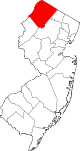
Crandon Lakes, New Jersey — CDP — Map of Crandon Lakes in Sussex County
Coordinates: 41°7′29″N 74°50′27″W / 41.12472°N 74.84083°WCoordinates: 41°7′29″N 74°50′27″W / 41.12472°N 74.84083°W Country United States State New Jersey County Sussex Area – Total 2.7 sq mi (6.9 km2) – Land 2.5 sq mi (6.6 km2) – Water 0.1 sq mi (0.3 km2) Elevation 860 ft (262 m) Population (2000) – Total 1,180 – Density 466.1/sq mi (180.0/km2) Time zone Eastern (EST) (UTC-5) – Summer (DST) EDT (UTC-4) FIPS code 34-15610[1] GNIS feature ID 1867359[2] Crandon Lakes is a census-designated place and unincorporated residential development split between Hampton Township and Stillwater Township, in Sussex County, New Jersey. As of the United States 2000 Census, the CDP population was 1,180.
Geography
Crandon Lakes is located at 41°07′29″N 74°50′27″W / 41.124746°N 74.840788°W (41.124746, -74.840788).[3]
According to the United States Census Bureau, the CDP has a total area of 6.9 km2 (2.7 mi2). 6.6 km2 (2.5 mi2) of it is land and 0.3 km2 (0.1 mi2) of it (4.87%) is water.
Demographics
Historical populations Census Pop. %± 1990 1,177 — 2000 1,180 0.3% source: [4] As of the census[1] of 2000, there were 1,180 people, 405 households, and 326 families residing in the CDP. The population density was 180.1/km2 (466.1/mi2). There were 492 housing units at an average density of 75.1/km2 (194.4/mi2). The racial makeup of the CDP was 97.71% White, 0.34% African American, 0.34% Native American, 0.51% Asian, 0.08% from other races, and 1.02% from two or more races. Hispanic or Latino of any race were 1.19% of the population.
There were 405 households out of which 45.9% had children under the age of 18 living with them, 66.2% were married couples living together, 10.4% had a female householder with no husband present, and 19.5% were non-families. 15.1% of all households were made up of individuals and 6.7% had someone living alone who was 65 years of age or older. The average household size was 2.91 and the average family size was 3.26.
In the CDP the population was spread out with 29.5% under the age of 18, 6.5% from 18 to 24, 33.1% from 25 to 44, 23.1% from 45 to 64, and 7.8% who were 65 years of age or older. The median age was 36 years. For every 100 females there were 96.0 males. For every 100 females age 18 and over, there were 93.0 males.
The median income for a household in the CDP was $56,188, and the median income for a family was $60,114. Males had a median income of $50,281 versus $36,429 for females. The per capita income for the CDP was $22,642. About 0.9% of families and 1.5% of the population were below the poverty line, including 1.2% of those under age 18 and none of those age 65 or over.
References
- ^ a b "American FactFinder". United States Census Bureau. http://factfinder.census.gov. Retrieved 2008-01-31.
- ^ "US Board on Geographic Names". United States Geological Survey. 2007-10-25. http://geonames.usgs.gov. Retrieved 2008-01-31.
- ^ "US Gazetteer files: 2010, 2000, and 1990". United States Census Bureau. 2011-02-12. http://www.census.gov/geo/www/gazetteer/gazette.html. Retrieved 2011-04-23.
- ^ "Population Finder: Crandon Lakes CDP, New Jersey". U.S. Census Bureau. http://factfinder.census.gov/servlet/SAFFPopulation?_event=Search&geo_id=06000US3403776790&_geoContext=01000US%7C04000US34%7C05000US34037%7C06000US3403776790&_street=&_county=crandon+lakes&_cityTown=crandon+lakes&_state=&_zip=&_lang=en&_sse=on&ActiveGeoDiv=geoSelect&_useEV=&pctxt=fph&pgsl=060&_submenuId=population_0&ds_name=null&_ci_nbr=null&qr_name=null®=null%3Anull&_keyword=&_industry=. Retrieved 2007-03-09.
Municipalities and communities of Sussex County, New Jersey Boroughs Andover | Branchville | Franklin | Hamburg | Hopatcong | Ogdensburg | Stanhope | Sussex
Town Townships CDPs Crandon Lakes | Highland Lakes | Lake Mohawk | Vernon Valley
Unincorporated
communitiesCategories:- Populated places in Sussex County, New Jersey
- Census-designated places in New Jersey


Wikimedia Foundation. 2010.