- North Harmony, New York
-
North Harmony — Town — Location within the state of New York
 North Harmony
Coordinates: 42°8′3″N 79°26′16″W / 42.13417°N 79.43778°WCoordinates: 42°8′3″N 79°26′16″W / 42.13417°N 79.43778°W Country United States State New York County Chautauqua Government – Type Town Council – Town Supervisor Sally P. Carlson (R) – Town Council Members' ListArea – Total 42.2 sq mi (109.3 km2) – Land 42.2 sq mi (109.3 km2) – Water 0.0 sq mi (0.0 km2) Elevation 1,473 ft (449 m) Population (2000) – Total 2,521 – Density 59.8/sq mi (23.1/km2) Time zone Eastern (EST) (UTC-5) – Summer (DST) EDT (UTC-4) FIPS code 36-52155 GNIS feature ID 0979288 North Harmony is a town in Chautauqua County, New York, United States. The population was 2,521 at the 2000 census.
The Town of North Harmony is on the west side of Chautauqua Lake. The shore of the lake is the location of many summer resort communities.
Contents
History
The Town of North Harmony was established in 1919 from part of the Town of Harmony.
Geography
According to the United States Census Bureau, the town has a total area of 42.2 square miles (109 km2), all of it land.
The Southern Tier Expressway (Interstate 86 and New York State Route 17) passes through the town. New York State Route 394 follows the west shore of Chautauqua Lake, and New York State Route 474 crosses the southeast part of the town.
Adjacent towns and areas
The eastern border of North Harmony is Lake Chautauqua. On the northern border is the Town of Chautauqua. The western border is the Town of Sherman. To the south are the Towns of Clymer and Harmony. North Harmony shares a short border on its southeast corner with the Town of Busti.
Demographics
As of the census[1] of 2000, there were 2,521 people, 927 households, and 724 families residing in the town. The population density was 59.8 people per square mile (23.1/km²). There were 1,412 housing units at an average density of 33.5 per square mile (12.9/km²). The racial makeup of the town was 98.85% White, 0.12% African American, 0.16% Native American, 0.04% Asian, 0.08% from other races, and 0.75% from two or more races. Hispanic or Latino of any race were 0.79% of the population.
There were 927 households out of which 35.3% had children under the age of 18 living with them, 67.1% were married couples living together, 6.6% had a female householder with no husband present, and 21.8% were non-families. 18.7% of all households were made up of individuals and 8.1% had someone living alone who was 65 years of age or older. The average household size was 2.72 and the average family size was 3.10.
In the town the population was spread out with 27.3% under the age of 18, 6.3% from 18 to 24, 26.2% from 25 to 44, 27.8% from 45 to 64, and 12.3% who were 65 years of age or older. The median age was 39 years. For every 100 females there were 102.8 males. For every 100 females age 18 and over, there were 101.8 males.
The median income for a household in the town was $42,181, and the median income for a family was $47,614. Males had a median income of $34,375 versus $22,554 for females. The per capita income for the town was $18,795. About 7.2% of families and 9.7% of the population were below the poverty line, including 14.2% of those under age 18 and 9.1% of those age 65 or over.
Communities and locations in North Harmony
- Ashville – A hamlet in the southeast corner of the town on NY Route 474.
- Bly Bay – A bay on the west side of Chautauqua Lake, south of Cheney's Point.
- Cheney's Point – A lake shore hamlet south of Hadley Bay on a headland called Cheney's Point.
- Connelly Park – A lake shore hamlet south of Hadley Bay.
- Elm Tree – A hamlet at the junction of the Southern Tier Expressway and County Road 33.
- Hadley Bay – A lake shore hamlet south of the Southern Tier Expressway.
- Long View – A lake shore hamlet south of Cheney's Point.
- Niets Crest – A hamlet south of Longview.
- Quigley Park – A hamlet near Cheney's Point.
- Stebbins Corners – A hamlet on the town line in the northwest corner of the town at the junction of County Roads 18 and 25.
- Stedman – A hamlet near the north town line at the junction of County Roads 18 and 33.
- Stow – A lakeshore hamlet and resort village north of the Southern Tier Expressway.
- Toms Point – A headland on Lake Chautauqua near Stow.
- Victoria – A hamlet north of Stow.
- Warner Bay – A bay on the west side of Chautauqua Lake, south of Long View.
- Woodlawn – A hamlet north of Stow.
References
- ^ "American FactFinder". United States Census Bureau. http://factfinder.census.gov. Retrieved 2008-01-31.
External links
Municipalities and communities of Chautauqua County, New York Cities 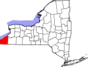
Towns Villages Bemus Point | Brocton | Cassadaga | Celoron | Cherry Creek | Falconer | Forestville | Fredonia | Lakewood | Mayville | Panama | Sherman | Silver Creek | Sinclairville | Westfield
CDPs Other
hamletsIndian
reservationCategories:- Towns in New York
- Populated places in Chautauqua County, New York


Wikimedia Foundation. 2010.