- Mayville, New York
-
Mayville — Village — near the intersection of Routes 430 and 394 Location within the state of New York
 Mayville
Coordinates: 42°15′5″N 79°30′0″W / 42.25139°N 79.5°WCoordinates: 42°15′5″N 79°30′0″W / 42.25139°N 79.5°W Country United States State New York County Chautauqua Area – Total 2.0 sq mi (5.2 km2) – Land 2.0 sq mi (5.2 km2) – Water 0.0 sq mi (0.0 km2) Elevation 1,453 ft (443 m) Population (2000) – Total 1,756 – Density 875.0/sq mi (337.8/km2) Time zone Eastern (EST) (UTC-5) – Summer (DST) EDT (UTC-4) ZIP code 14757 Area code(s) 716 FIPS code 36-46239 GNIS feature ID 0956714 Mayville is a village in Chautauqua County, New York, United States. The population was 1,709 at the 2010 census, which is down 2.7% from the 2000 census.
The Village of Mayville is in the Town of Chautauqua, and is the county seat of Chautauqua County.[1] The Village and Town offices share a building on Main Street, directly across from the Chautauqua County courthouse.
Contents
History
The first settlement in the county was at this location in 1804, and the Village of Mayville was incorporated in 1830. A noted incident in the community's early history came in 1836 when local residents rioted against the Holland Land Company and broke into its office, destroying furniture and papers.
This is also the location where the Pennsylvania Railroad built a train station and pier on the shores of Chautauqua Lake. This location, along with the Jamestown Boat Landing at the South end of the lake, was the main mode of transportation to the rest of the communities around Chautauqua Lake via the large fleet of Steamboats [2] operating before the trolley line was constructed. In modern times the steamboat Chautauqua Belle still operates out of Mayville, running between Point Chautauqua, Chautauqua Institution, and the vessels home port in Mayville.
The Pennsylvania Railroad Station was listed on the National Register of Historic Places in 1993.[3] The Point Chautauqua Historic District was listed in 1996.[3]
Geography
Mayville is located at 42°15′5″N 79°30′0″W / 42.25139°N 79.5°W (42.251402, -79.500015).[4]
According to the United States Census Bureau, the village has a total area of 2.0 square miles (5.2 km2), all of it land. However, the village borders on the north end of the picturesque Chautauqua Lake. Mayville is at the junction of New York State Routes 394 and 430, a short drive south of the New York State Thruway (Interstate 90).
Mayville is the nearest village to the Chautauqua Institution, which draws thousands of visitors during the summer months. Businesses in the village do a brisk tourist business both with Chautauquans and with visitors to cottages and resorts on the east and west sides of the lake.
Climate
Climate data for Mayville, NY Month Jan Feb Mar Apr May Jun Jul Aug Sep Oct Nov Dec Year Average high °F (°C) 34
(1)36
(2)46
(8)57
(14)69
(21)78
(26)82
(28)79
(26)72
(22)61
(16)49
(9)39
(4)58.5
(14.7)Average low °F (°C) 19
(−7)19
(−7)27
(−3)37
(3)49
(9)58
(14)63
(17)62
(17)55
(13)45
(7)35
(2)25
(−4)41.2
(5.1)Precipitation inches (mm) 2.46
(62.5)2.40
(61)2.98
(75.7)3.39
(86.1)3.65
(92.7)4.37
(111)4.15
(105.4)4.45
(113)5.30
(134.6)4.75
(120.7)4.42
(112.3)3.51
(89.2)45.83
(1,164.1)Source: The Weather Channel[5] Demographics
As of the census[6] of 2000, there were 1,756 people, 686 households, and 399 families residing in the village. The population density was 875.0 people per square mile (337.3/km²). There were 860 housing units at an average density of 428.5 per square mile (165.2/km²). The racial makeup of the village was 93.85% White, 3.64% African American, 0.51% Native American, 0.51% Asian, 0.17% from other races, and 1.31% from two or more races. Hispanic or Latino of any race were 1.59% of the population.
There were 686 households out of which 27.0% had children under the age of 18 living with them, 44.9% were married couples living together, 9.5% had a female householder with no husband present, and 41.8% were non-families. 36.6% of all households were made up of individuals and 16.8% had someone living alone who was 65 years of age or older. The average household size was 2.22 and the average family size was 2.92.
In the village the population was spread out with 21.8% under the age of 18, 10.1% from 18 to 24, 29.8% from 25 to 44, 22.2% from 45 to 64, and 16.1% who were 65 years of age or older. The median age was 38 years. For every 100 females there were 114.4 males. For every 100 females age 18 and over, there were 118.3 males.
The median income for a household in the village was $32,250, and the median income for a family was $45,595. Males had a median income of $30,574 versus $24,028 for females. The per capita income for the village was $16,561. About 5.5% of families and 10.2% of the population were below the poverty line, including 10.5% of those under age 18 and 8.4% of those age 65 or over.
References
- ^ "Find a County". National Association of Counties. http://www.naco.org/Counties/Pages/FindACounty.aspx. Retrieved 2011-06-07.
- ^ http://jamestowntrolley.org/steamer/larges/lsteamb.html
- ^ a b "National Register Information System". National Register of Historic Places. National Park Service. 2009-03-13. http://nrhp.focus.nps.gov/natreg/docs/All_Data.html.
- ^ "US Gazetteer files: 2010, 2000, and 1990". United States Census Bureau. 2011-02-12. http://www.census.gov/geo/www/gazetteer/gazette.html. Retrieved 2011-04-23.
- ^ "Monthly Averages for Mayville, NY". Weather.com. 2010. http://preview.weather.com/outlook/health/fitness/wxclimatology/monthly/graph/USNY0887. Retrieved 2010-11-18.
- ^ "American FactFinder". United States Census Bureau. http://factfinder.census.gov. Retrieved 2008-01-31.
External links
- Mayville New York Facebook Page
- Mayville Sentinel-News.
- Village of Mayville, NY webpage.
- Mayville government
- Mayville Events
Municipalities and communities of Chautauqua County, New York County seat: MayvilleCities 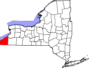
Towns Villages Bemus Point | Brocton | Cassadaga | Celoron | Cherry Creek | Falconer | Forestville | Fredonia | Lakewood | Mayville | Panama | Sherman | Silver Creek | Sinclairville | Westfield
CDPs Other
hamletsIndian
reservationCategories:- Villages in New York
- County seats in New York
- Populated places established in 1804
- Populated places in Chautauqua County, New York


Wikimedia Foundation. 2010.