- Otisco, New York
-
Otisco, New York — Town — Otisco countryside. Location within the state of New York
 Otisco, New York
Coordinates: 42°51′57″N 76°14′21″W / 42.86583°N 76.23917°WCoordinates: 42°51′57″N 76°14′21″W / 42.86583°N 76.23917°W Country United States State New York County Onondaga Government - Type Town Council - Town Supervisor Wayne S. Amato (R) - Town Council Members' ListArea - Total 31.2 sq mi (80.7 km2) - Land 29.6 sq mi (76.7 km2) - Water 1.5 sq mi (4.0 km2) Elevation 1,460 ft (445 m) Population (2000) - Total 2,561 - Density 86.4/sq mi (33.4/km2) Time zone Eastern (EST) (UTC-5) - Summer (DST) EDT (UTC-4) ZIP code 13159 Area code(s) 315 FIPS code 36-55651 GNIS feature ID 0979328 Otisco is a town in Onondaga County, New York, United States. The population was 2,561 at the 2000 census. The Town of Otisco is in the southwest part of the county. Otisco is situated at the northern edge of the Appalacian Highlands, where an escarpment declines to the Lake Ontario plain and the City of Syracuse five miles to the north. Extremely hilly terrain affords a sense of spatial grandeur and magnificent views.
Contents
History
The town was part of the former Central New York Military Tract. The town was first settled by outsiders around 1798, but permanent settlement began around 1801. The Town of Otisco was formed in 1806 from parts of other towns: Pompey, Marcellus, and Tully. The name, "Otisco," derives from the Native American (Iroquois), Us-te-ke, meaning "bitter-nut-hickory." The name "Otisco" appeared on an 1825 map. The same Iroquois name referred to Nine Mile Creek. This and alternate suggestions about the origin of the name appear in the Beauchamp article, cited below.
Geography
According to the United States Census Bureau, the town has a total area of 31.2 square miles (81 km2), of which, 29.6 square miles (77 km2) of it is land and 1.5 square miles (3.9 km2) of it (4.94%) is water.
Otisco is in the Finger Lakes District of New York and borders Otisco Lake.
New York State Route 80 is a north-south highway in the town. A short part of US Route 20 crosses the northeast corner of the town.
Demographics
As of the census[1] of 2000, there were 2,561 people, 922 households, and 693 families residing in the town. The population density was 86.4 people per square mile (33.4/km²). There were 1,200 housing units at an average density of 40.5 per square mile (15.6/km²). The racial makeup of the town was 97.27% White, 0.23% African American, 0.31% Native American, 0.62% Asian, 0.16% from other races, and 1.41% from two or more races. Hispanic or Latino of any race were 0.47% of the population.
There were 922 households out of which 42.2% had children under the age of 18 living with them, 61.4% were married couples living together, 8.2% had a female householder with no husband present, and 24.8% were non-families. 18.9% of all households were made up of individuals and 6.3% had someone living alone who was 65 years of age or older. The average household size was 2.78 and the average family size was 3.22.
In the town the population was spread out with 31.2% under the age of 18, 6.4% from 18 to 24, 31.0% from 25 to 44, 21.8% from 45 to 64, and 9.6% who were 65 years of age or older. The median age was 36 years. For every 100 females there were 103.6 males. For every 100 females age 18 and over, there were 102.8 males.
The median income for a household in the town was $44,643, and the median income for a family was $49,318. Males had a median income of $39,656 versus $26,463 for females. The per capita income for the town was $19,726. About 3.2% of families and 5.7% of the population were below the poverty line, including 8.3% of those under age 18 and 1.6% of those age 65 or over.
Communities and locations in Otisco
- Amber – A hamlet in the northwest part of Otisco by Otisco Lake.
- Amber Brook – A stream flowing into Otisco Lake by Amber.
- Bay Shores – A lakeside hamlet north of Rice Grove.
- Bear Mountain (the blue hole) – An elevation in the northeast once known for the number of bears; the blue hole is a water hole on the mountain that is known for its swift current and waterfalls .
- Case – A location in the northeast part of Otisco, south of Maple Grove.
- Gamble Mill – A hamlet between Otisco hamlet and Rice Grove.
- Heath Grove – A location south of Amber.
- Maple Grove – A hamlet in the northeast part of Otisco.
- Otisco – The hamlet of Otisco.
- Otisco Valley – A hamlet near the town line in the southwest part of Otisco.
- Rice Grove – A hamlet in the southwest part of the town, on Otisco Lake, west of Otisco hamlet.
- Williams Grove – A lakeshore hamlet south of Rice Grove.
References
- ^ "American FactFinder". United States Census Bureau. http://factfinder.census.gov. Retrieved 2008-01-31.
External links
Municipalities and communities of Onondaga County, New York City 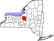
Towns Villages Baldwinsville | Camillus | East Syracuse | Elbridge | Fabius | Fayetteville | Jordan | Liverpool | Manlius | Marcellus | Minoa | North Syracuse | Skaneateles | Solvay | Tully
CDPs Brewerton‡ | Bridgeport‡ | Fairmount | Galeville | Lakeland | Lyncourt | Mattydale | Nedrow | Seneca Knolls | Village Green | Westvale
Other
hamletsAmber | Amboy | Apulia | Apulia Station | Borodino | Cardiff | Cedarvale | Clintonville | Collingwood | Delphi | Delphi Falls | Geddes | Hart Lot | Hinsdale | Howlett Hill | Indian Village | Jack's Reef | Jamesville | Long Branch | Marietta | Memphis | Messina Springs | Mottville | Mycenae | Navarino | Onondaga Hill | Oran | Otisco | Plainville | Pompey Center | Rose Hill | Shepard Settlement | Skaneateles Falls | South Onondaga | South Spafford | Southwood | Spafford Valley | Split Rock | State Fair Grounds | Taunton | Thorn Hill | Vesper | Warners | Watervale
Indian
reservationFootnotes ‡This populated place also has portions in an adjacent county or counties
Categories:- Towns in New York
- Syracuse metropolitan area
- Populated places in Onondaga County, New York
- Place names in New York of Native American origin


Wikimedia Foundation. 2010.